Spencerville, Ohio
| Spencerville, Ohio | |
|---|---|
| Village | |
|
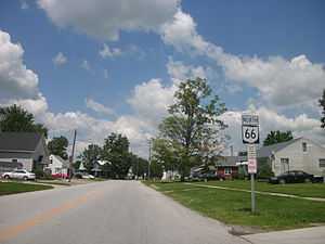
SR 66 through Spencerville, north of downtown. | |
 Location of Spencerville, Ohio | |
| Coordinates: 40°42′32″N 84°21′6″W / 40.70889°N 84.35167°WCoordinates: 40°42′32″N 84°21′6″W / 40.70889°N 84.35167°W | |
| Country | United States |
| State | Ohio |
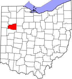
| County | Allen |
| Township | Spencer |
| Government | |
| • Mayor | John P. Johnson |
| • Administrator | Sean Chapman |
| Area[1] | |
| • Total | 0.97 sq mi (2.51 km2) |
| • Land | 0.97 sq mi (2.51 km2) |
| • Water | 0 sq mi (0 km2) |
| Elevation[2] | 830 ft (253 m) |
| Population (2010)[3] | |
| • Total | 2,223 |
| • Estimate (2012[4]) | 2,204 |
| • Density | 2,291.8/sq mi (884.9/km2) |
| Time zone | Eastern (EST) (UTC-5) |
| • Summer (DST) | EDT (UTC-4) |
| ZIP code | 45887 |
| Area code(s) | 419 |
| FIPS code | 39-74034[5] |
| GNIS feature ID | 1065366[2] |
| Website | http://spencervilleoh.com/ |
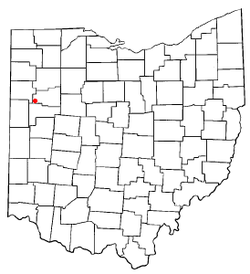
Spencerville is a village in Allen County, Ohio, United States. The population was 2,223 at the 2010 census. It is included in the Lima, Ohio Metropolitan Statistical Area.
Geography
Spencerville is located at 40°42′32″N 84°21′6″W / 40.70889°N 84.35167°W (40.708912, -84.351620).[6]
According to the United States Census Bureau, the village has a total area of 0.97 square miles (2.51 km2), all land.[1]
Demographics
2010 census
As of the census[3] of 2010, there were 2,223 people, 817 households, and 583 families residing in the village. The population density was 2,291.8 inhabitants per square mile (884.9/km2). There were 886 housing units at an average density of 913.4 per square mile (352.7/km2). The racial makeup of the village was 96.5% White, 0.4% African American, 0.2% Native American, 0.4% Asian, and 2.5% from two or more races. Hispanic or Latino of any race were 0.7% of the population.
There were 817 households of which 40.3% had children under the age of 18 living with them, 49.3% were married couples living together, 16.2% had a female householder with no husband present, 5.9% had a male householder with no wife present, and 28.6% were non-families. 24.6% of all households were made up of individuals and 12.2% had someone living alone who was 65 years of age or older. The average household size was 2.66 and the average family size was 3.15.
The median age in the village was 33.4 years. 30.6% of residents were under the age of 18; 7.8% were between the ages of 18 and 24; 25.5% were from 25 to 44; 20.8% were from 45 to 64; and 15.2% were 65 years of age or older. The gender makeup of the village was 48.7% male and 51.3% female.
2000 census
As of the census[5] of 2000, there were 2,235 people, 845 households, and 599 families residing in the village. The population density was 2,454.9 people per square mile (948.3/km²). There were 903 housing units at an average density of 991.8 per square mile (383.1/km²). The racial makeup of the village was 97.72% White, 0.63% African American, 0.18% Native American, 0.09% Asian, and 1.39% from two or more races. Hispanic or Latino of any race were 0.31% of the population.
There were 845 households out of which 35.9% had children under the age of 18 living with them, 53.4% were married couples living together, 13.1% had a female householder with no husband present, and 29.1% were non-families. 25.4% of all households were made up of individuals and 13.0% had someone living alone who was 65 years of age or older. The average household size was 2.54 and the average family size was 3.03.
In the village the population was spread out with 28.5% under the age of 18, 7.2% from 18 to 24, 27.2% from 25 to 44, 20.4% from 45 to 64, and 16.6% who were 65 years of age or older. The median age was 35 years. For every 100 females there were 89.9 males. For every 100 females age 18 and over, there were 82.9 males.
The median income for a household in the village was $32,619, and the median income for a family was $40,625. Males had a median income of $30,701 versus $22,708 for females. The per capita income for the village was $17,140. About 12.3% of families and 13.0% of the population were below the poverty line, including 20.4% of those under age 18 and 7.9% of those age 65 or over.
Education
Spencerville High School sports participate in the Northwest Conference, an athletic body sanctioned by the Ohio High School Athletic Association. Spencerville built a new school that houses K-12 and opened in 2008. Spencerville Schools sports include soccer, basketball, baseball, softball, football, volleyball, tennis, cross-country, track, and wrestling.
History
Spencerville was platted by William Tyler in 1844 on the banks of the newly constructed Miami and Erie Canal. Originally deemed "Spencer" in honor of Colonel William Spencer, a staunch supporter of Ohio canal development during the 19th Century, the town's name was changed to Acadia in 1854. The name returned to a form of the original (Spencerville) following the townspeople's vote in favor of incorporation on September 3, 1866. Spencerville was officially approved by state charter on April 30, 1867. The canal spurred the early growth of the town through the 1870s, when railroads began supplanting the slower canal system.
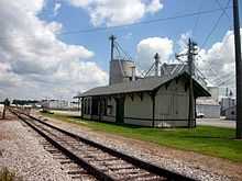
The Erie Railroad and subsequently the Erie-Lackawanna Railway ran through Spencerville until abandoned in 1976 by the Conrail merger in favor of a parallel former Penn Central line running through Lima. In 1978 the now defunct Spencerville and Elgin Railroad (SPEG) operated as a short line running on a portion of the abandoned E-L line between Lima and Ohio City until it closed down in 1997. Originally, the SPEG ran all the way to the Ohio-Indiana state line where it met up with the trains of the now defunct Erie Western Railway which ran from that point towards Chicago. The SPEG line's western terminus was then moved back to Glenmore. Since that time,the short line was taken over (and is now owned) by the Western Ohio division of the R.J. Corman Railroad Group which moved the terminus back to Elgin in May 2010 with the section between Elgin and Glenmore abandoned and the trackage sold for scrap.
The shortline now owned by R.J. Corman continues to serve the Spencerville, Elgin and Lima communities. In addition, R.J. Corman operates a segment of the former Nickel Plate Road extending from Lima to Portland, Indiana with a spur running between St. Marys to Minster along with the remaining trackage of the former Cincinnati Northern between Greenville and Ansonia.
(see video reference below)
References
- ↑ 1.0 1.1 "US Gazetteer files 2010". United States Census Bureau. Retrieved 2013-01-06.
- ↑ 2.0 2.1 "US Board on Geographic Names". United States Geological Survey. 2007-10-25. Retrieved 2008-01-31.
- ↑ 3.0 3.1 "American FactFinder". United States Census Bureau. Retrieved 2013-01-06.
- ↑ "Population Estimates". United States Census Bureau. Retrieved 2013-06-17.
- ↑ 5.0 5.1 "American FactFinder". United States Census Bureau. Retrieved 2008-01-31.
- ↑ "US Gazetteer files: 2010, 2000, and 1990". United States Census Bureau. 2011-02-12. Retrieved 2011-04-23.
| |||||||||||||||||||||||||||||