Sparta, Ohio
| Sparta, Ohio | |
|---|---|
| Village | |
 Location of Sparta, Ohio | |
| Coordinates: 40°23′41″N 82°41′58″W / 40.39472°N 82.69944°WCoordinates: 40°23′41″N 82°41′58″W / 40.39472°N 82.69944°W | |
| Country | United States |
| State | Ohio |
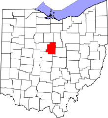
| County | Morrow |
| Area[1] | |
| • Total | 0.09 sq mi (0.23 km2) |
| • Land | 0.09 sq mi (0.23 km2) |
| • Water | 0 sq mi (0 km2) |
| Elevation[2] | 1,358 ft (414 m) |
| Population (2010)[3] | |
| • Total | 161 |
| • Estimate (2012[4]) | 162 |
| • Density | 1,788.9/sq mi (690.7/km2) |
| Time zone | Eastern (EST) (UTC-5) |
| • Summer (DST) | EDT (UTC-4) |
| ZIP code | 43350 |
| Area code(s) | 419 |
| FIPS code | 39-73950[5] |
| GNIS feature ID | 1065362[2] |
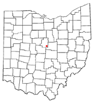
Sparta is a village in Morrow County, Ohio, United States. The population was 161 at the 2010 census. Sparta is southeast of Mount Gilead, Ohio, the county seat.
Geography
Sparta is located at 40°23′41″N 82°41′58″W / 40.39472°N 82.69944°W (40.394773, -82.699527).[6] It is considered to be a part of "Central Ohio".
According to the United States Census Bureau, the village has a total area of 0.09 square miles (0.23 km2), all of it land.[1]
Demographics
2010 census
As of the census[3] of 2010, there were 161 people, 65 households, and 46 families residing in the village. The population density was 1,788.9 inhabitants per square mile (690.7/km2). There were 76 housing units at an average density of 844.4 per square mile (326.0/km2). The racial makeup of the village was 95.7% White, 1.9% African American, 0.6% from other races, and 1.9% from two or more races. Hispanic or Latino of any race were 0.6% of the population.
There were 65 households of which 30.8% had children under the age of 18 living with them, 41.5% were married couples living together, 27.7% had a female householder with no husband present, 1.5% had a male householder with no wife present, and 29.2% were non-families. 26.2% of all households were made up of individuals and 7.7% had someone living alone who was 65 years of age or older. The average household size was 2.48 and the average family size was 2.96.
The median age in the village was 40.6 years. 25.5% of residents were under the age of 18; 6.8% were between the ages of 18 and 24; 26% were from 25 to 44; 27.3% were from 45 to 64; and 14.3% were 65 years of age or older. The gender makeup of the village was 44.1% male and 55.9% female.
2000 census
As of the census[5] of 2000, there were 191 people, 70 households, and 56 families residing in the village. The population density was 2,159.5 people per square mile (819.4/km²). There were 75 housing units at an average density of 848.0 per square mile (321.8/km²). The racial makeup of the village was 96.86% White, 1.57% African American, 0.52% from other races, and 1.05% from two or more races. Hispanic or Latino of any race were 0.52% of the population.
There were 70 households out of which 38.6% had children under the age of 18 living with them, 54.3% were married couples living together, 22.9% had a female householder with no husband present, and 20.0% were non-families. 17.1% of all households were made up of individuals and 7.1% had someone living alone who was 65 years of age or older. The average household size was 2.73 and the average family size was 3.04.
In the village the population was spread out with 25.1% under the age of 18, 9.4% from 18 to 24, 28.8% from 25 to 44, 20.9% from 45 to 64, and 15.7% who were 65 years of age or older. The median age was 36 years. For every 100 females there were 101.1 males. For every 100 females age 18 and over, there were 85.7 males.
The median income for a household in the village was $28,750, and the median income for a family was $31,458. Males had a median income of $31,500 versus $15,313 for females. The per capita income for the village was $11,793. About 18.8% of families and 16.4% of the population were below the poverty line, including 14.3% of those under the age of eighteen and 10.0% of those sixty five or over.
Notable residents
- Tim Belcher, former Major League Baseball pitcher and one-time pitching coach for Major League Baseball's Cleveland Indians
References
- ↑ 1.0 1.1 "US Gazetteer files 2010". United States Census Bureau. Retrieved 2013-01-06.
- ↑ 2.0 2.1 "US Board on Geographic Names". United States Geological Survey. 2007-10-25. Retrieved 2008-01-31.
- ↑ 3.0 3.1 "American FactFinder". United States Census Bureau. Retrieved 2013-01-06.
- ↑ "Population Estimates". United States Census Bureau. Retrieved 2013-06-17.
- ↑ 5.0 5.1 "American FactFinder". United States Census Bureau. Retrieved 2008-01-31.
- ↑ "US Gazetteer files: 2010, 2000, and 1990". United States Census Bureau. 2011-02-12. Retrieved 2011-04-23.
| |||||||||||||||||||||||||||||||||