Space weather
Space weather is a branch of space physics and aeronomy concerned with the time varying conditions within the Solar System, including the solar wind, and especially the space surrounding the Earth, including conditions in the magnetosphere, ionosphere, and thermosphere. Space weather is distinct from the terrestrial weather of the Earth's atmosphere (troposphere and stratosphere). The science of space weather is focused in two distinct directions: fundamental research and practical applications. The term space weather is first known to be used in the 1950s but only came into common usage in the 1990s.[1]
History of the concept
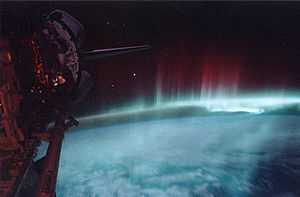
For many centuries, the effects of space weather were noticed but not understood. Beautiful displays of auroral light have long been admired by people living at high latitudes. In 1724, George Graham reported that the needle of a magnetic compass was regularly deflected from magnetic north over the course of each day. This effect was eventually attributed to overhead electric currents flowing in what we now recognize as the ionosphere and magnetosphere by Balfour Stewart in 1882 and, subsequently, confirmed by Arthur Schuster in 1889 from analysis of magnetic observatory data. In 1852, the astronomer and British major general, Edward Sabine showed that the probability of the occurrence of magnetic storms on Earth is correlated with the number of sunspots, thus demonstrating the existence of what we, today, might call solar-terrestrial interaction. In 1859, a great magnetic storm caused brilliant auroral displays, and it also disrupted telegraph operations around the world, events that were reported in many major newspapers at that time. Richard Carrington correctly connected the storm with a solar flare that he had observed the day before in the vicinity of a large sunspot group—thus demonstrating that specific events occurring on the Sun's surface can, in turn, affect the Earth.
Kristian Birkeland explained the physics of aurora by creating artificial aurora in his laboratory and predicted the solar wind. With the introduction of radio for commercial and military uses, it was noted that periods of extreme static or noise occurred. Severe radar jamming during a large solar event in 1942 led to the discovery of solar radio bursts (radio waves which cover a broad frequency range created by a solar flare), another aspect of space weather.
In the 20th century, the interest in space weather has expanded as military and commercial systems have come to depend on systems affected by space weather. Communications satellites are a vital part of global commerce. Weather satellite systems provide information about terrestrial weather. The signals from satellites of the Global Positioning System are used in a wide variety of commercial products and processes. Space weather phenomena can interfere with or damage these satellites or interfere with the radio signals to and from these satellites. Space weather phenomena can cause damaging surges in long electrical transmission lines and expose passengers and crew of aircraft travel to radiation,[2][3] especially on polar routes.
The International Geophysical Year (IGY), created an enormous increase in research into space weather. Ground-based data obtained during IGY demonstrated that the aurora occurred in an auroral oval, a permanent region of luminescence 15 to 25 degrees in latitude from the magnetic poles and 5 to 20 degrees wide.[4] In 1958, the Explorer I satellite discovered the Van Allen belts[5] or regions of radiation particles trapped by the Earth's magnetic field. In January 1959, the Soviet satellite Luna 1 first directly observed the solar wind and measured its strength. In 1969, INJUN-5 (a.k.a. Explorer 40[6]) made the first direct observation of the electric field impressed on the Earth's high latitude ionosphere by the solar wind.[7] In the early 1970s, Triad data demonstrated that permanent electric currents flowed between the auroral oval and the magnetosphere.[8] From these and other fundamental discoveries, research into space weather has grown exponentially.
Within our own solar system, space weather is greatly influenced by the speed and density of the solar wind and the interplanetary magnetic field (IMF) carried by the solar wind plasma. A variety of physical phenomena are associated with space weather, including geomagnetic storms and substorms, energization of the Van Allen radiation belts, ionospheric disturbances and scintillation of satellite-to-ground radio signals and long-range radar signals, aurora and geomagnetically induced currents at Earth's surface. Coronal mass ejections and their associated shock waves are also important drivers of space weather as they can compress the magnetosphere and trigger geomagnetic storms. Solar energetic particles, accelerated by coronal mass ejections or solar flares, are also an important driver of space weather as they can damage electronics onboard spacecraft (e.g. Galaxy 15 failure), and threaten the life of astronauts.
The term space weather came into usage in the 1990s when it became apparent that the impact of the space environment on human systems demanded a more coordinated research and application framework.[9] The purpose of the National Space Weather Program in the USA is to focus research on the needs of the commercial and military communities which are affected by space weather, to connect the research community to the user community, to create coordination between operational data centers and to create better definitions of what the user community needs are. The concept was turned into an action plan in 2000,[10] an implementation plan in 2002, an assessment in 2006[11] and a revised strategic plan in 2010.[12] A revised action plan will be released in 2011 and a revised implementation plan will be release in 2012. One part of the National Space Weather Program is to make users aware that space weather affects their business.[13] Private companies now acknowledge space weather "is a real risk for today's businesses".[14]
Effect of space weather on space systems
Spacecraft anomalies

Spacecraft malfunction for a variety of reasons. Some malfunctions are reported but many are not reported. A few failures can be directly attributed to space weather; many more failures are suspected to have a space weather component; and many failures are unrelated to space weather. One indicator that space weather is a significant driver of spacecraft failure is that 46 of the 70 failures reported in 2003 occurred during the October 2003 geomagnetic storm. The two most common adverse space weather effects on spacecraft are radiation damage and spacecraft charging. Radiation (high energy particles) passes through the skin of the spacecraft and into the electronic components. In most cases the radiation causes an erroneous signal or changes one bit in memory of a spacecraft's electronics (single event upsets). In a few cases, the radiation destroys a section of the electronics (single-event latchup). Spacecraft charging is the accumulation of an electrostatic charge on a non-conducting material on the spacecraft's surface by low energy particles. If enough charge is built-up, a discharge (spark) occurs. Damage to the spacecraft is done by causing an erroneous signal to be detected and acted on by the spacecraft computer as if the signal came from the ground controller or the electronics are damaged by a surge of electrical current. A recent study indicates that spacecraft charging is the predominant space weather effect on spacecraft in geosynchronous orbit.[16]
Spacecraft orbit changes
The orbits of spacecraft in low Earth orbit (LEO) decay to lower and lower altitudes due to the resistance from the friction between the spacecraft's surface (i.e. , drag) and the outer layer of the Earth's atmosphere (a.k.a. the thermosphere and exosphere). Eventually, a spacecraft's orbit will decay so much that it will fall out of orbit and crash to the Earth's surface. Many spacecraft launched in the past couple of decades have the ability to fire a small rocket (1) to increase the altitude to compensate for the decay and extend the lifetime in space, (2) to re-enter the atmosphere and crash into the ocean, or (3) change the orbit to avoid collision with other spacecraft. In order to accomplish the goal of firing a small rocket, very precise information about the orbit is needed. A geomagnetic storm can cause an orbit change over a couple of days that otherwise would occur over a year or more. The geomagnetic storm adds heat to the thermosphere, causing the thermosphere to expand and rise, which increases the drag on spacecraft in low Earth orbits. The 2009 satellite collision between the Iridium 33 and Cosmos 2251 demonstrated the importance of having precise knowledge of all objects in orbit. Iridium 33 had the capability to maneuver out of the path of Cosmos 2251 and could have evaded the crash, if a credible collision prediction had been available,
Effect of radiation on humans in space
The exposure of a human body to ionizing radiation has the same harmful effects whether the source of the radiation is a medical X-ray machine, a nuclear power plant or radiation in space. The degree of the harmful effect depends on the length of exposure and the energy density of the radiation. The ever-present radiation belts extend down to the altitude of manned spacecraft such as the International Space Station (ISS) and the Space Shuttle but the amount of exposure is within the acceptable lifetime exposure limit under normal conditions. During a major space weather event which includes a burst of solar energetic particles, the flux can increase by one to several orders of magnitude. There are areas within ISS where the thickness of the spacecraft surface and equipment can provide extra shielding and may keep the total dose absorbed within lifetime safe limits.[17] For the Shuttle, such an event would have required an immediate termination of the mission.
Effects of space weather on ground systems

Disruption of GPS and other spacecraft signals
The ionosphere bends radio waves in the same manner that water in a swimming pool bends visible light. When the medium through which the light or radio waves travel is disturbed, the light image or radio information is distorted and can become unrecognizable. The degree of distortion (scintillation) of a radio wave by the ionosphere depends on the frequency of the radio signal. Radio signals in the VHF band (30 to 300 MHz) can be distorted beyond recognition by a disturbed ionosphere. Radio signals in the UHF band (300 MHz to 3 GHz) will propagate through a disturbed ionosphere but a receiver may not be able to keep locked to the carrier frequency. The Global Positioning System uses signals at 1575.42 MHz (L1) and 1227.6 MHz (L2) which can be distorted by a disturbed ionosphere and a receiver computes an erroneous position or fails to compute any position. Because the GPS signals are used by wide range of applications, any space weather event which makes GPS signal unreliable, the impact on society can be significant. For example the Wide Area Augmentation System (WAAS) operated by the Federal Aviation Administration is used as a precision navigation tool for commercial aviation in North America. It is disabled by every major space weather event. In some cases WAAS is disabled for minutes and in a few cases it has been disabled for a few days. Major space weather events can push the disturbed polar ionosphere 10° to 30° of latitude toward the equator and can cause large ionospheric gradients (changes in density over distance of hundreds of km) at mid and low latitude. Both of these factors can distort GPS signals.
Disruption of long-distance radio signals
Radio wave in the HF band (3 to 30 MHz) (also known as the shortwave band) are bent so much by the ionosphere that they are reflected back in the same manner as a mirror reflects light. Since the ground also reflects HF wave, a signal can be transmitted around the curvature of the Earth to a distant station. During the 20th century, HF communications was the only method for a ship or aircraft far from land or a base station to communicate. With the advent of systems such as Iridium, there are now other methods of communications but HF is still considered to be critical because not all vessels carry the newer equipment and even if the newer equipment is on board, HF is considered a critical backup system. Space weather events can create irregularities in the ionosphere that scatter HF signals instead of reflecting them and make HF communications over long distance poor or impossible. At auroral and polar latitudes, small space weather events which occur frequently disrupt HF communications. At mid-latitudes, HF communications are disrupted by solar radio bursts, by X-rays from solar flares (which enhance and disturb the ionospheric D-layer) and by TEC enhancements and irregularities during major geomagnetic storms which are infrequent.
Transpolar routes flown by airplanes are particularly sensitive to space weather, in part because of Federal Aviation Regulations requiring reliable communication over the entire flight.[18] It is estimated to cost about $100,000 each time such a flight is diverted from a polar route.[13]

Effect of radiation on humans at and near ground level
The Earth's extended magnetic field (magnetosphere) guides cosmic ray and solar energetic particles to polar latitudes and high energy charged particles enter the mesosphere, stratosphere, and troposphere. These energetic particles at the top of the atmosphere shatter atmospheric atoms and molecules, creating lower energy, but still harmful, particles which penetrate deep into the atmosphere. All aircraft flying above 8 km (26,200 feet) altitude are exposed to these particles, which create a measurable amount of radiation. The dose exposure is greater in polar regions than at mid-latitude and equatorial regions. Many commercial aircraft from Europe and North America to East Asia fly over the polar region. When a space weather event causes radiation exposure to exceed the safe level set by aviation authorities,[19] the aircraft's flight path is deviated to avoid the polar region.
While the most significant, but highly unlikely, health consequences to atmospheric radiation exposure may include death from cancer due to long-term exposure, there are many lifestyle degrading and career impacting cancer forms that can also occur.[20][21] A cancer diagnosis can have significant career impact for a commercial pilot. The FAA requires each pilot to hold a medical certificate in order to exercise the privileges of his or her pilot’s license. A cancer diagnosis can ground a pilot for some time, perhaps permanently given the diagnosis and time remaining in his or her career. International guidelines from the International Commission on Radiological Protection (ICRP) have been developed to mitigate this statistical risk.[22][23][24] The ICRP recommends effective dose limits of a 5-year average of 20 mSv/yr with no more than 50 mSv in a single year for non-pregnant, occupationally exposed persons, and 1 mSv/yr for the general public. Radiation dose limits are not engineering limits. In the U.S., they are treated as an upper limit of acceptability and not a design limit.[25]
Ground Induced Electric Fields
Magnetic storm activity can induce geoelectric fields in the Earth's conducting lithosphere.[26] Corresponding voltage differentials can find their way into electric power grids through ground connections, driving uncontrolled electric currents that interfere with grid operation, damaging transformers, tripping protective relays, and sometimes causing blackouts.[27] The reality of this complicated chain of causes and effects was demonstrated during the great magnetic storm of March 1989,[28] which caused the complete collapse of the Hydro-Québec electric-power grid in Canada, temporarily leaving nine million people without electricity. The possible occurrence in the future of an even more intense magnetic storm, one that could cause widespread loss of electric power,[29] has motivated regulatory agencies to issue operational standards intended to mitigate induction-hazard risks. Concerns in the private sector have motivated reinsurance companies to commission related assessments of risk.[30]
Geophysical exploration
Air and ship borne magnetic surveys can be affected by rapid magnetic field variations during geomagnetic storms. Geomagnetic storms cause data interpretation problems because the space-weather-related magnetic field changes are similar in magnitude to those of the sub-surface crustal magnetic field in the survey area. Accurate geomagnetic storm warnings, including an assessment of the magnitude and duration of the storm, allows for an economic use of survey equipment.
Geophysics and hydrocarbon production
For economic and other reasons, oil and gas production often involves the directional drilling of well paths many kilometers from a single wellhead in both the horizontal and vertical directions. Accuracy requirements are strict, due to target size – reservoirs may only be a few tens to hundreds of meters across – and for safety reasons, because of the proximity of other boreholes. Surveying by the most accurate gyroscopic method is expensive, since it can involve the cessation of drilling for a number of hours. An alternative is to use a magnetic survey, which enables measurement while drilling (MWD). Near real time magnetic data can be used to correct the drilling direction and nearby magnetic observatories prove vital.[31][32] Magnetic data and space weather forecasts can also be helpful in clarifying unknown sources of drilling error on an ongoing basis.
Effect of space weather on terrestrial weather
The amount of energy entering the troposphere and stratosphere from all space weather phenomena is trivial compared to the solar insolation in the visible and infra-red portions of the solar electromagnetic spectrum. However there does seem to be some linkage between the 11-year sunspot cycle and the Earth's climate.[33] For example, the Maunder minimum, a 70-year period almost devoid of sunspots, correlates to a cooling of the Earth's climate. One suggestion for the linkage between space and terrestrial weather is that changes in cosmic ray flux cause changes in the amount of cloud formation.[34] Another suggestion is that variations in the EUV flux subtly influence existing drivers of the climate and tips the balance between states such as the El Niño/La Niña states.[35] However, a linkage between space weather and the climate has not been demonstrated conclusively.
Observations of space weather
The observation of space weather is done both for scientific research and for applications. The type of observation done for science has varied over the years as the frontiers of our understanding has increased and due to competition for resources from other types of space-related research. The observations related to applications have been more systematic and has expanded over the years as awareness and applications have increased.
Observing space weather from the ground
Presently, space weather is monitored at ground level by observing changes in the Earth's magnetic field over periods of seconds to days, by observing the surface of the Sun and by observing radio noise created in the Sun's atmosphere.
The Sunspot Number (SSN) is the number of sunspots on the Sun's photosphere in visible light on the side of the Sun visible to an Earth observer. The number and total area of sunspots are related to the brightness of the Sun in the extreme ultraviolet (EUV) and X-ray portions of the solar spectrum and to solar activity such as solar flares and coronal mass ejections (CMEs).
10.7 cm radio flux (F10.7) is a measurement of RF emissions from the Sun and is approximately correlated with the solar EUV flux. Since this RF emission is easily obtained from the ground and EUV flux is not, this value has been measured and disseminated continuously since 1947. The world standard measurements are made by the Dominion Radio Astrophysical Observatory at Penticton, B.C., Canada and reported once a day at local noon[36] in solar flux units (10−22W·m−2·Hz−1). F10.7 is archived by the National Geophysical Data Center.[37]
Fundamental space weather monitoring data are provided by ground-based magnetometers and magnetic observatories. Indeed, magnetic storms were first discovered by ground-based measurement of occasional magnetic disturbance. Ground magnetometer data are used for informing real-time situational awareness, for post-event analysis of effects, and because many magnetic observatories have been in continuous operations for decades to centuries, their data also inform studies of long-term changes in space climatology.[38][39]
Dst index is an estimate of the magnetic field change at the Earth's magnetic equator due to a ring of electrical current at and just earthward of GEO.[40] The index is based on data from four ground-based magnetic observatories between 21° and 33° magnetic latitude during a one-hour period. Stations closer to the magnetic equator are not used due to ionospheric effects. The Dst index is compiled and archived by the World Data Center for Geomagnetism, Kyoto[41]
Kp/ap Index: 'a' is an index created from the geomagnetic disturbance at one mid-latitude (40° to 50° latitude) geomagnetic observatory during a 3-hour period. 'K' is the quasi-logarithmic counterpart of the 'a' index. Kp and ap are the average of K and an over 13 geomagnetic observatories to represent planetary-wide geomagnetic disturbances. The Kp/ap index[42] indicates both geomagnetic storms and substorms (auroral disturbance). Kp/ap is available from 1932 onward.
AE index is compiled from geomagnetic disturbances at 12 geomagnetic observatories in and near the auroral zones and is recorded at 1-minute intervals.[41] The AE index is made public with a delay of two to three days, which severely limits its utility for space weather applications. The AE index indicates the intensity of geomagnetic substorms except during a major geomagnetic storm when the auroral zones expand equatorward from the observatories.
Radio noise burst are observed and reported by the Radio Solar Telescope Network to the U.S. Air Force and to NOAA. The radio bursts are associated with plasma from a solar flare interacting with the ambient solar atmosphere.
The Sun's photosphere is observed continuously by a series of observatories[43] for activity which can be the precursors to solar flares and CMEs. The Global Oscillation Network Group (GONG)[44] project monitors both the surface and the interior of the Sun by using helioseismology, the study of sound waves propagating through the Sun and observed as ripples on the solar surface. GONG can detect sunspot groups on the far side of the Sun. This ability has recently been verified by visual observations from the NASA STEREO spacecraft.
Neutron monitors on the ground indirectly monitor cosmic rays from the Sun and galactic sources. Cosmic rays do not reach the Earth's surface due to the shielding of the Earth's magnetic field and atmosphere. When cosmic rays interact with the atmosphere, atomic interactions occur which cause a shower of lower energy particles to descend deeper into the atmosphere and to ground level. The presence of cosmic rays in the near-Earth space environment can be detected by monitoring high energy neutrons at ground level. Small fluxes of cosmic rays are present continuously. Large fluxes are produced by the Sun during events related to energetic solar flares.
Total Electron Content (TEC) is a measure of the ionosphere over a given location. TEC is the number of electrons in a column one meter square from the base of the ionosphere (approximately 90 km altitude) to the top of the ionosphere (approximately 1000 km altitude). Many of the measurements of TEC are made by monitoring the two frequencies transmitted by GPS spacecraft. Presently GPS TEC is monitored and distributed in real time from more than 360 stations maintained by numerous agencies in many countries.
Geoeffectiveness is a measure of how strongly the magnetic fields of space weather events, such as coronal mass ejections, will couple with the Earth's magnetic field. This is determined by the direction the magnetic field held within the plasma that originates from the Sun. New techniques measuring Faraday Rotation in radio waves are being developed to measure the direction of the magnetic field.[45][46]
Observing space weather with satellites
After Explorer I discovered that space was not a void, many research spacecraft have been launched to discover and characterize the space environment. There have been too many spacecraft since then to list them all here and they have carried a wide variety of instruments.[47][48][49][50][51] The spacecraft of the Orbiting Geophysical Observatory series were among the first spacecraft with the mission of discovering the space environment. Significant recent spacecraft are the NASA-ESA Solar-Terrestrial Relations Observatory (STEREO) pair of spacecraft launched in 2006 into solar orbit and the Van Allen Probes, launched in 2012 into a highly elliptical Earth-orbit. The two STEREO spacecraft drift away from the Earth by about 22° per year, one leading and the other trailing the Earth in its orbit. Together they compile information about the Sun's surface and atmosphere in three dimensions. The Van Allen probes are obtaining detailed information about the radiation belts, geomagnetic storms and the relationship between the two.
The mission of most spacecraft is unrelated to gathering information about the space environment for research or applications, but some of these other spacecraft have carried auxiliary instrument or had some part of their primary payload used for space weather. Some of the earliest such spacecraft were part of the Applications Technology Satellite[52] (ATS) series at GEO which were precursors to the modern Geostationary Operational Environmental Satellite (GOES) weather satellite and many communication satellites. The ATS spacecraft carried environmental particle sensors as auxiliary payloads and had their navigational magnetic field sensor used for sensing the environment.
Many of the earliest instruments used for monitoring the space environment were and are research spacecraft which were re-purposed or jointly purposed for space weather applications and forecasting. One of the first of these is the IMP-8 (Interplanetary Monitoring Platform)[53] The IMP-8 orbited the Earth at 35 Earth Radii and observed the solar wind for two-thirds of its 12-day orbit from 1973 to 2006. Since the solar wind carries disturbances which affect the magnetosphere and ionosphere, IMP-8 demonstrated the utility of continuously monitoring the solar wind. IMP-8 was followed by ISEE-3 which was placed near the L1 Sun-Earth Lagrangian point, 235 Earth radii above the surface (about 1.5 million km, or 924,000 miles) and continuously monitored the solar wind from 1978 to 1982. The next spacecraft to monitor the solar wind at the L1 point was WIND from 1994 to 1998. After April 1998, the WIND spacecraft orbit was change to circle the Earth and pass by the L1 point occasionally. The NASA Advanced Composition Explorer (ACE) has monitored the solar wind at the L1 point from 1997 to present. It is estimated to cease operating about 2024. Funding for a replacement for ACE is in the 2012 budget request for NOAA with a planned launch in 2015. The replacement's primary mission will be space weather forecasting and applications.
In addition to monitoring the solar wind, monitoring the Sun is important to space weather. Because the solar EUV cannot be monitored from the ground, the joint NASA-ESA Solar and Heliospheric Observatory (SOHO) spacecraft was launched and has provide EUV images of the Sun from 1995 to the present. SOHO is a main source of near-real time solar data for both research and space weather prediction and inspired the STEREO mission. The Yohkoh spacecraft at LEO observed the Sun from 1991 to 2001 in the X-ray portion of the solar spectrum and was useful for both research and space weather prediction. Data from Yohkoh inspired the Solar X-ray Imager on GOES.

Spacecraft with instruments whose primary purpose is to provide data for space weather predictions and applications include the Geostationary Operational Environmental Satellite (GOES) series of spacecraft, the POES series, the DMSP series, and the Meteosat series. The GOES spacecraft have carried an X-ray sensor (XRS) which measures the flux from the whole solar disk in two bands – 0.05 to 0.4 nm and 0.1 to 0.8 nm – since 1974, an X-ray imager (SXI) since 2004, a magnetometer which measures the distortions of the Earth’s magnetic field due to space weather, a whole disk EUV sensor since 2004, and particle sensors (EPS/HEPAD) which measure ions and electrons in the energy range of 50 keV to 500 MeV. Starting sometime after 2015, the GOES-R generation of GOES spacecraft will replace the SXI with a solar EUV image (SUVI) similar to the one on SOHO and STEREO and the particle sensor will be augmented with a component to extend the energy range down to 30 eV.
The Deep Space Climate Observatory (DSCOVR) satellite is a NOAA Earth observation and space weather satellite that was launched in February 2015. Among its features is advance warning of coronal mass ejections, which can disrupt radio transmissions, damage satellites, affect electrical transmission line facilities with accompanying power outages,[54][55] and interrupt GPS navigation and airplane travel.[56]
Space weather modeling
Space weather models are computer simulations of the space weather environment. Like computer models for meteorology, space weather models take a limited set of data values and extrapolate to values which describe the entire space weather environment or a segment of the space weather environment in the model. Each model makes a prediction or a set of predictions about how the environment evolves with time. Computer models use the sets of mathematical equations to describe the physical processes involved. The early space weather models were heuristic; i.e., they relate one phenomenon with another without including any physics in the relationship. Some of these simple models are still used because they take minimal resources and yield results which are good enough for some purposes. Present research and development efforts concentrate on complex sets of equations which account for as many elements of physics as possible. Space weather models differ from meteorological model in that amount of input is vastly smaller and no single space weather model yet can reliably predict the environment from the surface of the Sun to the bottom of the Earth's ionosphere.
A significant portion of space weather model research and development in the past two decades has been done as part of the Geospace Environmental Model (GEM) program of the National Science Foundation. Two major centers for modeling are the Center for Space Environment Modeling (CSEM)[57] and the Center for Integrated Space weather Modeling (CISM).[58] The Community Coordinated Modeling Center[59] (CCMC) at the NASA Goddard Space Flight Center is a facility for coordinating the development and testing of research models, for the improvement of models and for preparing models for transition to space weather prediction and application.[60]
Modeling efforts to simulate the environment from the Sun to the Earth use several method including (a) magnetohydrodynamics in which the environment is treated as a fluid, (b) particle in cell in which non-fluid interactions are handled within a cell and then a series of cells are connected together to describe the environment, (c) first principles in which physical processes are in balance (or equilibrium) with one another, (d) semi-static modeling in which a statistical or empirical relationship is described, or a combination of several of these methods.
Commercial space weather activities
In a recent Decadal Survey[61] it was noted that, during the first decade of the 21st Century, a vibrant commercial sector has emerged that is engaged in space weather providing services and products for customers ranging from agencies and commercial aerospace to consumers. After the start of the space weather discipline in the 1990s, and particularly after 2000, there has been a growing community of commercial space weather providers. These are mostly small companies that provide a variety of space weather data, models, derivative products, and service distribution for government, commercial, and consumer customers.
The commercial sector pillar of the space weather enterprise continues to develop services and products in response to societal space weather needs. Their personnel include scientific and engineering researchers as well as users of services and products. The activities of this commercial sector are primarily directed toward understanding, measuring, and managing the impacts of space weather upon technology. These include, for example: i) atmospheric drag on LEO satellites caused by energy inputs into the thermosphere from solar UV, FUV, Lyman-alpha, EUV, XUV, and X-ray photons as well as by charged particle precipitation and Joule heating at high latitudes; ii) surface and internal charging from increased energetic particle fluxes, leading to effects such as discharges, single event upsets, and latch-up, on LEO to GEO satellites; iii) disrupted GPS signals caused by ionospheric scintillation leading to increased uncertainty in navigation systems such as aviation’s Wide Area Augmentation System (WAAS); iv) lost HF, UHF, and L-band radio communications due to ionosphere scintillation, solar flares, and geomagnetic storms; v) increased radiation to human tissue and avionics from GCRs and SEPs, especially during large solar flares, at all altitudes above 8 km;[62] vi) increased inaccuracy in surveying and oil/gas exploration that uses the Earth’s main magnetic field when it is disturbed by geomagnetic storms; and vii) loss of power transmission from GIC surges in the electrical power grid and transformer shutdowns during large geomagnetic storms. Many of these disturbances result in a broad number of societal impacts from space weather that account for a significant part of the national GDP. These represent the domain of potential customers for commercial space weather services and products.
On April 29, 2010, the commercial space weather community evolved from the Commercial Space Weather Interest Group (CSWIG) into the American Commercial Space Weather Association (ACSWA). It is a formal industry association representing private-sector commercial interests related to space weather.
ACSWA promotes space weather risk mitigation for critical national infrastructure related to national daily life, economic strength, and national security. ACSWA, as an association and in conjunction with its member companies, is playing a vital role by identifying important data and technology gaps that can be filled by private or government actions and by developing value-added products and services for the benefit of human and property safety as well as for vibrant commerce.
The goals of ACSWA are to:
- provide quality space weather data and services to help mitigate risks to technology that is vital to the country and government;
- provide advisory services regarding space weather to government agencies;
- provide guidance to government agencies on what tasks can be better provided by commercial space weather providers versus government agencies;
- represent the interests of commercial space weather providers;
- represent commercial space weather capabilities in the national and international arena;
- and develop operational space weather best-practices.
A summary of the broad technical capabilities in space weather that are available from the association can be found on their web site.
Notable space weather events
- On the night of December 21, 1806, Alexander von Humboldt observed that his compass had become erratic during a bright auroral event.[63]
- The Solar storm of 1859 causes widespread disruption of telegraph service.
- The Aurora of November 17, 1882 disrupts telegraph service.
- The May 1921 geomagnetic storm,[64] one of the largest geomagnetic storms causes worldwide disruption of telegraph service and damage to electrical equipment.
- August 7, 1972, a large Solar Energetic Particles event occurred. If astronauts had been in space at the time, the dose would have been deadly or at least life-threatening.[65] Fortunately, this large event happened between the Apollo 16 and Apollo 17 lunar missions.
- The March 1989 geomagnetic storm included the full array of space weather effects: Solar Energetic Particles, Coronal Mass Ejection, Forbush decrease, ground level enhancement, geomagnetic storm, etc..
- The 2000 Bastille Day event produces exceptionally bright aurora.
- April 21, 2002, the Nozomi Mars Probe was hit by a large Solar Energetic Particles event which caused large-scale failure. The mission, which was already about 3 years behind schedule, was eventually abandoned in December 2003.[66]
See also
- Atmospheric physics
- Earth's magnetic field
- Geomagnetic storm
- Heliophysics
- List of solar storms
- Meteorology
- Plasma physics
- Radio propagation
- Receiver Autonomous Integrity Monitoring
- Space exploration
- Sudden ionospheric disturbance
- Solar energetic particles
- Solar wind
- Space radiation
Notes
- ↑ Cade III, William B.; Christina Chan-Park (2015). "The Origin of "Space Weather"". Space Weather. doi:10.1002/2014SW001141.
- ↑ Fisher, Genene M. "Integrating Space Weather and Meteorological Products for Aviation, (2003)". Bull. Amer. Meteor. Soc. 84: 1519–1523. doi:10.1175/BAMS-84-11-1519.
- ↑ Meier, Matthias M; Hubiak, Melina (2010). "Measurements of the radiation quality factor Q at aviation altitudes during solar minimum (2006–2008)". Adv. in Space Res. 45 (9): 1178–1181. doi:10.1016/j.asr.2009.08.008.
- ↑ Feldstein, Y. I. (1986). "A Quarter Century with the Auroral Oval, EOS". Trans. Am. Geophys. Union 67 (40): 761. doi:10.1029/eo067i040p00761-02.
- ↑ Paul Dickson, Sputnik: The Launch of the Space Race. (Toronto: MacFarlane Walter & Ross, 2001), 190.
- ↑ NASA NSSDC INJUN-5 page
- ↑ Cauffman, D., and D. Gurnett (1971), Double-Probe Measurements of Convection Electric Fields with the Injun-5 Satellite, J. Geophys. Res., 76(25), 6014-6027
- ↑ A. J. Zmuda and J. C. Armstrong, The Diurnal Flow Pattern of Field-Aligned Currents, J. Geophys. Res., 79, 31, 4611pp, 1974
- ↑ Space Weather: A Research Perspective, National Academy of Science, 1997. "Space weather describes the conditions in space that affect Earth and its technological systems. Our space weather is a consequence of the behavior of the Sun, the nature of Earth's magnetic field, and our location in the solar system."
- ↑ The National Space Weather Program: Strategic Plan, Implementation Plan and Space Weather Architecture Transition Plan and Report of the Assessment Committee for the NSWP, Office of the Federal Coordinator for Meteorology, 2000
- ↑ Report of the Assessment Committee for the National Space Weather Program, Office of the Federal Coordinator for Meteorology, 2006
- ↑ 2010 National Space Weather Program Strategic Plan
- ↑ 13.0 13.1 Severe Space Weather Events - Understanding Societal and Economic Impacts – Workshop Report, National Research Council of the National Academies, The National Academies Press, Washington, D. C., 2008
- ↑ Hapgood, Mike. "Space Weather: Its impact on Earth and implications for business" (PDF). Lloyd's 360 Risk Insight. Lloyd's of London. Retrieved 24 June 2013.
- ↑ 15.0 15.1 "Extreme Space Weather Events". National Geophysical Data Center.
- ↑ Choi, Ho-Sung; J. Lee, K.-S. Cho, Y.-S. Kwak, I.-H. Cho, Y.-D. Park, Y.-H. Kim, D. N. Baker, G. D. Reeves, and D.-K. Lee (2011). "Analysis of GEO spacecraft anomalies: Space weather relationships". Space Weather 9 (S06001): 12. Bibcode:2011SpWea...906001C. doi:10.1029/2010SW000597.
- ↑ Space station radiation shields disappointing, New Scientist, 23 October 2002
- ↑ FAA Advisory Circular 120-42B, June 6, 2008, Extended Operations (ETOPS and Polar Operations)
- ↑ FAA Advisory Circular 120-52, March 5, 1990, Radiation exposure of air carrier crew members
- ↑ Wilson, J.W., P. Goldhagen, V. Rafnsson, J.M. Clem, and G. De Angelis (2002), Overview of Atmospheric Ionizing Radiation (AIR) Research: SST-Present, COSPAR, Houston, TX.
- ↑ Tobiska, et al., Advances in atmospheric radiation measurements and modeling needed to improve international air safety, Space Weather Journal, 2015.
- ↑ ICRP, 1991. 1990 Recommendations of the International Commission on Radiological Protection. ICRP Publication 60. Ann. ICRP 21 (1-3).
- ↑ ICRP, 2005. Low-dose Extrapolation of Radiation-related Cancer Risk. ICRP Publication 99. Ann. ICRP 35 (4).
- ↑ ICRP, 2007. The 2007 Recommendations of the International Commission on Radiologi-cal Protection. ICRP Publication 103. Ann. ICRP 37 (2-4).
- ↑ NCRP Report No. 116 - Limitation of Exposure to Ionizing Radiation, National Council on Radiation Protection and Measurements (1993)
- ↑ Geomagnetically induced currents during magnetic storms, Pirjola, R., IEEE Trans. Plasma Sci., 28, 6, 1867-73, 2000, doi:10.1109/27.902215
- ↑ Extreme Space Weather: Impacts on Engineered Systems and Infrastructure, pp. 1-68. Roy. Acad. Engineer., London, UK (2013)
- ↑ Allen, J., Frank, L., Sauer, H., Reiff, P.: Effects of the March 1989 solar activity. EOS Trans. Am. Geophys. Union 70, 1479,1486-1488 (1989)
- ↑ Baker, D.N., Balstad, R., Bodeau, J.M., Cameron, E., Fennell, J.E., Fisher, G.M., Forbes, K.F., Kintner, P.M., Leffler, L.G., Lewis, W.S., Reagan, J.B., Small, A.A., Stansell, T.A., Strachan, L.: Severe Space Weather Events: Understanding Societal and Economic Impacts, pp. 1-144, The National Academy Press, Washington, DC (2008)
- ↑ Lloyd's: Emerging Risk Report: Solar Storm Risk to the North American Electric Grid, pp. 1--22. Lloyd's of London, London, UK (2013)
- ↑ Clark, T.D.G., Clarke, E. Space weather services for the offshore drilling industry, in: Proceedings of the ESA Space Weather Workshop, ESTEC, the Netherlands, 17–19 Dec, 2001, ESA WPP-194, 2001.; Reay et al., 2006
- ↑ Large-magnitude geomagnetic disturbances in the North Sea region: Statistics, causes, and forecasting, H. Gleisner, O. Rasmussen, J. Watermann, (2006), Adv. in Space Res. 37, 1169–117, doi:10.1016/j.asr.2005.04.082
- ↑ Variability of the solar cycle length during the past five centuries and the apparent association with terrestrial climate, K. Lassen and E. Friis-Christensen, 57, 8, pp. 835–845, 1995
- ↑ What do we really know about the Sun-climate connection?, E. Friis-Christensen and H. Svensmark, Adv. Space Res., 20, 4/5, pp. 913–921, 1997.
- ↑ Amplifying the Pacific climate system response to a small 11-year solar cycle forcing, Meehl, G.A.; Arblaster, J.M.; Matthes, K.; Sassi, F.; van Loon, H., Science, 325, 5944, 1114-18, 28 Aug. 2009
- ↑ Last 7 days of solar radio flux
- ↑ NOAA/NGDC F10.7 archive
- ↑ Love, J. J. (2008). "Magnetic monitoring of Earth and space" (PDF). Physics Today 61: 31–37. doi:10.1063/1.2883907.
- ↑ Love, J. J.; Finn, C. A. (2011). "The USGS Geomagnetism Program and its role in space weather monitoring" (PDF). Space Weather 9. doi:10.1029/2011SW000684.
- ↑ Description of Dst extracted from IAGA Bulletin 40
- ↑ 41.0 41.1 World Data Center for Geomagnetism, Kyoto
- ↑ Helmholtz Centre PotsdamGFZ German Research Centre for Geosciences
- ↑ List of solar observatories
- ↑ Global Oscillation Network Group home page
- ↑ "Under Sunveillance". physics.org. Retrieved 12 September 2012.
- ↑ "Solar-Heliospheric-Ionospheric Science". MIT Haystack Observatory. Retrieved 12 September 2012.
- ↑ Measurement Techniques in Space Plasmas: Particles, Robert F. Pfaff, Joseph E. Borovsky, David T. Young, Editors, Geophysical Monograph, 102, 1998, 368 pages, hardcover; ISBN 0-87590-085-2
- ↑ Measurement Techniques in Space Plasmas: Fields, Robert F. Pfaff, Joseph E. Borovsky, David T. Young, Editors, Geophysical Monograph, 103, 1998. 326 pages, hardcover; ISBN 0-87590-086-0
- ↑ The Large Angle Spectroscopic Coronagraph (LASCO): visible light coronal imaging and spectroscopy, Brueckner, G.E., Howard, R.A., Koomen, M.J., Korendyke, C.M., Michels, D.J., Moses, J.D., Socker, D.G., Dere, K.P., Lamy, P.L., Llebaria, A., Bout, M.V., Schwenn, R., Simnett, G.M., Bedford, D.K., Eyles, C.J. Source: Solar Physics, 162, 1-2, 357-402, 1995
- ↑ The NOAA Goes-12 Solar X-ray Imager (SXI). Part 1. Instrument, operations, and data, Hill, S.M., Pizzo, V.J.; Balch, C.C., Biesecker, D.A., Bornmann, P., Hildner, E.,Lewis, L.D., Grubb, R.N., Husler, M.P., Prendergast, K., Vickroy, J., Greer, S., Defoor, T., Wilkinson, D.C., Hooker, R., Mulligan, P., Chipman, E., Bysal, H., Douglas, J.P., Reynolds, R., Davis, J.M., Wallace, K.S., Russell, K., Freestone, K., Bagdigian, D., Page, T., Kerns, S., Hoffman, R., Cauffman, S.A., Davis, M.A., Studer, R., Berthiaume, F.E., Saha, T.T., Berthiume, G.D., Farthing, H., Zimmermann, F., Solar Physics, 226, 2, 255-81, 2005, doi:10.1007/s11207-005-7416-x
- ↑ Solar short-wavelength telescopes and spectrometers on space missions, Klaus Wilhelm, Astronomy and Astrophysics - Astronomy, Astrophysics and Cosmology - Instruments and Methods, Vol. 4A, J. E. Trumper, ed., Springer-Verlag, 2010, doi:10.1007/978-3-540-70607-6 • ISBN 978-3-540-70606-9
- ↑ ATS, Past NASA Missions
- ↑ IMP-8 Project Information
- ↑ Baker, Daniel N. et al. (2008). Severe Space Weather Events – Understanding Societal and Economic Impacts: A Workshop Report. National Academies Press. p. 77. ISBN 978-0-309-12769-1.
These assessments indicate that severe geomagnetic storms pose a risk for long-term outages to major portions of the North American grid. John Kappenman remarked that the analysis shows "not only the potential for large-scale blackouts but, more troubling, ... the potential for permanent damage that could lead to extraordinarily long restoration times."
- ↑ Wired world is increasingly vulnerable to coronal ejections from the Sun, Aviation Week & Space Technology, 14 January 2013 issue, pp. 49–50: "But the most serious potential for damage rests with the transformers that maintain the proper voltage for efficient transmission of electricity through the grid."
- ↑ Leberfinger, Mark (February 9, 2015). "NOAA's DSCOVR Satellite Launch Attempt Delayed by Technical Issues". AccuWeather.com (AccuWeather, Inc.).
- ↑ Univ. of Michigan Center for Space Environment Modeling
- ↑ Boston Univ. Center for Integrated Space Weather Modeling
- ↑ NASA Community Coordinated Modeling Center
- ↑ Wang-Sheeley-Arge-Enlil Cone Model Transitions to Operations, Pizzo, V., G. Millward, A. Parsons, D. Biesecker, S. Hill, and D. Odstrcil (2011), Space Weather, 9, S03004, doi:10.1029/2011SW000663
- ↑ National Academies Press, “Solar and Space Physics: A Science for a Technological Society,” Committee on a Decadal Strategy for Solar and Space Physics (Heliophysics); Space Studies Board; Aeronautics and Space Engineering Board; Division of Earth and Physical Sciences; National Research Council ISBN 978-0-309-16428-3, 2012
- ↑ Tobiska, et al., Advances in atmospheric radiation measurements and modeling needed to improve international air safety, Space Weather Journal, 2015
- ↑ Russell, Randy (March 29, 2010). "Geomagnetic Storms". Windows to the Universe. National Earth Science Teachers Association. Retrieved 23 February 2013.
- ↑ Low-latitude auroras: the magnetic storm of 14–15 May 1921, S. M. Silverman and E. W. Cliver, J. of Atmos. and Solar-Terres. Physics, 63, 5, March 2001, 523-535, doi:10.1016/S1364-6826(00)00174-7
- ↑ 1972 Apollo Mission and SEP events (NASA)
- ↑ Nozomi Mars Probe hit by a large SEP event
Bibliography
- Rainer Schwenn, Space Weather, Living Reviews in Solar Physics 3, (2006), 2, online article.
- Jean Lilensten and Jean Bornarel, Space Weather, Environment and Societies, Springer, ISBN 978-1-4020-4331-4.
- Mark Moldwin: An introduction to space weather. Cambridge Univ. Press, Cambridge 2008, ISBN 978-0-521-86149-6.
- Ioannis A. Daglis: Effects of Space Weather on Technology Infrastructure. Springer, Dordrecht 2005, ISBN 1-4020-2748-6.
Further reading
- Clark, T. D. G. and E. Clarke, 2001. Space weather services for the offshore drilling industry. In Space Weather Workshop: Looking Towards a Future European Space Weather Programme. ESTEC, ESA WPP-194.
- Carlowicz, M. J., and R. E. Lopez, 2002, Storms from the Sun, Joseph Henry Press, Washington DC, ISBN 0-309-07642-0.
- Reay, S. J., W. Allen, O. Baillie, J. Bowe, E. Clarke, V. Lesur, S. Macmillan, 2005. Space weather effects on drilling accuracy in the North Sea. Annales Geophysicae, Vol. 23, pp. 3081–3088.
- Odenwald, S. 2006, The 23rd Cycle;Learning to live with a stormy star, Columbia University Press, ISBN 0-231-12078-8.
- Bothmer, V.; Daglis, I., 2006, Space Weather: Physics and Effects, Springer-Verlag New York, ISBN 3-642-06289-X.
- Gombosi, Tamas I., Houghton, John T., and Dessler, Alexander J., (Editors), 2006, Physics of the Space Environment, Cambridge University Press, ISBN 978-0-521-60768-1.
- Daglis, I. A. (Editor), 2001, Space Storms and Space Weather Hazards, Springer-Verlag New York, ISBN 1-4020-0031-6.
- Song, P., Singer, H., and Siscoe, G., (Editors), 2001, Space Weather (Geophysical Monograph), Union, Washington, D.C, ISBN 0-87590-984-1.
- Freeman, John W., 2001, Storms in Space, Cambridge University Press, Cambridge, UK, ISBN 0-521-66038-6.
External links
| Wikimedia Commons has media related to Space meteorology. |
Real-time space weather forecast
- NOAA-SWPC Space Weather Now - (U.S. National Oceanic and Atmospheric Administration [NOAA])
- Space Weather Canada site
- Space Environment Technologies' real-time space weather
- Utah State Univ SWC Real-time GAIM Ionosphere - (real-time model of ionosphere)
- Space Weather and Radio Propagation. Live and historical data and images with a perspective on how it affects radio propagation
- Latest Data from STEREO, HINODE and SDO (Large bandwidth)
- Spaceweather.com - Space Weather news, forecasts and pictures
- British Geological Survey's Space Weather site
Other links
- Space Weather FX - Video podcast series on Space Weather from MIT Haystack Observatory
- ESA's Space Weather Site
- Space Weather European Network - (ESA)
- SpaceWeather.com - News and information about meteor showers, solar flares, auroras, and near-Earth asteroids
- - American Commercial Space Weather Association (ACSWA)
- - Atmospheric and Environmental Research (AER)
- - Atmospheric and Space Technology Research Associates (ASTRA)
- - Carmel Research Center (CRC)
- - Computational Physics, Incorporated (CPI)
- - Exploration Physics International (EXPI)
- - Flare Forecast LLC (FF)
- - GeoOptics (GeoOptics)
- - PlanetIQ, LLC (PlanetIQ)
- - Predictive Sciences, Inc. (PSI)
- - Q-Up Now (Q-up)
- - Scientific Solutions, Inc. (SSI)
- - Space Environment Corporation (SEC)
- - Space Environment Technologies (SET)
- - Space Services Holdings, Inc. (SSH)
- - Space Weather For Today and Tomorrow (SWFTT)
- - Storm Analysis Consultants (SAC)
- - Utah State University Space Weather Center (SWC)
| ||||||||||||||||||||||||||||||
| |||||||||||||||||||||||||||||||||||||||||||||||
