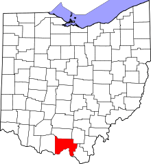
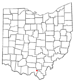
South Webster, Ohio
| South Webster, Ohio | |
|---|---|
| Village | |
|
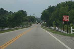
A view of SR 140 as it enters South Webster from the northeast. On the right, a sign celebrating the state basketball championship. | |
 Location of South Webster, Ohio | |
| Coordinates: 38°48′56″N 82°43′34″W / 38.81556°N 82.72611°WCoordinates: 38°48′56″N 82°43′34″W / 38.81556°N 82.72611°W | |
| Country | United States |
| State | Ohio |
| County | Scioto |
| Area[1] | |
| • Total | 1.32 sq mi (3.42 km2) |
| • Land | 1.31 sq mi (3.39 km2) |
| • Water | 0.01 sq mi (0.03 km2) |
| Elevation[2] | 715 ft (218 m) |
| Population (2010)[3] | |
| • Total | 866 |
| • Estimate (2012[4]) | 853 |
| • Density | 661.1/sq mi (255.3/km2) |
| Time zone | Eastern (EST) (UTC-5) |
| • Summer (DST) | EDT (UTC-4) |
| ZIP code | 45682 |
| Area code(s) | 740 |
| FIPS code | 39-73824[5] |
| GNIS feature ID | 1084066[2] |
South Webster is a village in northeast Scioto County, Ohio, United States. It lies along State Route 140, and the population was 866 at the 2010 census.[6]
South Webster was platted by John Bennett in 1853.[7] The village hosts the Cornhole World Championship.[8]
Geography
South Webster is located at 38°48′56″N 82°43′34″W / 38.81556°N 82.72611°W (38.815454, -82.726091).[9]
According to the United States Census Bureau, the village has a total area of 1.32 square miles (3.42 km2), of which 1.31 square miles (3.39 km2) is land and 0.01 square miles (0.03 km2) is water.[1]
Demographics
2010 census
As of the census[3] of 2010, there were 866 people, 370 households, and 265 families residing in the village. The population density was 661.1 inhabitants per square mile (255.3/km2). There were 395 housing units at an average density of 301.5 per square mile (116.4/km2). The racial makeup of the village was 98.2% White, 0.1% African American, 0.1% Native American, 0.3% Asian, and 1.3% from two or more races. Hispanic or Latino of any race were 0.3% of the population.
There were 370 households of which 31.6% had children under the age of 18 living with them, 54.6% were married couples living together, 11.6% had a female householder with no husband present, 5.4% had a male householder with no wife present, and 28.4% were non-families. 25.4% of all households were made up of individuals and 13.7% had someone living alone who was 65 years of age or older. The average household size was 2.34 and the average family size was 2.76.
The median age in the village was 43.9 years. 22.7% of residents were under the age of 18; 4.1% were between the ages of 18 and 24; 24.3% were from 25 to 44; 29.2% were from 45 to 64; and 19.7% were 65 years of age or older. The gender makeup of the village was 47.7% male and 52.3% female.
2000 census
As of the census[5] of 2000, there were 764 people, 312 households, and 224 families residing in the village. The population density was 584.8 people per square mile (225.2/km²). There were 338 housing units at an average density of 258.7 per square mile (99.6/km²). The racial makeup of the village was 98.30% White, 0.65% Native American, 0.39% Pacific Islander, 0.13% from other races, and 0.52% from two or more races. Hispanic or Latino of any race were 0.65% of the population.
There were 312 households out of which 31.1% had children under the age of 18 living with them, 56.4% were married couples living together, 11.9% had a female householder with no husband present, and 27.9% were non-families. 26.0% of all households were made up of individuals and 15.1% had someone living alone who was 65 years of age or older. The average household size was 2.45 and the average family size was 2.91.
In the village the population was spread out with 24.6% under the age of 18, 10.1% from 18 to 24, 26.2% from 25 to 44, 24.7% from 45 to 64, and 14.4% who were 65 years of age or older. The median age was 38 years. For every 100 females there were 87.7 males. For every 100 females age 18 and over, there were 81.1 males.
The median income for a household in the village was $26,818, and the median income for a family was $40,938. Males had a median income of $31,583 versus $22,727 for females. The per capita income for the village was $15,047. About 13.0% of families and 16.4% of the population were below the poverty line, including 21.7% of those under age 18 and 14.1% of those age 65 or over.
Public services
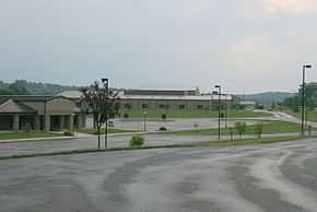
South Webster is home to the Bloom-Vernon Local School District. The district includes Bloom-Vernon Elementary School, South Webster Jr.-Sr. High School, South Webster Headstart, and Vernon Adult Learning Center. South Webster's mascot is the Jeeps. They were the 2006 Ohio High School Athletic Association Division IV basketball champions.[10] South Webster is served by the Portsmouth Public Library-South Webster Branch.
Notable person
- Chet Spencer, baseball player
References
- ↑ 1.0 1.1 "US Gazetteer files 2010". United States Census Bureau. Retrieved 2013-01-06.
- ↑ 2.0 2.1 "US Board on Geographic Names". United States Geological Survey. 2007-10-25. Retrieved 2008-01-31.
- ↑ 3.0 3.1 "American FactFinder". United States Census Bureau. Retrieved 2013-01-06.
- ↑ "Population Estimates". United States Census Bureau. Retrieved 2013-06-17.
- ↑ 5.0 5.1 "American FactFinder". United States Census Bureau. Retrieved 2008-01-31.
- ↑ "Profile of General Population and Housing Characteristics: 2010 Demographic Profile Data (DP-1): South Webster village, Ohio". U.S. Census Bureau, American Factfinder. Retrieved March 29, 2012.
- ↑ "Portsmouth Area Resource Guide, 2007-2008". The Community Common. 2007-07-29. p. 7.
- ↑ Jeff Taepke (2007-07-29). "King of Corn: Competition fierce at Cornhole Championships". Portsmouth Daily Times. Retrieved 2007-07-29.
- ↑ "US Gazetteer files: 2010, 2000, and 1990". United States Census Bureau. 2011-02-12. Retrieved 2011-04-23.
- ↑ OHSAA. "Ohio High School Athletic Association Web site". Retrieved 2006-12-31.
External links
| |||||||||||||||||||||||||||||