South Toowoomba, Queensland
| South Toowoomba Toowoomba, Queensland | |||||||||||||
|---|---|---|---|---|---|---|---|---|---|---|---|---|---|
|
| |||||||||||||
| Coordinates | 27°34′34″S 151°57′14″E / 27.576°S 151.954°ECoordinates: 27°34′34″S 151°57′14″E / 27.576°S 151.954°E | ||||||||||||
| Population | 5,225 (2011 census)[1] | ||||||||||||
| • Density | 1,412/km2 (3,660/sq mi) | ||||||||||||
| Postcode(s) | 4350 | ||||||||||||
| Area | 3.7 km2 (1.4 sq mi) | ||||||||||||
| Location | 2 km (1 mi) S of Toowoomba | ||||||||||||
| LGA(s) | Toowoomba Region | ||||||||||||
| State electorate(s) | Toowoomba South | ||||||||||||
| Federal Division(s) | Groom | ||||||||||||
| |||||||||||||

South Toowoomba is an inner suburb of Toowoomba, Queensland, Australia, located directly south of the city centre.[2] At the 2011 Australian Census the suburb recorded a population of 5,225.[1]
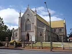
St Patricks Cathedral, 2014
The suburb is home to St Patricks Cathedral, City Golf Course, the Downs Shopping Centre, St Saviour's College and Toowoomba South State School.
References
- ↑ 1.0 1.1 Australian Bureau of Statistics (31 October 2012). "South Toowoomba (State Suburb)". 2011 Census QuickStats. Retrieved 25 March 2015.
- ↑ Department of Environment and Resource Management. "Place name details — South Toowoomba". Retrieved 4 June 2011.
| ||||||||||||||||||