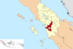
South Tapanuli Regency
| South Tapanuli Regency Tapanuli Selatan | |
|---|---|
| Regency | |
 | |
| Country | Indonesia |
| Province | North Sumatra |
| Capital | Sipirok |
| Area | |
| • Total | 4,352.86 km2 (1,680.65 sq mi) |
| Population (2014) | |
| • Total | 274,905 |
| • Density | 63/km2 (160/sq mi) |
| Time zone | WIB (UTC+7) |
| Website | http://www.tapselkab.go.id/ |
South Tapanuli is a regency in North Sumatra. Its seat is Sipirok. The regency covers an area of 4,352.86 square kilometres and according to the 2010 census it had a population of 264,108;[1] the latest estimate (for January 2014) is 274,905.
Administration
The regency is divided into twelve districts (kecamatan), tabulated below with their 2010 Census population:[2]
| Name | Population Census 2010[2] |
|---|---|
| Batang Angkola | 32,129 |
| Sayur Matinggi | 37,655 |
| Angkola Timur (East Angkola) | 18,553 |
| Angkola Selatan (South Angkola) | 27,500 |
| Angkola Barat (West Angkola) | 41,254 |
| Batang Toru | 28,595 |
| Marancar | 9,351 |
| Muara Batang Toro | 11,401 |
| Sipirok | 30,435 |
| Arse | 7,871 |
| Sapar Dolok Hole | 12,674 |
| Aek Bilah | 6,396 |
Archaeology
The Padang Lawas archaeological site is partly located in the regency. The site covers approximately 1,500 km² over the district (kecamatan) of Padangbolak in South Tapanuli, and in Padang Lawas and North Padang Lawas regencies.
The village of Batu Gana in Padangbolak Julu district is the location of a burial site consisting of a megalithic structure.
In the village of Padang Bujur in the same district, one can also find megalithic remains and what seems to be the base for a padmasana.
Other megalithic remains are found at Aek Korsik and Aek Tolong Huta, also in the Padangbolak district.
References
- ↑ Seta,William J. Atlas Lengkap Indonesia dan Dunia (untuk SD, SMP, SMU, dan Umum). Pustaka Widyatama. p. 9. ISBN 979-610-232-3.
- ↑ 2.0 2.1 Biro Pusat Statistik, Jakarta, 2011.
Sources
- Simanjuntak, Truman, M. Hisyam, Bagyo Prasetyo, Titi Surti Nastiti (éds.), Archaeology: Indonesian perspective : R.P. Soejono's festschrift, LIPI, Jakarta, 2006, ISBN 979-26-2499-6