South Royalton, Vermont
| South Royalton, Vermont | |
|---|---|
| Census-designated place | |
 | |
| Coordinates: 43°49′13″N 72°31′16″W / 43.82028°N 72.52111°WCoordinates: 43°49′13″N 72°31′16″W / 43.82028°N 72.52111°W | |
| Country | United States |
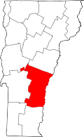
| State | Vermont |
| County | Windsor |
| Area | |
| • Total | 1.2 sq mi (3.1 km2) |
| • Land | 1.1 sq mi (2.9 km2) |
| • Water | 0.08 sq mi (0.2 km2) |
| Elevation | 490 ft (150 m) |
| Population (2010) | |
| • Total | 694 |
| • Density | 580/sq mi (220/km2) |
| Time zone | Eastern (EST) (UTC-5) |
| • Summer (DST) | EDT (UTC-4) |
| ZIP code | 05068 |
| Area code(s) | 802 |
| FIPS code | 50-68050[1] |
| GNIS feature ID | 1459612[2] |
South Royalton is a census-designated place (CDP) in the town of Royalton, Windsor County, Vermont, United States. With a population at the 2010 census of 694,[3] South Royalton is the largest village in the town. It is the home to Vermont Law School.
Geography
South Royalton is located in northern Windsor County along the White River. Vermont Route 14 runs along the north side of the river, just outside the CDP limits, leading southeast to White River Junction and northwest to Barre. Vermont Route 110 leads north from South Royalton into Tunbridge. Interstate 89 passes to the west of the village but does not serve it with a direct exit. Access to South Royalton is either from Exit 2 (at Sharon) or Exit 3 (at North Royalton).
References
- ↑ "American FactFinder". United States Census Bureau. Retrieved 2008-01-31.
- ↑ "US Board on Geographic Names". United States Geological Survey. 2007-10-25. Retrieved 2008-01-31.
- ↑ "Profile of General Population and Housing Characteristics: 2010 Demographic Profile Data (DP-1): South Royalton CDP, Vermont". U.S. Census Bureau, American Factfinder. Retrieved August 3, 2012.
| |||||||||||||||||||||||||