South Holland, Lincolnshire
| South Holland District | |
|---|---|
| Non-metropolitan district | |
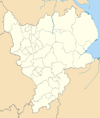
 Shown within the ceremonial county of Lincolnshire | |
| Sovereign state | United Kingdom |
| Constituent country | England |
| Region | East Midlands |
| Administrative county | Lincolnshire |
| Admin. HQ | Spalding |
| Government | |
| • Type | South Holland District Council |
| • Leadership: | Leader & Cabinet |
| • Executive: | Conservative |
| • MP: | John Hayes |
| Area | |
| • Total | 286.6 sq mi (742.4 km2) |
| Area rank | 48th |
| Population (2011 est.) | |
| • Total | 88,400 |
| • Rank | Ranked 264th |
| • Density | 310/sq mi (120/km2) |
| Time zone | Greenwich Mean Time (UTC+0) |
| • Summer (DST) | British Summer Time (UTC+1) |
| ONS code |
32UF (ONS) E07000140 (GSS) |
| Ethnicity | 98.8% White |
| Website | sholland.gov.uk |
South Holland is a local government district of Lincolnshire. The district council is based in Spalding.
It was formed on 1 April 1974, under the Local Government Act 1972, as a merger of the Spalding urban district with East Elloe Rural District and Spalding Rural District. All these were previously in the administrative county of Holland.
South Holland borders the borough of Boston to the north, The Wash and the county of Norfolk to the east, the county of Cambridgeshire and Peterborough unitary authority to the south, the Lincolnshire district of South Kesteven to the west, and the district of North Kesteven to the north-west.
Demographics
There were 76,512 citizens in the district at the 2001 census.[1] The median age is nearly 43.[1] 82.6% of people in the district claim to be of a Christian religion - the highest proportion for any district in the East Midlands (St Helens has the highest proportion of Christians in the UK at 86.9%). The district has the lowest unemployment in Lincolnshire and average hours worked per week are the second highest for UK districts (Eden, Cumbria has the highest).
The 2011 census reports 88,270 people at 1.2 per hectare in 37,264 households. [2]
Much of the district is low-lying and is kept free from inundation by land drainage. This is the responsibility of the South Holland Internal Drainage Board and the Environment Agency.[3]
References
- ↑ 1.0 1.1 "District Council's summary of 2001 census results" (PDF).
- ↑ "South Holland:Key Statistics". 2011 census. Office for national statistics. Retrieved 20 April 2013.
- ↑ "South Holland IDB". Water Management Alliance. Retrieved 12 June 2013.
| ||||||||||||||||||||||||||||
| ||||||||||||||||||||||