South Greenfield, Missouri
| South Greenfield, Missouri | |
|---|---|
| Village | |
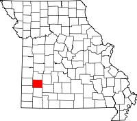
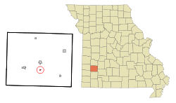 Location of South Greenfield, Missouri | |
| Coordinates: 37°22′32″N 93°50′27″W / 37.37556°N 93.84083°WCoordinates: 37°22′32″N 93°50′27″W / 37.37556°N 93.84083°W | |
| Country | United States |
| State | Missouri |
| County | Dade |
| Area[1] | |
| • Total | 0.16 sq mi (0.41 km2) |
| • Land | 0.16 sq mi (0.41 km2) |
| • Water | 0 sq mi (0 km2) |
| Elevation | 965 ft (294 m) |
| Population (2010)[2] | |
| • Total | 90 |
| • Estimate (2012[3]) | 87 |
| • Density | 562.5/sq mi (217.2/km2) |
| Time zone | Central (CST) (UTC-6) |
| • Summer (DST) | CDT (UTC-5) |
| ZIP code | 65752 |
| Area code(s) | 417 |
| FIPS code | 29-68888[4] |
| GNIS feature ID | 0729966[5] |
South Greenfield is a village in Dade County, Missouri, United States. The population was 90 at the 2010 census.
Geography
South Greenfield is located at 37°22′32″N 93°50′27″W / 37.37556°N 93.84083°W (37.375496, -93.840812).[6]
According to the United States Census Bureau, the village has a total area of 0.16 square miles (0.41 km2), all of it land.[1]
Demographics
2010 census
As of the census[2] of 2010, there were 90 people, 40 households, and 26 families residing in the village. The population density was 562.5 inhabitants per square mile (217.2/km2). There were 46 housing units at an average density of 287.5 per square mile (111.0/km2). The racial makeup of the village was 96.7% White and 3.3% Native American.
There were 40 households of which 30.0% had children under the age of 18 living with them, 52.5% were married couples living together, 5.0% had a female householder with no husband present, 7.5% had a male householder with no wife present, and 35.0% were non-families. 30.0% of all households were made up of individuals and 17.5% had someone living alone who was 65 years of age or older. The average household size was 2.25 and the average family size was 2.73.
The median age in the village was 41.5 years. 24.4% of residents were under the age of 18; 6.7% were between the ages of 18 and 24; 22.3% were from 25 to 44; 28.9% were from 45 to 64; and 17.8% were 65 years of age or older. The gender makeup of the village was 46.7% male and 53.3% female.
2000 census
As of the census[4] of 2000, there were 136 people, 54 households, and 40 families residing in the village. The population density was 798.1 people per square mile (308.9/km²). There were 59 housing units at an average density of 346.3 per square mile (134.0/km²). The racial makeup of the village was 99.26% White, and 0.74% from two or more races.
There were 54 households out of which 38.9% had children under the age of 18 living with them, 61.1% were married couples living together, 7.4% had a female householder with no husband present, and 25.9% were non-families. 22.2% of all households were made up of individuals and 7.4% had someone living alone who was 65 years of age or older. The average household size was 2.52 and the average family size was 2.90.
In the village the population was spread out with 29.4% under the age of 18, 8.8% from 18 to 24, 31.6% from 25 to 44, 19.9% from 45 to 64, and 10.3% who were 65 years of age or older. The median age was 32 years. For every 100 females there were 100.0 males. For every 100 females age 18 and over, there were 104.3 males.
The median income for a household in the village was $19,000, and the median income for a family was $30,000. Males had a median income of $21,250 versus $13,125 for females. The per capita income for the village was $10,241. There were 28.1% of families and 30.0% of the population living below the poverty line, including 38.2% of under eighteens and 35.7% of those over 64.
History
"Prior to the year 1881 there were no railroads in Dade County. In that early day Greenfield was the metropolis of the county and all the horsetracks in the road pointed in that direction. The old railroad survey to which Dade County had subscribed bonds in the sum of, 000.00 touched the townsite of Greenfield on the southwest but when the Kansas City, Fort Scott and Gulf Railroad was built in 1881 it missed the town three miles (5 km). It followed a natural depression out of the Turnback and Limestone hills to the prairie leaving the county seat stranded on high and dry ground.People in their enthusiasm and speculation expected to see Greenfield with her business interests and county offices move bodily to the railroad point. To facilitate this enterprise Levin W. Shafer, in company with John A. Ready, two Greenfield lawyers and real estate dealers having financial relations with the Dade County Bank, purchased a 41-acre (170,000 m2) tract of land and laid out the pretentious city of sough Greenfield, with its spacious Public Square upon which a Court House was to be erected when the county seat was removed to that point.
John A. Myers immediately platted an Addition on the northwest, G. W. Yeager an Addition on the southwest, Jacob Cox sold lots by metes and bounds on the south and L. J. Griggs Addition on the north, but this plat was never recorded. Many business men from Greenfield became interested in South Greenfield enterprises. Horace Howard embarked in the livery business, J. L. Wetzel sold general merchandise and many other lines were represented so that in a few years the new city attained a population of about 600.
At this juncture the unexpected happened. T. A. Miller, a man of action and great business sagacity conceived the idea of building a branch railroad from Greenfield to South Greenfield by popular subscription. Greenfield business men took kindly to the idea and in a short time the Greenfield & Northern railroad was a reality. Its original promoters expected to extend this line to Stockton and on the some Missouri River point, but the north corporate limits of Greenfield became and remained its northern terminus. The rolling stock of this road consisted of one little wheezy, jerky engine, one box car and one combination express-baggage-passenger coach, one hand-car with tools and equipment sufficient for the section foreman and one hand. Later on this road was extended southward thirty miles to Aurora and was sold to the Frisco system and is now one of its important branches.
With the building of this railroad the county seat hopes of south Greenfield gradually faded and finally vanished in thin air. The boom proclivities of the town subsided and its population gradually diminished until now it has something like 300 people within its corporate limits. Having Lockwood on the West, Everton on the east, Greenfield on the north and Pennsboro on the south its trade territory is restricted and yet, notwithstanding all this South Greenfield has made a substantial little city, junction railroad point and is the center of a rock-road district with about 20-mile (32 km) of permanently improved highways. It has privately owned electric light and water-works systems, a beautiful public park, is the home of the Cumberland Presbyterian Camp Grounds and is in every way a very desirable place in which to live."
References
- ↑ 1.0 1.1 "US Gazetteer files 2010". United States Census Bureau. Retrieved 2012-07-08.
- ↑ 2.0 2.1 "American FactFinder". United States Census Bureau. Retrieved 2012-07-08.
- ↑ "Population Estimates". United States Census Bureau. Retrieved 2013-05-30.
- ↑ 4.0 4.1 "American FactFinder". United States Census Bureau. Retrieved 2008-01-31.
- ↑ "US Board on Geographic Names". United States Geological Survey. 2007-10-25. Retrieved 2008-01-31.
- ↑ "US Gazetteer files: 2010, 2000, and 1990". United States Census Bureau. 2011-02-12. Retrieved 2011-04-23.
- ↑ Taken from http://www.dadecountymissouri.20m.com/custom2.html which was copied from "History of Dade County and It's People." Goodspeed Publishing, November 1, 1917. Submitter owns the web page and an original copy of the copyright expired book.
| |||||||||||||||||||||||||||||