South Africa–Swaziland border

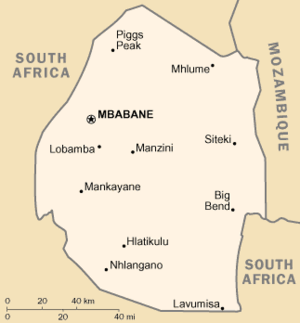
Swaziland is nearly surrounded by South Africa

The border between South Africa and Swaziland is 430 kilometres (267 mi) long;[1][2][3] South Africa surrounds Swaziland to the north, west, south and southeast, with Mozambique bordering it on the northeast.

Crossings

Border post

The border crossings are listed from north to south in the table below.[4]

South Africa Swaziland Opening hours Geographical coordinates Notes
Road Border post Road Border post
R571 Mananga MR5 Mananga 07:00–18:00 25°55′59″S 31°45′41″E / 25.9331°S 31.7613°E Durban–Komatipoort railway also crosses here
R570 Jeppe's Reef MR1 Matsamo 07:00–20:00 25°45′03″S 31°28′03″E / 25.7507°S 31.4676°E  
R40 Josephsdal MR20 Bulembu 08:00–16:00 25°56′41″S 31°07′17″E / 25.9446°S 31.1215°E  
N17 Oshoek MR3 Ngwenya 07:00–00:00 26°12′45″S 30°59′21″E / 26.2125°S 30.9892°E   the changes to time were initiated last year in April 2012.
  Waverley   Lundzi 08:00–16:00 26°19′39″S 30°53′19″E / 26.3275°S 30.8885°E  
R65 Nerston MR19 Sandlane 08:00–18:00 26°34′11″S 30°47′30″E / 26.5697°S 30.7918°E  
  Emahlathini MR4 Sicunusa 08:00–18:00 26°51′38″S 30°54′30″E / 26.8605°S 30.9084°E  
  Bothashoop   Gege 08:00–16:00 26°58′25″S 30°58′06″E / 26.9737°S 30.9684°E  
R543 Mahamba MR9 Mahamba 07:00–22:00 27°06′20″S 31°04′09″E / 27.1055°S 31.0691°E  
  Onverwacht MR21 Salitje 08:00–18:00 27°18′58″S 31°38′38″E / 27.3162°S 31.6438°E
  Golela MR8 Lavumisa 07:00–22:00 27°19′02″S 31°53′18″E / 27.3172°S 31.8884°E Durban–Komatipoort railway also crosses here

References

  1. South Africa entry at The World Factbook
  2. South Africa–Swaziland Boundary (Report). International Boundary Study No. 137. United States Department of State. 7 July 1973. Retrieved 26 April 2013.
  3. Brownlie, Ian (1979). "South Africa–Swaziland". African Boundaries: A Legal and Diplomatic Encyclopaedia. London: C. Hurst & Co. pp. 1313–1343. ISBN 0903983877.
  4. "South African Ports of Entry". Department of Home Affairs. Retrieved 28 July 2013.