Sore, Landes
| Sore | |
|---|---|
|
The church in Sore | |
 Sore | |
|
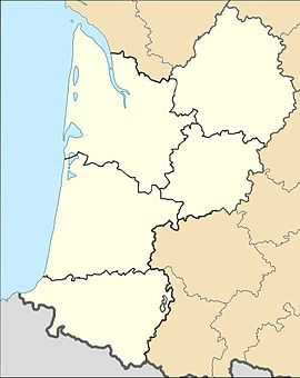
Location within Aquitaine region  Sore | |
| Coordinates: 44°19′28″N 0°34′48″W / 44.3244°N 0.58°WCoordinates: 44°19′28″N 0°34′48″W / 44.3244°N 0.58°W | |
| Country | France |
| Region | Aquitaine |
| Department | Landes |
| Arrondissement | Arrondissement of Mont-de-Marsan |
| Canton | Canton of Sore |
| Intercommunality | Communauté de communes du Pays d'Albret |
| Government | |
| • Mayor (2008–2014) | Max Roumegoux |
| Area1 | 147.72 km2 (57.04 sq mi) |
| Population (2006)2 | 985 |
| • Density | 6.7/km2 (17/sq mi) |
| INSEE/Postal code | 40307 / 40430 |
| Elevation |
45–99 m (148–325 ft) (avg. 73 m or 240 ft) |
|
1 French Land Register data, which excludes lakes, ponds, glaciers > 1 km² (0.386 sq mi or 247 acres) and river estuaries. 2 Population without double counting: residents of multiple communes (e.g., students and military personnel) only counted once. | |
Sore is a commune in the Landes department in Aquitaine in south-western France. It is in the middle of the Landes de Gascogne Regional Natural Park.
Sore is about 65 km south of Bordeaux and about 50 km inland east of the Atlantic coast.
See also
- Communes of the Landes department
- Parc naturel régional des Landes de Gascogne
| Wikimedia Commons has media related to Sore (Landes). |
