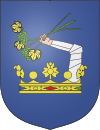
Somogy County
| Somogy County | |||
|---|---|---|---|
 | |||
| |||
 | |||
| Country | Hungary | ||
| Region | Southern Transdanubia | ||
| County seat | Kaposvár | ||
| Area | |||
| • Total | 6,065.07 km2 (2,341.74 sq mi) | ||
| Population (2011 census) | |||
| • Total | 317,307 | ||
| • Density | 52/km2 (140/sq mi) | ||
| Website |
www | ||
Somogy (Slovene: Šomodska županija) is an administrative county (comitatus or megye) in present Hungary, and also in the former Kingdom of Hungary.
Somogy county
Somogy county lies in south-western Hungary, on the border with Croatia. It stretches between the river Dráva and the southern shore of Lake Balaton. It shares borders with the Hungarian counties Zala, Veszprém, Fejér, Tolna and Baranya. It is the most sparsely populated county in Hungary. The capital of Somogy county is Kaposvár. Its area is 6036 km².
History
Somogy was also the name of a historic administrative county (comitatus) of the Kingdom of Hungary. Its territory, which was slightly larger than that of present Somogy county, is now in south-western Hungary. The capital of the county was Kaposvár.

Regional structure
City with county rights
- Kaposvár (county seat)
Towns
(ordered by population, according to the 2012 census)
- Siófok (24,375)
- Marcali (11,567)
- Barcs (11,378)
- Nagyatád (10,734)
- Balatonboglár (5,932)
- Csurgó (5,186)
- Fonyód (4,728)
- Balatonlelle (4,735)
- Tab (4,242)
- Nagybajom (3,431)
- Lengyeltóti (3,227)
- Kadarkút (2,583)
- Zamárdi (2,363)
- Balatonföldvár (2,064)
- Igal (1,308)
Villages
Presidents of the General Assembly
| Name | Period |
|---|---|
| István Gyenesei | 1990 - 1994 |
| István Kolber | 1994 - 1998 |
| István Gyenesei | 1998 - 2006 |
| Attila Gelencsér | 2006 - Present |
See also
-

Kereki - Castle from above
-

Aerial Photo: Nagyberki - Palace
-

Aerial Photo: Iharosberény - Palace
-

Aerial Photo: Babócsa - Palace
References
| ||||||||||||
| ||||||||||||||

