Soda Mountains
| Soda Mountains | |
|---|---|
|
Northern Soda Mountains | |
| Highest point | |
| Elevation | 1,102 m (3,615 ft) |
| Geography | |
|
<div style="padding:2px 2px 5px 2px;>  location of Soda Mountains in California [1] | |
| Country | United States |
| State | California |
| District | San Bernardino County |
| Range coordinates | 35°13′00″N 116°14′03″W / 35.2166°N 116.2342°WCoordinates: 35°13′00″N 116°14′03″W / 35.2166°N 116.2342°W |
| Topo map | USGS West of Soda Lake |
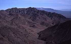
The Soda Mountains are located in the eastern Mojave Desert in San Bernardino County, California, USA. The range lies to the north of Interstate 15 west of the town of Baker.
Geography
The range reaches an elevation of 1,102 meters (3,615 ft) at the western end of the range. The mountains lie between the Avawatz Mountains to the north and the Bristol Mountains to the south. The Cronese Mountains are located southwest of the Soda Mountains.
References
- ↑ "Soda Mountains". Geographic Names Information System. United States Geological Survey. Retrieved 2009-05-04.