Smoky Mountains (Idaho)
| Smoky Mountains | |
|---|---|
|
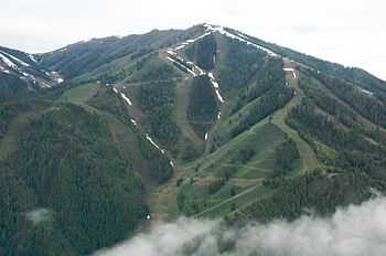
Bald Mountain in the Smoky Mountains | |
| Highest point | |
| Peak | Saviers Peak |
| Elevation | 10,441 ft (3,182 m) |
| Coordinates | 43°49′19″N 114°42′47″W / 43.821944°N 114.713056°WCoordinates: 43°49′19″N 114°42′47″W / 43.821944°N 114.713056°W |
| Dimensions | |
| Length | 45 mi (72 km) N/S |
| Width | 39 mi (63 km) E/W |
| Geography | |
| Country | United States |
| State | Idaho |
The Smoky Mountains are part of the Rocky Mountains and located on the west side of the Wood River Valley near Sun Valley, Idaho, in the Western United States. The range is within Sawtooth National Forest, while part of it is within the Sawtooth National Recreation Area.[1] The highest point in the range is Saviers Peak at 10,441 ft (3,182 m).[2]
The Smoky Mountains area closely surrounded by other mountain ranges including the Sawtooth Mountains to the northwest, Boulder Mountains to the north, Pioneer Mountains to the east, and Soldier Mountains to the south. The Smoky Mountains are located within the watersheds of the Big Wood, Salmon, and Boise Rivers. The mountains are most easily accessed from Idaho State Highway 75, although many unimproved and improved dirt road, including National Forest road 227, enter and cross the mountains.
The Smoky Mountains were named from the frequent forest fires in the mountains. In 2007 the Castle Rock Fire burned 48,000 acres of the Smoky Mountains near Ketchum.[3] [4]
Peaks
Lakes
| Lake | Elevation | Max. length | Max. width | Location | Primary Outflow |
|---|---|---|---|---|---|
| Baker Lake | 2,685 m (8,809 ft) | 280 m (920 ft) | 150 m (490 ft) | 43°41′26″N 114°40′32″W / 43.690651°N 114.675674°W | Baker Creek |
| Big Lost Lake | 2,797 m (9,177 ft) | 295 m (968 ft) | 210 m (690 ft) | 43°44′38″N 114°39′44″W / 43.743924°N 114.662344°W | Norton Creek |
| Dollar Lake | 1,815 m (5,955 ft) | 053 m (174 ft) | 046 m (151 ft) | 43°41′18″N 114°25′07″W / 43.688218°N 114.418695°W | Warm Springs Creek |
| Little Lost Lake | 2,768 m (9,081 ft) | 075 m (246 ft) | 028 m (92 ft) | 43°44′12″N 114°39′37″W / 43.736715°N 114.660383°W | Norton Creek |
| Lower Norton Lake | 2,737 m (8,980 ft) | 190 m (620 ft) | 106 m (348 ft) | 43°44′56″N 114°39′15″W / 43.748834°N 114.654185°W | Norton Creek |
| Mill Lake | 2,510 m (8,230 ft) | 320 m (1,050 ft) | 257 m (843 ft) | 43°46′45″N 114°38′23″W / 43.779064°N 114.639653°W | Mill Creek |
| Miner Lake | 2,678 m (8,786 ft) | 390 m (1,280 ft) | 240 m (790 ft) | 43°45′33″N 114°39′55″W / 43.759270°N 114.665195°W | Prairie Creek |
| Paradise Lake | 2,741 m (8,993 ft) | 177 m (581 ft) | 084 m (276 ft) | 43°44′00″N 114°50′46″W / 43.733329°N 114.846167°W | Paradise Creek |
| Penny Lake | 1,810 m (5,940 ft) | 072 m (236 ft) | 041 m (135 ft) | 43°41′10″N 114°25′08″W / 43.686078°N 114.418867°W | Warm Springs Creek |
| Smoky Lake | 2,755 m (9,039 ft) | 100 m (330 ft) | 095 m (312 ft) | 43°44′22″N 114°39′34″W / 43.739392°N 114.659457°W | Norton Creek |
| Snowslide Lake | 2,670 m (8,760 ft) | 102 m (335 ft) | 060 m (200 ft) | 43°44′19″N 114°49′31″W / 43.738611°N 114.825412°W | Snowslide Creek |
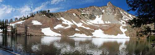
| Titus Lake | 2,719 m (8,921 ft) | 105 m (344 ft) | 093 m (305 ft) | 43°51′18″N 114°42′38″W / 43.855021°N 114.710435°W | Titus Creek |
| Upper Norton Lake | 2,780 m (9,120 ft) | 279 m (915 ft) | 106 m (348 ft) | 43°45′07″N 114°39′22″W / 43.751912°N 114.656145°W | Norton Creek |
Gallery
-
Titus Lake in the Smoky Mountains
-

Bald Mountain
-
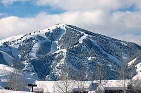
Smoky Mountains from Wood River Valley
-
Smoky Mountains from Wood River Valley
-

Fighting the Castle Rock Fire
-

Castle Rock Fire fighters
-

Along the trail to Baker Lake
-

Baker Lake
-

Along the trail to Baker Lake
See also
| Wikimedia Commons has media related to Smoky Mountains (Idaho). |
References
- ↑ Sawtooth National Forest. “Sawtooth National Forest” [map].1:126,720, 1”=2 miles. Twin Falls, Idaho: Sawtooth National Forest, United States Forest Service, 1998.
- ↑ SummitPost.org - Smoky Mountains. Retrieved 17 January 2012.
- ↑ Idaho Mountain Express - Castle Rock Fire battle ends where it began. Retrieved 05 February 2012.
- ↑ Idaho Mountain Express - Still scarred - but new life emerges. Retrieved 05 February 2012.


