Slope County, North Dakota
| Slope County, North Dakota | |
|---|---|
 Slope County Courthouse in Amidon | |
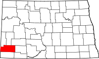 Location in the state of North Dakota | |
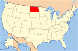 North Dakota's location in the U.S. | |
| Founded | January 14, 1915 |
| Seat | Amidon |
| Largest city | Marmarth |
| Area | |
| • Total | 1,219 sq mi (3,157 km2) |
| • Land | 1,215 sq mi (3,147 km2) |
| • Water | 4.2 sq mi (11 km2), 0.3% |
| Population (Est.) | |
| • (2014) | 765 |
| • Density | 0.6/sq mi (0/km²) |
| Congressional district | At-large |
| Time zone | Mountain: UTC-7/-6 |
| Website |
www |
Slope County is a county located in the U.S. state of North Dakota. As of the 2010 census, the population was 727,[1] making it the least populous county in North Dakota and the 20th-least populous county in the United States. The county seat is Amidon.[2] The county was created in 1914 when Billings County was subdivided into three new counties;[3] it was organized on January 14, 1915.[4][5] The name refers to the Missouri Slope, a geographical feature that is also a popular designation for western North Dakota, particularly the area west of the Missouri River.
Geography
.JPG)
According to the U.S. Census Bureau, the county has a total area of 1,219 square miles (3,160 km2), of which 1,215 square miles (3,150 km2) is land and 4.2 square miles (11 km2) (0.3%) is water.[6]
White Butte, the highest natural point in North Dakota at an elevation of 3506 ft (1062 m), is in Slope County.
Major highways
-
 U.S. Highway 12
 -
 U.S. Highway 85
National protected areas
- Little Missouri National Grassland (part)
- Stewart Lake National Wildlife Refuge
- White Lake National Wildlife Refuge
Adjacent counties
- Billings County (north)
- Stark County (northeast)
- Hettinger County (east)
- Adams County (southeast)
- Bowman County (south)
- Fallon County, Montana (west)
- Golden Valley County (southwest)
Demographics
| Historical population | |||
|---|---|---|---|
| Census | Pop. | %± | |
| 1920 | 4,940 | — | |
| 1930 | 4,150 | −16.0% | |
| 1940 | 2,932 | −29.3% | |
| 1950 | 2,315 | −21.0% | |
| 1960 | 1,893 | −18.2% | |
| 1970 | 1,484 | −21.6% | |
| 1980 | 1,157 | −22.0% | |
| 1990 | 907 | −21.6% | |
| 2000 | 767 | −15.4% | |
| 2010 | 727 | −5.2% | |
| Est. 2014 | 765 | 5.2% | |
As of the census of 2000, there were 767 people, 313 households, and 222 families residing in the county. The population density was 0.63 people per square mile (0.14/km²). There were 451 housing units at an average density of 0.37 per square mile (0.24/km²). The racial makeup of the county was 99.84% White, 0.08% Native American, and 0.13% from two or more races. 0.08% of the population were Hispanic or Latino of any race. Slope County has the highest percentage white population of any U.S. county. 46.9% were of German, 15.2% Norwegian, 8.1% American, 7.4% English and 7.2% Swedish ancestry.
There were 313 households out of which 30.0% had children under the age of 18 living with them, 64.5% were married couples living together, 3.8% had a female householder with no husband present, and 28.8% were non-families. 27.2% of all households were made up of individuals and 10.5% had someone living alone who was 65 years of age or older. The average household size was 2.45 and the average family size was 2.96.
In the county the population was spread out with 25.3% under the age of 18, 4.2% from 18 to 24, 25.0% from 25 to 44, 27.6% from 45 to 64, and 17.9% who were 65 years of age or older. The median age was 42 years. For every 100 females there were 116.7 males. For every 100 females age 18 and over, there were 117.0 males.
The median income for a household in the county was $24,667, and the median income for a family was $26,058. Males had a median income of $20,000 versus $12,115 for females. The per capita income for the county was $14,513. About 15.40% of families and 16.90% of the population were below the poverty line, including 16.30% of those under age 18 and 8.00% of those age 65 or over.
Communities
Cities
Unincorporated communities
See also
References
- ↑ 1.0 1.1 "State & County QuickFacts". United States Census Bureau. Retrieved November 1, 2013.
- ↑ "Find a County". National Association of Counties. Retrieved 2011-06-07.
- ↑ "Slope County, North Dakota". North Dakota GenWeb Project. Retrieved 14 September 2012.
- ↑ "County History". Official Portal for North Dakota State Government. Retrieved 4 May 2011.
- ↑ "Dakota Territory, South Dakota, and North Dakota: Individual County Chronologies". Dakota Territory Atlas of Historical County Boundaries. The Newberry Library. 2006. Retrieved February 1, 2015.
- ↑ "2010 Census Gazetteer Files". United States Census Bureau. August 22, 2012. Retrieved February 1, 2015.
- ↑ "U.S. Decennial Census". United States Census Bureau. Retrieved February 1, 2015.
- ↑ "Historical Census Browser". University of Virginia Library. Retrieved February 1, 2015.
- ↑ Forstall, Richard L., ed. (April 20, 1995). "Population of Counties by Decennial Census: 1900 to 1990". United States Census Bureau. Retrieved February 1, 2015.
- ↑ "Census 2000 PHC-T-4. Ranking Tables for Counties: 1990 and 2000" (PDF). United States Census Bureau. April 2, 2001. Retrieved February 1, 2015.
- "Slope Saga", Slope Saga Committee, 1976, Pioneer Print, Bowman County Pioneer
External links
| Wikimedia Commons has media related to Slope County, North Dakota. |
 |
Golden Valley County | Billings County | Stark County | |
| Fallon County, Montana | |
Hettinger County | ||
| ||||
| | ||||
| Bowman County | Adams County |
| |||||||||||||||||||||||||