Skyway
- For the SkyWalk in Toronto, Canada, see SkyWalk.
 A Han Dynasty (202 BC – 220 AD) Chinese miniature model of two residential towers joined by a skyway |
 Skybridge in Covent Garden, London. |
 A three-storey bridge at The Core Shopping Centre in Calgary. |
 The skyway system in Taipei. |
 Skyways in the Peachtree Center district of Atlanta. |

In an urban setting, a skyway, catwalk, skybridge, or skywalk is a type of pedway consisting of an enclosed or covered bridge between two buildings. This protects pedestrians from the weather. These skyways are usually owned by businesses, and are therefore not public spaces (compare with sidewalk). However, in Asia, such as Bangkok's skywalks, they are built and owned separately by the city government, connecting between privately run rail stations or other transport with their own footbridges, and run many kilometers. Skyways usually connect on the first few floors above the ground-level floor, though they are sometimes much higher, as in Petronas Towers, SWFC, and Kingdom Centre. A notable exception in North America are the Saint Paul skyways, which are publicly owned, unlike most skyways in North America. The space in the buildings connected by skyways is often devoted to retail business, so areas around the skyway may operate as a shopping mall. Non-commercial areas with closely associated buildings, such as university campuses, can often have skyways and/or tunnels connecting buildings.
The world's largest discontinuous skyway network – Calgary, Alberta's "+15 Walkway" system – has a total length of 18 km (11 mi). The Minneapolis Skyway System is the world's largest continuous system and spans 8 miles (13 km) connecting 69 blocks in downtown Minneapolis.
Other cities in the Midwest, such as Saint Paul, Des Moines, Cedar Rapids, Rochester, and Duluth also have significant skyway systems. On a smaller scale, terminals of large airports are often connected by skywalk systems, as at Manchester Airport, United Kingdom.
The Mumbai Skywalk Project is a discontinuous system of 50 skywalks planned in the Mumbai Metropolitan Region, each 1 to 2 km in length. When completed, the system will be the largest skyway system in the world. The first of these is a 1.3 km (0.8 mi) long skywalk connecting the suburban regions of Bandra and Kurla.[1][2][3]
Some cities have the equivalent of a skyway underground, and many locales have mixed subway/skyway systems; see underground city.
Early examples
- Florence, Italy, Vasari Corridor, connects Palazzo Vecchio to Uffizi and then to Palazzo Pitti, 16th century
- Venice, Italy, Bridge of Sighs, connects Doge's Palace and prison, 16th century
- Copenhagen, Denmark: skywalk connecting courts building to adjacent uses, 18th century
- Faaborg, Funen, Denmark: skywalk in centrum, 18th century
Environmental factors
Besides pedestrian safety and convenience, the chief reasons assigned by urban planners for skywalk development are decrease of traffic congestion, reduction in vehicular air pollution and separation of people from vehicular noise. A number of cities (for example, Spokane, Washington) have given intricate analysis to skywalk systems employing computer models to optimize skywalk layout.[4]
List of cities with notable systems
| City | Length | Blocks connected | Link |
|---|---|---|---|
| Atlanta, Georgia | 14 blocks | map | |
| Pasar Bogor, Bogor, Indonesia | < 50 m | between two buildings | |
| Bangkok, Thailand (between Skytrain Siam Station and Central World) | > 2 km | ||
| Brussels, Belgium (between the two Belgacom Towers) | picture | ||
| Calgary, Alberta (+15 or +30 Walkway) | 18 km (11 miles)[5] | ~64 blocks | map |
| Cedar Rapids, Iowa | 15 blocks | map | |
| Cincinnati, Ohio (Cincinnati Skywalk) | 1.3 miles (2.1 km) | 15 blocks | map |
| Dallas, Texas (Skywalks are a part of the larger Dallas Pedestrian Network) | ~12 buildings | map | |
| Des Moines, Iowa (Skywalk) | 4 miles (6.4 km)[6] | 30 blocks | map |
| Detroit, Michigan | 10 buildings, ~ 8 blocks | map | |
| Duluth, Minnesota (Skywalk) | 3 miles (4.8 km)[7] | ~17 blocks | map |
| Edmonton, Alberta (Edmonton Pedway) | ~13 blocks | map | |
| Fargo, North Dakota | 6 blocks | ||
| Grand Rapids, MI (Skywalk) | > 1 mile (1.7 km) | 7 blocks – connects 12,000-seat VanAndel Arena, JW Marriott, Amway Grand Plaza and Marriott Courtyard hotels as well as 1,000,000 sq ft (93,000 m2) DeVos Place Convention Center | map |
| Hong Kong (footbridges, including the Central Elevated Walkway) | |||
| Houston (skyways are a small part of the larger Houston Downtown Tunnel System) | > 6 miles (9.7 km) including tunnels | ~35 blocks (95 total) | map |
| Indianapolis, IN (Skywalk) | Connects Indiana Convention Center, Lucas Oil Stadium, Circle Centre Mall, Indianapolis Union Station, Indiana Statehouse, and 12 hotels | ||
| Kansas City (Crown Center) | |||
| Kuala Lumpur, Malaysia (Petronas Twin Towers) | 170 m above the ground and 58 m long | between the two towers on 41st and 42nd floors, world's highest 2-story bridge | |
| London, Barbican Estate and London Wall | map | ||
| Louisville, KY (Skywalk) |
A glassed-in skywalk called the Louie Link stretches six city blocks and links together the Kentucky International Convention Center (KICC), Fourth Street Live!, three hotels (Galt House Hotel & Suites, Marriott and Hyatt Regency), and 2,300 hotel rooms. In 2010 it was extended from the Galt House to the new $16 million Skywalk Garage, an eight-level, 860-space parking facility on Third Street, and a second skywalk connects from the garage across Third Street to the new KFC Yum! Center. | ||
| Melbourne, Australia | 4 blocks & Airport | ||
| Milwaukee, Wisconsin | Empire building, Chase tower, Grand Avenue mall, Federal building, Hyatt Regency, Hilton, Frontier Airlines center | ||
| Minneapolis, Minnesota (Minneapolis Skyway System) | > 11 miles (18 km) | ~80 blocks | map |
| Mumbai Metropolitan Region, India | 50+ km | Mumbai Suburban Railway stations to important junctions | MMRDA Skywalks |
| Oklahoma City, Oklahoma | ~30 buildings | ||
| Paradise, Nevada (skyways provided in lieu of street level pedestrian crossings) | |||
| Pittsburgh, Pennsylvania | 16 blocks | map | |
| Rochester, Minnesota (Skyway) | ~17 blocks | map | |
| Rochester, New York | 20 buildings over 13 blocks | map | |
| Saint Paul, Minnesota (Skyway) | > 5 miles (8.0 km) | 30 blocks | map |
| Sioux City, Iowa | 13 blocks | map | |
| Spokane, Washington | 16 blocks | ||
| Toronto, Ontario (SkyWalk) | 0.7 km | 2 blocks – Metro Toronto Convention Centre South Building and Union Station (Toronto) | |
| Winnipeg, Manitoba (Winnipeg Walkway) | 18 blocks | map |
More cities and details: Montgomery, Michael R. and Richard Bean, "Market failure, government failure, and the private supply of public goods: the case of climate-controlled walkway networks", in Public Choice, Vol. 99 (1999), pages 403–437, whose abstract may be seen at RePEc: Research Papers in Economics.
Gallery
-

Skyway in Interlaken, Switzerland.
-
_031.jpg)
A Brutalist skyway at the University of Leeds, England.
-

A skybridge connects the two towers of Petronas Towers in Kuala Lumpur, Malaysia.
-
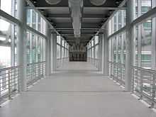
An inside view of the skybridge of Petronas Towers.
-

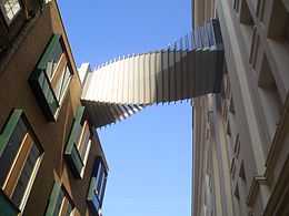
This skyway at London Gatwick Airport is designed to allow aircraft to pass under.


See also
| Wikimedia Commons has media related to Skyways. |
References
- ↑
- ↑ Bellman, Eric. (2010-01-19) Packed Streets Have a City of Walkers Looking Skyward for Answers. Online.wsj.com. Retrieved on 2011-09-30.
- ↑
- ↑ Carbon monoxide dispersion analysis in downtown Spokane, ESL Inc., Sunnyvale, (1973)
- ↑ "Calgary's +15 Skywalk".
- ↑ Skywalks – Greater Des Moines Convention and Visitors Bureau. Seedesmoines.com. Retrieved on 2011-09-30.
- ↑ Duluth Business & Tourism - Greater Downtown Council - Duluth Skywalk. downtownduluth.com. Retrieved on 2012-12-27.
| ||||||||||
| ||||||||||||||||||||||||||||||
http://www.catchdesmoines.com/about/transportation/skywalks/