Skelton Township, Warrick County, Indiana
| Skelton Township | |
|---|---|
| Township | |
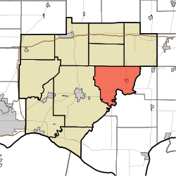 Location in Warrick County | |
| Coordinates: 38°04′41″N 87°09′07″W / 38.07806°N 87.15194°WCoordinates: 38°04′41″N 87°09′07″W / 38.07806°N 87.15194°W | |
| Country | United States |
| State | Indiana |
| County | Warrick |
| Government | |
| • Type | Indiana township |
| Area | |
| • Total | 39.91 sq mi (103.4 km2) |
| • Land | 39.54 sq mi (102.4 km2) |
| • Water | 0.37 sq mi (1.0 km2) 0.93% |
| Elevation | 423 ft (129 m) |
| Population (2010) | |
| • Total | 1,625 |
| • Density | 41.1/sq mi (15.9/km2) |
| ZIP codes | 47523, 47601, 47637 |
| GNIS feature ID | 0453850 |
Skelton Township is one of ten townships in Warrick County, Indiana, United States. As of the 2010 census, its population was 1,625 and it contained 635 housing units.[1]
Geography
According to the 2010 census, the township has a total area of 39.91 square miles (103.4 km2), of which 39.54 square miles (102.4 km2) (or 99.07%) is land and 0.37 square miles (0.96 km2) (or 0.93%) is water.[1]
Cities, towns, villages
Unincorporated towns
- Ash Iron Springs at 38°02′07″N 87°11′12″W / 38.035326°N 87.186669°W
- De Gonia Springs at 38°03′20″N 87°11′08″W / 38.055604°N 87.185558°W
- Eames at 38°04′45″N 87°07′54″W / 38.079216°N 87.131668°W
(This list is based on USGS data and may include former settlements.)
Adjacent townships
- Pigeon Township (northeast)
- Jackson Township, Spencer County (east)
- Grass Township, Spencer County (southeast)
- Boon Township (west)
- Owen Township (northwest)
Cemeteries
The township contains these eight cemeteries: Clark, Garrison, Kelley, Mill, Polk, Polk, Reed, Roth and Skelton.
School districts
- Warrick County School Corporation
Political districts
- Indiana's 8th congressional district
- State House District 74
- State Senate District 47
References
- United States Census Bureau 2007 TIGER/Line Shapefiles
- United States Board on Geographic Names (GNIS)
- IndianaMap
- ↑ 1.0 1.1 "Population, Housing Units, Area, and Density: 2010 - County -- County Subdivision and Place -- 2010 Census Summary File 1". United States Census. Retrieved 2013-05-10.
External links
| |||||||||||||||||||||||||