Sirikot
| Sirikot | |
|---|---|
| Union council | |
|
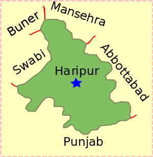
Sirikot is located in Haripur District | |
| Coordinates: 34°10′N 73°43′E / 34.167°N 73.717°ECoordinates: 34°10′N 73°43′E / 34.167°N 73.717°E | |
| Country |
|
| Province | Khyber Pakhtunkhwa |
| District | Haripur |
| Tehsil | Ghazi |
| Population | |
| • Total | 85,000 |
Sirikot is a Mashwani village in Haripur District and Ghazi Tehsil, in Pakistan's Khyber Pakhtunkhwa Province at 34°10'60N 73°43'50E.[1] It is the principal settlement of the Union Council.[2]
A majority of the population of Sirikot and Gudwallian (Goodvalley) speaks Pashto and are of the Mashwani tribe, of the Sayyid family.
Etymology
"Sirikot" means "village at the top" or "hill-top village", because "siri" means "top" and "kot" means "village". The name is a reference to its mountainous physical geography.
The mountainous formation of the area is called Gandghar, which also has the Cave of Raja Risalu.
To the west of Haripur Tehsil there is another populous village of the Mashwani's known as Gudwalian ("Goodvalley"), it is located between Haripur city and Sirikot (Ghazi). It is between 12–14 km from Haripur and is the site of "Ali Masjid", a well-known mosque.
Geography and climate
Due to its high altitude, temperatures in Hazara are cooler than on the plains, though Abbottabad, at 1,200 metres (3,900 ft) still has maxima around 32 °C (90 °F) with high humidity in June and July. Further up, temperatures are cooler, often cooler than the Northern Areas valleys due to the cloudiness. In winter, temperatures are cold, with minima in January around 0 °C (32 °F) and much lower in the high mountains. Snowfalls are not uncommon even at lower levels.
Hazara lies close to the crossroads formed by the Indus River and the Grand Trunk Road. The Karakoram Highway begins at the town of Havelian and goes north through the division towards China via the Northern Areas. While, the Sirikot village is a mountainous area lying towards the west of Haripur District on West of Tarbela Dam. The nearest Union Council to this is Kundi-Umarkhana, which have Mashwani population in Majority as Sirikot towards Tarbela (Ghazi) side. On the other hand, Gudwalian, another populated area of Mashwanis, lies closer to Haripur city. The climate of Sirikot is better than Haripur on average due to its hilly location on the upper range of Tarbela.
Population
Nintety-five percent of the population of Sirikot speaks Pashto but there are some whose mother tongue is Hindko. Mashwani (Sayyid) is the major tribe in Sirikot but there are a few other Pashtuns. The population of the Sirikot Union Council was estimated to be around 85,000 in 2005. The total area of Hazara is 18,013 km².
Sub-tribes
The sub-tribes of Mashwani residing in the area include: Manikhel, Jalal Khail, Sahib Khail, Sen Khail (Moolhan), Dura Khail, Bhatal, Haseen Khail, Wares Khail, Wahdet Khail, Baji Khel, Ludin, Matkani, Roghani, Ganjiyan, Murjankhel, Janikhel, Rahatkhel, Senkhael.
The Mashwani population of Sirikot was around 50,000 and 35,000 other Pashtuns Yousafzai,Tareen,Jadoon,Utmanzai,Dilazak and Taniwal(Tanoli).
References
External links
| ||||||||||||
