Simpson Falls
| JC Slaughter Falls | |
|---|---|
|
Sightseers overlooking the JC Slaughter Falls in 2009. | |
 | |
| Location | Brisbane, Queensland, Australia |
| Coordinates | 27°27′54″S 152°57′18″E / 27.465°S 152.955°ECoordinates: 27°27′54″S 152°57′18″E / 27.465°S 152.955°E |
| Type | Cascade |
| Watercourse | West Ithaca Creek |
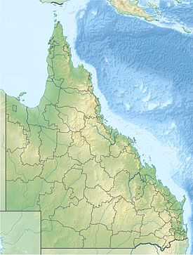
The Simpson Falls, a cascade waterfall on the West Ithaca Creek, is located within the Mount Coot-tha Forest, in Brisbane, Queensland, Australia.[1]
Location and features
The Mount Coot-tha Forest is approximately 1,500 hectares (3,700 acres) of open eucalypt forest forming the south-eastern part of D'Aguilar National Park. These two areas make up a 30,000-hectare (74,000-acre) forest that extends into suburban Brisbane. It is home to powerful owls, goshawks, eagles, wrens and robins as well as possums and bats. Visitor facilities in the forest include picnic tables, barbecues and toilets. The forest may be approached from Sir Samuel Griffith Drive or Gap Creek Road, Mt Coot-tha. Limited parking is available.[1] The area is popular with birdwatchers, who can see White-throated Treecreeper, Variegated Fairy-wren, Powerful Owl, Rose Robin and Varied Sitella.[2]
In 2006 a 58-year-old Bardon woman was walking her dog through the Mount Coot-tha picnic spot Simpson Falls when two dingoes stalked and circled her for a kilometre. Brisbane City Council erected warning signs and set additional traps in response to the incident.[3]
Brisbane City Council occasionally burns sections of bush around Simpson Falls to prevent fuel build up.[4]
See also
References
- ↑ 1.0 1.1 "Mt Coot-tha Reserve track map". Environment & Waste. Brisbane City Council. Retrieved 30 May 2014.
- ↑ Birds Queenslland
- ↑ "Picnic area attack fears". The Sunday Mail (Queensland). 18 November 2006.
- ↑ "Planned burns Brisbane west". Brisbane City Council. 2011.
External links
- National Public Toilet Map, Simpson Falls, Queensland, Australia
- National Public Toilet Map, Mount Coot-tha, Queensland, Australia
- Ithaca Creek group on Flickr
| ||||||||||||||||||||||||||||||||||||||||||||||||||||||||||||||||||||||||||||||||||
