Sibleyville, Kansas
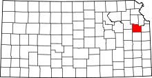
Sibleyville is an unincorporated community in Douglas County, Kansas located five miles southeast of Lawrence. It was at the intersection of County Road 458 and the Leavenworth, Lawrence and Fort Gibson railroad tracks although the town never had more than a dozen houses.[2]
References
- ↑ "US Board on Geographic Names". United States Geological Survey. 2007-10-25. Retrieved 2008-01-31.
- ↑ Kaw Valley Landscapes by James R. Shortridge. University Press of Kansas, 1977, 1988 pg. 190