Shire of West Wimmera
| Shire of West Wimmera Victoria | |||||||||||||
|---|---|---|---|---|---|---|---|---|---|---|---|---|---|
|
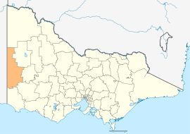
Location in Victoria | |||||||||||||
| Population | 4,251 (2011 census)[1] | ||||||||||||
| • Density | 0.46678/km2 (1.20896/sq mi) | ||||||||||||
| Established | 1995 | ||||||||||||
| Gazetted | 20 January 1995[2] | ||||||||||||
| Area | 9,107 km2 (3,516.2 sq mi) | ||||||||||||
| Mayor | Cr Ron Hawkins | ||||||||||||
| Council seat | Edenhope | ||||||||||||
| Region | Western Victoria | ||||||||||||
| State electorate(s) | Lowan | ||||||||||||
| Federal Division(s) | Mallee | ||||||||||||
| Website | Shire of West Wimmera | ||||||||||||
| |||||||||||||
The Shire of West Wimmera is a local government area in the western part of the Wimmera region of Victoria, Australia, located in the western part of the state. It covers an area of 9,107 square kilometres (3,516 sq mi) and, at the 2011 Census, had a population of 4,251.[1] It includes the towns of Apsley, Edenhope, Goroke, Gymbowen, Harrow, Kaniva, Minimay, Nurcoung and Serviceton. It was formed in 1995 from the amalgamation of the Shire of Kaniva and parts of the Shire of Kowree, Shire of Arapiles and Shire of Glenelg.[2]
The Shire is governed and administered by the West Wimmera Shire Council; its seat of local government and administrative centre is located at the council headquarters in Edenhope, it also has a service centre located in Kaniva. The Shire is named after the Wimmera region, in which the LGA occupies the western portion. The LGA is also located entirely to the west of the Wimmera River, which actually meanders through another municipality to the east, that is the Rural City of Horsham.
Council
Current composition
The council is composed of five councillors elected to represent an unsubdivided municipality.[3]
| Ward | Councillor | Notes | |
|---|---|---|---|
| Unsubdivided | Ron Hawkins | Mayor (2013–14) | |
| Annette Jones | |||
| Bruce Meyer | |||
| Warren Wait | |||
| Richard Wait | |||
Administration and governance
The council meets in the council chambers at the council headquarters in the Edenhope Municipal Offices, which is also the location of the council's administrative activities. It also provides customer services at both its administrative centre in Edenhope, and its service centre in Kaniva.
See also
- List of localities (Victoria)
References
- ↑ 1.0 1.1 Census QuickStats (2011). "West Wimmera (S) – LGA26890". Australian Bureau of Statistics. Government of Australia. Retrieved 10 January 2014.
- ↑ 2.0 2.1 Victoria Government Gazette – Online Archive (1837–1997). "S4 of 1995". State Library of Victoria. State Government of Victoria (published 20 January 1995). pp. 5–6. Retrieved 10 January 2014.
|chapter=ignored (help) - ↑ Local Government in Victoria. "West Wimmera Shire Council". Department of Transport, Planning and Local Infrastructure. State Government of Victoria. Retrieved 10 January 2014.
External links
- West Wimmera Shire Council official website
- Metlink local public transport map
- Link to Land Victoria interactive maps
| ||||||
| ||||||||||||||||||||||||||||||||||||
Coordinates: 36°43′00″S 141°28′00″E / 36.71667°S 141.46667°E