Shire of Ripon
For Riponshire, England, see Liberty of Ripon.
| Shire of Ripon Victoria | |||||||||||||
|---|---|---|---|---|---|---|---|---|---|---|---|---|---|
|
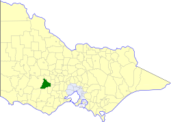
Location in Victoria | |||||||||||||
| Population | 3,530 (1992)[1] | ||||||||||||
| • Density | 2.303/km2 (5.964/sq mi) | ||||||||||||
| Established | 1861 | ||||||||||||
| Area | 1,533 km2 (591.9 sq mi) | ||||||||||||
| Council seat | Beaufort | ||||||||||||
| County | Grenville, Ripon | ||||||||||||
| |||||||||||||

The shire offices in Beaufort.
The Shire of Ripon was a local government area about 160 kilometres (99 mi) west-northwest of Melbourne, the state capital of Victoria, Australia. The shire covered an area of 1,533 square kilometres (591.9 sq mi), and existed from 1861 until 1994.
History
Ripon was incorporated as a road district on 12 April 1861, and became a shire on 18 December 1863.[2]
On 23 September 1994, the Shire was abolished, and merged with Shire of Lexton and most of Shire of Avoca into the Shire of Pyrenees.[3]
Wards
Ripon was divided into three ridings, each of which elected three councillors:
- Northwest Riding
- East Riding
- Central Riding
Towns and localities
- Beaufort
- Raglan
- Trawalla
- Snake Valley
- Brewster
- Stockyard Hill
- Waterloo
- Chute
- Middle Creek
- Camp Hill
- Mount Emu
Population
| Year | Population |
|---|---|
| 1954 | 3,365 |
| 1958 | 3,700* |
| 1961 | 3,581 |
| 1966 | 3,512 |
| 1971 | 3,212 |
| 1976 | 3,204 |
| 1981 | 3,088 |
| 1986 | 3,317 |
| 1991 | 3,464 |
* Estimate in the 1958 Victorian Year Book.
References
- ↑ Australian Bureau of Statistics, Victoria Office (1994). Victorian Year Book. pp. 49–52. ISSN 0067-1223.
- ↑ Victorian Municipal Directory. Brunswick: Arnall & Jackson. 1992. pp. 812–813. Accessed at State Library of Victoria, La Trobe Reading Room.
- ↑ Australian Bureau of Statistics (1 August 1995). Victorian local government amalgamations 1994-1995: Changes to the Australian Standard Geographical Classification (PDF). Commonwealth of Australia. p. 11. ISBN 0-642-23117-6. Retrieved 2008-01-05.