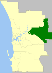
Shire of Mundaring
| Shire of Mundaring Western Australia | |||||||||||||
|---|---|---|---|---|---|---|---|---|---|---|---|---|---|
 | |||||||||||||
| Population | 39,796 (2013 est)[1] | ||||||||||||
| • Density | 61.709/km2 (159.825/sq mi) | ||||||||||||
| Established | 1903 | ||||||||||||
| Area | 644.9 km2 (249.0 sq mi) | ||||||||||||
| Mayor | Helen Dullard | ||||||||||||
| Council seat | Mundaring | ||||||||||||
| Region | Darling Scarp | ||||||||||||
| State electorate(s) | Darling Range, Kalamunda, Midland, Swan Hills | ||||||||||||
| Federal Division(s) | Hasluck, Pearce | ||||||||||||
|
| |||||||||||||
| Website | Shire of Mundaring | ||||||||||||
| |||||||||||||
The Shire of Mundaring is a local government area on the eastern fringe of metropolitan Perth, the capital of Western Australia. The Shire covers an area of 645 square kilometres (249 sq mi) and has a population of 36,529 (2011).
History
The Greenmount Road District was created on 17 April 1903. On 29 March 1934, it was renamed Mundaring. On 1 July 1961, it became the Shire of Mundaring after enactment of the Local Government Act 1960.[2]
Statistics
Mundaring Shire has published the following statistics for the period 1994-2006:[3]
- Population: 35,097
- Area: 643.32 km²
- Rateable area: 205.91 km²
- Rateable properties: 13,600
- Revenue: A$17.4M
- Vested reserves: 104.60 km²
- Forests and National Parks: 238.30 km²
Wards
The shire is divided into four wards.
- West Ward (three councillors)
- South Ward (three councillors)
- Central Ward (three councillors)
- East Ward (three councillors)
Suburbs and localities
Population
| Year | Population |
|---|---|
| 1911 | 2,716 |
| 1921 | 3,296 |
| 1933 | 4,975 |
| 1947 | 6,072 |
| 1954 | 7,619 |
| 1961 | 8,104 |
| 1966 | 8,925 |
| 1971 | 12,018 |
| 1976 | 16,867 |
| 1981 | 20,786 |
| 1986 | 24,415 |
| 1991 | 29,184 |
| 1996 | 31,462 |
| 2001 | 33,281 |
| 2006 | 35,095 |
| 2011 | 36,529 |
Presidents and chairmen
Main article: List of shire presidents of Mundaring
References
- ↑ "3218.0 Regional Population Growth, Australia. Table 5. Estimated Resident Population, Local Government Areas, Western Australia". 3 April 2014. Retrieved 11 September 2014.
- ↑ WA Electoral Commission, Municipality Boundary Amendments Register (release 3.0), 31 July 2007.
- ↑ Mundaring Shire Council. "Population & Area". Archived from the original on 2006-02-19. Retrieved 2006-04-01.
External links
| ||||||||||||||||||||||||||||||||||||||||||||||||||||||||||||