Shire of Cardinia
| Shire of Cardinia Victoria | |||||||||||||
|---|---|---|---|---|---|---|---|---|---|---|---|---|---|
 | |||||||||||||
| Population | 74,176 (2011)[1] | ||||||||||||
| • Density | 57.9228/km2 (150.019/sq mi) | ||||||||||||
| Established | 1994 | ||||||||||||
| Area | 1,280.6 km2 (494.4 sq mi) | ||||||||||||
| Mayor | Brett Owen | ||||||||||||
| Council seat | Officer | ||||||||||||
|
| |||||||||||||
| Website | Shire of Cardinia | ||||||||||||
| |||||||||||||
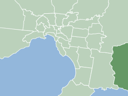
The Shire of Cardinia is a local government area in Victoria, Australia, in the south-east of Melbourne between Western Port and the Yarra Ranges on the outskirts of Melbourne. It has an area of 1,280 square kilometres, and has a population of 74,176.[1]
Cardinia Shire Council Offices are located in Pakenham, but the Council is set to move to new offices in Officer on November 17, 2014.
History
The areas within the present-day boundaries of Shire of Cardinia were originally parts of the Cranbourne and Berwick districts, which were incorporated in 1860 and 1862 respectively. The Shire of Fern Tree Gully, later Shire of Sherbrooke, split away in 1889 and included areas to the east of Melbourne. In 1973, the City of Berwick, including Berwick and areas closer to Dandenong, split away from the Shire of Berwick, with the remainder being renamed Shire of Pakenham.[2]
The Shire came into being on 15 December 1994 as the result of statewide local government reform, by merging the Shire of Pakenham with rural sections of the Shire of Sherbrooke and City of Cranbourne.[3]
Council locations
Administration
The Council Offices were originally located in Henty Way, Pakenham.[4] On November 17, 2014, the Council moved to a new office on Siding Avenue, Officer, which it uses presently. The Council holds its meetings and all of the administration staff work there.
Libraries
The Shire of Cardinia is part of the Casey Cardinia Library Corporation and there are two full-time libraries in Cardinia, in Emerald and Pakenham. In addition, the Moblie library visits the suburbs of Bunyip, Garfield, Tynong, Beaconsfield, Upper Beaconsfield, Gembrook, Maryknoll, Cockatoo, Lang Lang and Koo Wee Rup.[5]
Mayors
- 2004: Kate Lempriere
- 2005: Garry Runge
- 2006: Bill Ronald
- 2007: Kate Lempriere
- 2008: Bill Ronald
- 2009: Bill Pearson
- 2010: Graeme Legge
- 2011: George Blenkhorn
- 2012: Ed Chatwin
- 2013: Brett Owen
- 2014: Graeme Moore
Elected Councillors
The current Council, elected on 28 October 2012, is, in order of election by Ward:
| Ward | Councillor |
|---|---|
| Central Ward | Collin Ross |
| Jodie Owen | |
| George Blenkhorn | |
| Kate Lempriere | |
| Ranges Ward | Brett Owen |
| Leticia Wilmot | |
| Tania Baxter | |
| Port Ward | Graeme Moore |
| David Young | |
Geography
The Shire includes the following towns and localities:
- Avonsleigh
- Bayles
- Beaconsfield
- Beaconsfield Upper.
- Bunyip
- Bunyip North
- Caldermeade
- Cardinia
- Catani
- Clematis
- Cockatoo
- Cora Lynn
- Dalmore
- Dewhurst
- Emerald
- Garfield
- Garfield North
- Gembrook
- Guys Hill
- Iona
- Koo Wee Rup
- Koo Wee Rup North
- Lang Lang
- Lang Lang East
- Longwarry
- Maryknoll
- Menzies Creek
- Modella
- Monomeith
- Mount Burnett
- Nangana
- Nar Nar Goon
- Nar Nar Goon North
- Officer
- Officer South
- Pakenham
- Pakenham South
- Pakenham Upper
- Rythdale
- Tonimbuk
- Tynong
- Tynong North
- Vervale
- Yannathan
See also
References
- ↑ 1.0 1.1 Australian Bureau of Statistics (21 June 2012). "2011 Census QuickStats - Cardinia (S)". Retrieved 12 July 2012.
- ↑ Victorian Municipal Directory. Brunswick: Arnall & Jackson. 1992. pp. 639–40, 805–6, 832–3. Accessed at State Library of Victoria, La Trobe Reading Room.
- ↑ Australian Bureau of Statistics (1 August 1995). Victorian local government amalgamations 1994-1995: Changes to the Australian Standard Geographical Classification (PDF). Commonwealth of Australia. p. 5. ISBN 0-642-23117-6. Retrieved 2007-12-16.
- ↑ Municipal Association of Victoria - Cardinia
- ↑ CCLC Branch details
External links
- Cardinia Shire Council official website
- Cardinia Shire facts and statistics
- Casey Cardinia Libraries
- Metlink local public transport map
- Link to Land Victoria interactive maps
| ||||||||||||||||||||||||||||||||||||