Shirak Province
| Shirak Շիրակ | |
|---|---|
| Province | |
|
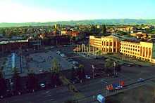
Shirak Province administration in Gyumri | |
 Location of Shirak within Armenia | |
| Coordinates: 40°50′N 43°55′E / 40.833°N 43.917°ECoordinates: 40°50′N 43°55′E / 40.833°N 43.917°E | |
| Country | Armenia |
| Capital | Gyumri |
| Government | |
| • Governor | Felix Tsolakyan (2013-) |
| Area | |
| • Total | 2,681 km2 (1,035 sq mi) |
| Area rank | 6th |
| Population (2011) | |
| • Total | 251,941 |
| • Rank | 2nd |
| • Density | 94/km2 (240/sq mi) |
| Time zone | UTC+04 |
| • Summer (DST) | UTC+05 (UTC) |
| Postal code | 2601–3126 |
| ISO 3166 code | AM-SH |
| FIPS 10-4 | AM07 |
| Website | official website |

| Part of a series on |
| Armenia Հայաստան |
|---|
  |
| Culture |
| History |
| Demographics |
| Administrative divisions |
|
| Armenia portal |
Shirak (Armenian: Շիրակ, Armenian pronunciation: [ʃiˈɾɑk]) is a province (marz) of Armenia. It is located in the north-west of the country, bordering Turkey in the west and Georgia in the north. Its capital is Gyumri. Shirak is known as the homeland of khash. It is as much semi-desert as it is mountain meadow or high alpine. In the south, the high steppes crash into mountain terrain, verdant green in the spring, hues of reddish brown in the summer. Shirak is served by Shirak International Airport near Gyumri.
History
The ancient history of Shirak is similar to its cousin the Ararat Valley, steeped in legend to some, but found by archaeologists to have been inhabited 25,000 years ago, with settlements popping up along the Akhurian Valley beginning around 9000 BC. Agriculturally based, the region has few of the metallurgical centers found South, but still had sophisticated settlements.[1]
Territory
Shirak borders the following provinces:
- Lori from the east.
- Aragatsotn from the south
Shirak province is bordered by Turkey from the west and Georgia from the north.
Communities
The province of Shirak consists of the following 119 communities (hamaynkner), of which 3 are considered urban and 116 are considered rural.[2]
Towns or urban communities
| Image | City (town) | Province | Founded | Land area (km2) | Population (2011 est.) |
|---|---|---|---|---|---|
 | Artik | Shirak | 1939 | 9 | 17,400 |
 | Gyumri | Shirak | 5th century BC as Kumayri rebuilt in 1837 as Alexandropol |
54 | 146,100 |
 | Maralik | Shirak | 5th century (first mentioned) | 4 | 6,100 |
Villages or rural communities
Non-community villages
- Shirak
-

Lmbatavank near Artik, 7th century
-

Harichavank Monastery, 8th century
-

Marmashen monastery, 10th century
-

The village of Harich

External links
- Shirak guide with detailed descriptions, by Rick Ney
- Shirak Marz Tourist Guide
- Shirak Regional Museum
References
- Report of the results of the 2001 Armenian Census, National Statistical Service of the Republic of Armenia
- ↑ Shirak Marz: page 3 of 35 – TourArmenia
- ↑ "RA Shirak Marz" (PDF). Marzes of the Republic of Armenia in Figures, 2002–2006. National Statistical Service of the Republic of Armenia. 2007.
| ||||||||||||