
Map of the 88
temples along the Shikoku Pilgrimage

An
aruki-henro or walking pilgrim, marked out by his distinctive sedge hat, white shirt, and
kongō-zue. The
henro-michi route passes through the countryside and a number of cities.
The Shikoku Pilgrimage (四国遍路, Shikoku Henro) or Shikoku Junrei (四国巡礼) is a multi-site pilgrimage of 88 temples associated with the Buddhist monk Kūkai (Kōbō Daishi) on the island of Shikoku, Japan. A popular and distinctive feature of the island's cultural landscape, and with a long history, large numbers of pilgrims (known as henro (遍路)) still undertake the journey for a variety of ascetic, pious, and tourism-related purposes.[1] The pilgrimage is traditionally completed on foot, but modern pilgrims use cars, taxis, buses, bicycles, or motorcycles. The standard walking course is approximately 1,200 kilometres (750 mi) long and can take anywhere from 30 to 60 days to complete.
In addition to the 88 "official" temples of the pilgrimage, there are over 200 bangai — temples not considered part of the official 88. To complete the pilgrimage, it is not necessary to visit the temples in order; in some cases it is even considered lucky to travel in reverse order. Henro (遍路) is the Japanese word for pilgrim, and the inhabitants of Shikoku call the pilgrims o-henro-san (お遍路さん), the o (お) being an honorific and the san (さん) a title similar to "Mr." or "Mrs.". They are often recognizable by their white clothing, sedge hats, and kongō-zue or walking sticks. Alms or osettai are frequently given. Many pilgrims begin and complete the journey by visiting Mount Kōya in Wakayama Prefecture, which was settled by Kūkai and remains the headquarters of Shingon Buddhism. The 21 kilometres (13 mi) walking trail up to Koya-san still exists, but most pilgrims use the train.
History
Background
Pilgrimages have played an important part in Japanese religious practice since at least the Heian period. Typically centred upon holy mountains, particular divinities, or charismatic individuals, they are usually to Buddhist sites although those to the shrines of Kumano and Ise are notable exceptions.[1][2]
Kōbō Daishi
Kūkai, born at Zentsū-ji (Temple 75) in 774, studied in China, and upon his return was influential in the promotion of esoteric Buddhism. He established the Shingon retreat of Kōya-san, was an active writer, undertook a programme of public works, and during visits to the island of his birth is popularly said to have established or visited many of its temples and to have carved many of their images. He is posthumously known as Kōbō Daishi.[3][4]
Development
The legends and cult of Kōbō Daishi, such as the episode of Emon Saburō, were maintained and developed by the monks of Kōya-san who travelled to expound Shingon and were active, along with other hijiri, in Shikoku.[5] In the Edo period, the policy of tochi kinbaku (土地緊縛) restricted and regulated the movement of ordinary people. Pilgrims were required to obtain travel permits, follow the main paths, and pass through localities within a certain time limit, with the book of temple stamps or nōkyō-chō helping to provide proof of passage.[6]
Practice
Stages
Shikoku literally means four provinces, those of Awa, Tosa, Iyo, and Sanuki, reorganised during the Meiji period into the Prefectures of Tokushima, Kōchi, Ehime, and Kagawa. The pilgrim's journey through these four provinces is likened to a symbolic path to enlightenment, with temples 1-23 representing the idea of awakening (発心, hosshin), 24-39 austerity and discipline (修行, shugyō), 40-65 attaining enlightenment (菩提, bodai), and 66-88 entering nirvana (涅槃, nehan).[7]
Equipment
The pilgrim's traditional costume comprises a white shirt (白衣, oizuru), conical Asian hat (すげ笠, suge-kasa), and kongō-zue (金剛杖). This may be supplemented by a wagesa (輪袈裟). The henro also carries a bag (ずだ袋, zuda-bukuro) containing name slips (納札, osame-fuda), prayer beads (数珠, juzu) (also known as nenju (念珠)), a nōkyō-chō (納経帳), incense sticks (線香, senkō), and coins used as offerings (お賽銭, o-saisen). The more religiously-minded henro may also carry a book of sutras (経本, kyōbon) and go-eika (ご詠歌) set with a bell.[8]
Rites
Upon arrival at each temple the henro washes before proceeding to the Hondō. After offering coins, incense, and the osame-fuda, the Heart Sutra (般若心経, Hannya Shingyō) is chanted along with repetition of the Mantra of the main image (本尊, honzon) and the Mantra of Light (光明真言, Kōmyō Shingon). After kigan and ekō prayers, the henro proceeds to the secondary temple (大師堂, Daishidō). Coins and a fuda are similarly offered, and again the Heart Sutra is chanted, along with repetition of the Gohōgō Mantra, namu-Daishi-henjō-kongō.[8]
Imitative versions
Attesting to the popularity of the Shikoku pilgrimage, from the eighteenth century a number of smaller imitative versions have been established.[2] These include a 150 kilometres (93 mi) circuit on Shōdo Island northeast of Takamatsu;[9] a 3 kilometres (1.9 mi) course on the grounds of Ninna-ji in Kyoto;[10] a route on the Chita Peninsula near Nagoya;[11] and circuits in Edo and Chiba Prefecture.[2] Outside of Japan, another version is on the Hawai'ian island of Kaua'i.[12]
Temples
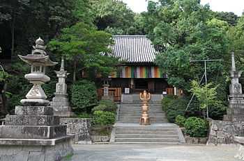
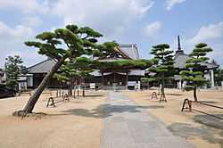
Collectively, the 88 temples are known as Shikoku Hachijūhakkasho (四国八十八箇所) or simply the Hachijūhakkasho (八十八箇所).
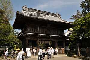
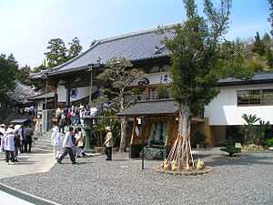
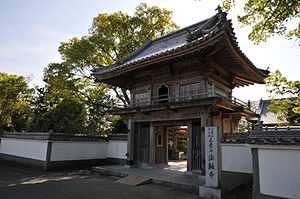
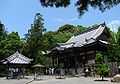
| No. |
Temple |
Honzon (main image) |
Location |
Coordinates |
Image |
|---|
| 1 |
Ryōzen-ji (霊山寺) |
Shaka Nyorai |
Naruto, Tokushima |
34°09′35″N 134°30′09″E / 34.159803°N 134.502592°E / 34.159803; 134.502592 (Ryōzen-ji (Shikoku Pilgrimage #1)) |
 |
| 2 |
Gokuraku-ji (極楽寺) |
Amida Nyorai |
Naruto, Tokushima |
34°09′20″N 134°29′25″E / 34.155556°N 134.490278°E / 34.155556; 134.490278 (Gokuraku-ji (Shikoku Pilgrimage #2)) |
 |
| 3 |
Konsen-ji (金泉寺) |
Shaka Nyorai |
Itano, Tokushima |
34°08′51″N 134°28′07″E / 34.147436°N 134.468544°E / 34.147436; 134.468544 (Konsen-ji (Shikoku Pilgrimage #3)) |
 |
| 4 |
Dainichi-ji (大日寺) |
Dainichi Nyorai |
Itano, Tokushima |
34°09′05″N 134°25′51″E / 34.151306°N 134.430889°E / 34.151306; 134.430889 (Dainichi-ji (Shikoku Pilgrimage #4)) |
 |
| 5 |
Jizō-ji (地蔵寺) |
Enmei Jizō Bosatsu |
Itano, Tokushima |
34°08′14″N 134°25′55″E / 34.137222°N 134.431944°E / 34.137222; 134.431944 (Jizō-ji (Shikoku Pilgrimage #5)) |
 |
| 6 |
Anraku-ji (安楽寺) |
Yakushi Nyorai |
Kamiita, Tokushima |
34°07′05″N 134°23′18″E / 34.118056°N 134.388389°E / 34.118056; 134.388389 (Anraku-ji (Shikoku Pilgrimage #6)) |
 |
| 7 |
Jūraku-ji (十楽寺) |
Amida Nyorai |
Awa, Tokushima |
34°07′15″N 134°22′41″E / 34.12075°N 134.377925°E / 34.12075; 134.377925 (Jūraku-ji (Shikoku Pilgrimage #7)) |
 |
| 8 |
Kumadani-ji (熊谷寺) |
Senjū Kannon |
Awa, Tokushima |
34°07′22″N 134°20′24″E / 34.122778°N 134.34°E / 34.122778; 134.34 (Kumadani-ji (Shikoku Pilgrimage #8)) |
 |
| 9 |
Hōrin-ji (法輪寺) |
Shaka Nyorai |
Awa, Tokushima |
34°06′16″N 134°20′02″E / 34.104378°N 134.333814°E / 34.104378; 134.333814 (Hōrin-ji (Shikoku Pilgrimage #9)) |
 |
| 10 |
Kirihata-ji (切幡寺) |
Senjū Kannon |
Awa, Tokushima |
34°06′28″N 134°18′15″E / 34.10775°N 134.304278°E / 34.10775; 134.304278 (Kirihata-ji (Shikoku Pilgrimage #10)) |
 |
| 11 |
Fujii-dera (藤井寺) |
Yakushi Nyorai |
Yoshinogawa, Tokushima |
34°03′06″N 134°20′55″E / 34.051667°N 134.3485°E / 34.051667; 134.3485 (Fujii-dera (Shikoku Pilgrimage #11)) |
 |
| 12 |
Shōsan-ji (焼山寺) |
Kokūzō Bosatsu |
Kamiyama, Tokushima |
33°59′06″N 134°18′37″E / 33.985028°N 134.31025°E / 33.985028; 134.31025 (Shōsan-ji (Shikoku Pilgrimage #12)) |
 |
| 13 |
Dainichi-ji (大日寺) |
Jūichimen Kannon |
Tokushima, Tokushima |
34°02′17″N 134°27′46″E / 34.038117°N 134.462683°E / 34.038117; 134.462683 (Dainichi-ji (Shikoku Pilgrimage #13)) |
 |
| 14 |
Jōraku-ji (常楽寺) |
Miroku Bosatsu |
Tokushima, Tokushima |
34°03′01″N 134°28′32″E / 34.050333°N 134.475639°E / 34.050333; 134.475639 (Jōraku-ji (Shikoku Pilgrimage #14)) |
 |
| 15 |
Awa Kokubun-ji (阿波国分寺) |
Yakushi Nyorai |
Tokushima, Tokushima |
34°03′20″N 134°28′25″E / 34.055611°N 134.473611°E / 34.055611; 134.473611 (Awa Kokubun-ji (Shikoku Pilgrimage #15)) |
 |
| 16 |
Kannon-ji (観音寺) |
Senjū Kannon |
Tokushima, Tokushima |
34°04′06″N 134°28′28″E / 34.068472°N 134.474344°E / 34.068472; 134.474344 (Kannon-ji (Shikoku Pilgrimage #16)) |
 |
| 17 |
Ido-ji (井戸寺) |
Yakushi Nyorai |
Tokushima, Tokushima |
34°05′07″N 134°29′08″E / 34.085167°N 134.485444°E / 34.085167; 134.485444 (Ido-ji (Shikoku Pilgrimage #17)) |
 |
| 18 |
Onzan-ji (恩山寺) |
Yakushi Nyorai |
Komatsushima, Tokushima |
33°59′10″N 134°34′42″E / 33.986°N 134.57825°E / 33.986; 134.57825 (Onzan-ji (Shikoku Pilgrimage #18)) |
 |
| 19 |
Tatsue-ji (立江寺) |
Jizō Bosatsu |
Komatsushima, Tokushima |
33°58′04″N 134°36′21″E / 33.967861°N 134.605806°E / 33.967861; 134.605806 (Tatsue-ji (Shikoku Pilgrimage #19)) |
 |
| 20 |
Kakurin-ji (鶴林寺) |
Jizō Bosatsu |
Katsuura, Tokushima |
33°54′50″N 134°30′20″E / 33.913861°N 134.505611°E / 33.913861; 134.505611 (Kakurin-ji (Shikoku Pilgrimage #20)) |
 |
| 21 |
Tairyūji (太竜寺) |
Kokūzō Bosatsu |
Anan, Tokushima |
33°52′57″N 134°31′19″E / 33.882528°N 134.521889°E / 33.882528; 134.521889 (Tairyūji (Shikoku Pilgrimage #21)) |
 |
| 22 |
Byōdō-ji (平等寺) |
Yakushi Nyorai |
Anan, Tokushima |
33°51′07″N 134°34′58″E / 33.851833°N 134.582778°E / 33.851833; 134.582778 (Byōdō-ji (Shikoku Pilgrimage #22)) |
 |
| 23 |
Yakuō-ji (薬王寺) |
Yakushi Nyorai |
Minami, Tokushima |
33°43′56″N 134°31′39″E / 33.732306°N 134.527583°E / 33.732306; 134.527583 (Yakuō-ji (Shikoku Pilgrimage #23)) |
 |
| 24 |
Hotsumisaki-ji (最御崎寺) |
Kokūzō Bosatsu |
Muroto, Kochi |
33°14′56″N 134°10′33″E / 33.249008°N 134.175739°E / 33.249008; 134.175739 (Hotsumisaki-ji (Shikoku Pilgrimage #24)) |
 |
| 25 |
Shinshō-ji (津照寺) |
Jizō Bosatsu |
Muroto, Kōchi |
33°17′16″N 134°08′54″E / 33.287806°N 134.14825°E / 33.287806; 134.14825 (Shinshō-ji (Shikoku Pilgrimage #25)) |
 |
| 26 |
Kongōchō-ji (金剛頂寺) |
Yakushi Nyorai |
Muroto, Kōchi |
33°18′26″N 134°07′22″E / 33.307222°N 134.122861°E / 33.307222; 134.122861 (Kongōchō-ji (Shikoku Pilgrimage #26)) |
%E3%80%8126%E7%95%AA%E6%9C%AD%E6%89%80_%E9%AB%98%E7%9F%A5%E7%9C%8C%E5%AE%A4%E6%88%B8%E5%B8%82%E5%85%83%E5%B4%8E%E5%B1%B1_DSCF7169.JPG) |
| 27 |
Kōnomine-ji (神峰寺) |
Jūichimen Kannon |
Yasuda, Kōchi |
33°28′03″N 133°58′29″E / 33.467611°N 133.974778°E / 33.467611; 133.974778 (Kōnomine-ji (Shikoku Pilgrimage #27)) |
 |
| 28 |
Dainichi-ji (大日寺) |
Dainichi Nyorai |
Kōnan, Kōchi |
33°34′39″N 133°42′19″E / 33.577583°N 133.705389°E / 33.577583; 133.705389 (Dainichi-ji (Shikoku Pilgrimage #28)) |
 |
| 29 |
Tosa Kokubun-ji (土佐国分寺) |
Senjū Kannon |
Nankoku, Kōchi |
33°35′55″N 133°38′26″E / 33.598694°N 133.640417°E / 33.598694; 133.640417 (Tosa Kokubun-ji (Shikoku Pilgrimage #29)) |
 |
| 30 |
Zenrakuji (善楽寺) |
Amida Nyorai |
Kōchi, Kōchi |
33°35′31″N 133°34′39″E / 33.591917°N 133.577556°E / 33.591917; 133.577556 (Zenrakuji (Shikoku Pilgrimage #30)) |
 |
| 31 |
Chikurin-ji (竹林寺) |
Monju Bosatsu |
Kōchi, Kōchi |
33°32′48″N 133°34′39″E / 33.546611°N 133.577472°E / 33.546611; 133.577472 (Chikurin-ji (Shikoku Pilgrimage #31)) |
 |
| 32 |
Zenjibu-ji (禅師峰寺) |
Jūichimen Kannon |
Nankoku, Kōchi |
33°31′36″N 133°36′41″E / 33.526694°N 133.611389°E / 33.526694; 133.611389 (Zenjibu-ji (Shikoku Pilgrimage #32)) |
 |
| 33 |
Sekkei-ji (雪蹊寺) |
Yakushi Nyorai |
Kōchi, Kōchi |
33°30′03″N 133°32′35″E / 33.500833°N 133.543083°E / 33.500833; 133.543083 (Sekkei-ji (Shikoku Pilgrimage #33)) |
 |
| 34 |
Tanema-ji (種間寺) |
Yakushi Nyorai |
Haruno, Kōchi |
33°29′30″N 133°29′15″E / 33.491722°N 133.487583°E / 33.491722; 133.487583 (Tanema-ji (Shikoku Pilgrimage #34)) |
 |
| 35 |
Kiyotaki-ji (清滝寺) |
Yakushi Nyorai |
Tosa, Kōchi |
33°30′45″N 133°24′34″E / 33.5125°N 133.4095°E / 33.5125; 133.4095 (Kiyotaki-ji (Shikoku Pilgrimage #35)) |
 |
| 36 |
Shōryū-ji (青竜寺) |
Fudō Myōō |
Tosa, Kōchi |
33°25′34″N 133°27′03″E / 33.426°N 133.450806°E / 33.426; 133.450806 (Shōryū-ji (Shikoku Pilgrimage #36)) |
 |
| 37 |
Iwamoto-ji (岩本寺) |
Five Buddhas |
Shimanto, Kōchi |
33°12′29″N 133°08′05″E / 33.207972°N 133.134611°E / 33.207972; 133.134611 (Iwamoto-ji (Shikoku Pilgrimage #37)) |
 |
| 38 |
Kongōfuku-ji (金剛福寺) |
Senjū Kannon |
Tosashimizu, Kōchi |
32°43′34″N 133°01′07″E / 32.726028°N 133.018556°E / 32.726028; 133.018556 (Kongōfuku-ji (Shikoku Pilgrimage #38)) |
 |
| 39 |
Enkō-ji (延光寺) |
Yakushi Nyorai |
Sukumo, Kōchi |
32°57′41″N 132°46′27″E / 32.961306°N 132.774056°E / 32.961306; 132.774056 (Enkō-ji (Shikoku Pilgrimage #39)) |
 |
| 40 |
Kanjizai-ji (観自在寺) |
Yakushi Nyorai |
Ainan, Ehime |
32°57′53″N 132°33′51″E / 32.964667°N 132.564056°E / 32.964667; 132.564056 (Kanjizai-ji (Shikoku Pilgrimage #40)) |
 |
| 41 |
Ryūkōji (竜光寺) |
Jūichimen Kannon |
Uwajima, Ehime |
33°17′43″N 132°35′55″E / 33.295194°N 132.5985°E / 33.295194; 132.5985 (Ryūkō-ji (Shikoku Pilgrimage #41)) |
 |
| 42 |
Butsumoku-ji (佛木寺) |
Dainichi Nyorai |
Uwajima, Ehime |
33°18′38″N 132°34′53″E / 33.310583°N 132.581472°E / 33.310583; 132.581472 (Butsumoku-ji (Shikoku Pilgrimage #42)) |
 |
| 43 |
Meiseki-ji (明石寺) |
Senjū Kannon |
Seiyo, Ehime |
33°22′09″N 132°31′08″E / 33.369222°N 132.518972°E / 33.369222; 132.518972 (Meiseki-ji (Shikoku Pilgrimage #43)) |
 |
| 44 |
Daihō-ji (大宝寺) |
Jūichimen Kannon |
Kumakōgen, Ehime |
33°39′39″N 132°54′43″E / 33.660889°N 132.912083°E / 33.660889; 132.912083 (Daihō-ji (Shikoku Pilgrimage #44)) |
 |
| 45 |
Iwaya-ji (岩屋寺) |
Fudō Myōō |
Kumakōgen, Ehime |
33°39′31″N 132°58′51″E / 33.658667°N 132.980722°E / 33.658667; 132.980722 (Iwaya-ji (Shikoku Pilgrimage #45)) |
 |
| 46 |
Jōruri-ji (浄瑠璃寺) |
Yakushi Nyorai |
Matsuyama, Ehime |
33°45′13″N 132°49′09″E / 33.753556°N 132.819111°E / 33.753556; 132.819111 (Jōruri-ji (Shikoku Pilgrimage #46)) |
 |
| 47 |
Yasaka-ji (八坂寺) |
Amida Nyorai |
Matsuyama, Ehime |
33°45′29″N 132°48′46″E / 33.757944°N 132.812861°E / 33.757944; 132.812861 (Yasaka-ji (Shikoku Pilgrimage #47)) |
 |
| 48 |
Sairin-ji (西林寺) |
Jūichimen Kannon |
Matsuyama, Ehime |
33°47′37″N 132°48′50″E / 33.793722°N 132.813944°E / 33.793722; 132.813944 (Sairin-ji (Shikoku Pilgrimage #48)) |
 |
| 49 |
Jōdo-ji (浄土寺) |
Shaka Nyorai |
Matsuyama, Ehime |
33°49′00″N 132°48′31″E / 33.816667°N 132.808528°E / 33.816667; 132.808528 (Jōdo-ji (Shikoku Pilgrimage #49)) |
 |
| 50 |
Hanta-ji (繁多寺) |
Yakushi Nyorai |
Matsuyama, Ehime |
33°49′41″N 132°48′16″E / 33.828139°N 132.804556°E / 33.828139; 132.804556 (Hanta-ji (Shikoku Pilgrimage #50)) |
 |
| 51 |
Ishite-ji (石手寺) |
Yakushi Nyorai |
Matsuyama, Ehime |
33°50′52″N 132°47′47″E / 33.847861°N 132.796472°E / 33.847861; 132.796472 (Ishite-ji (Shikoku Pilgrimage #51)) |
 |
| 52 |
Taisan-ji (太山寺) |
Jūichimen Kannon |
Matsuyama, Ehime |
33°53′06″N 132°42′54″E / 33.885083°N 132.714972°E / 33.885083; 132.714972 (Taisan-ji (Shikoku Pilgrimage #52)) |
 |
| 53 |
Enmyō-ji (圓明寺) |
Amida Nyorai |
Matsuyama, Ehime |
33°53′30″N 132°44′23″E / 33.89175°N 132.739667°E / 33.89175; 132.739667 (Enmyō-ji (Shikoku Pilgrimage #53)) |
 |
| 54 |
Enmei-ji (延命寺) |
Fudō Myōō |
Imabari, Ehime |
34°04′01″N 132°57′50″E / 34.066833°N 132.964°E / 34.066833; 132.964 (Enmei-ji (Shikoku Pilgrimage #54)) |
 |
| 55 |
Nankōbō (南光坊) |
Daitsū-chishō Butsu |
Imabari, Ehime |
34°04′08″N 132°59′45″E / 34.06875°N 132.99575°E / 34.06875; 132.99575 (Nankōbō (Shikoku Pilgrimage #55)) |
 |
| 56 |
Taisan-ji (泰山寺) |
Jizō Bosatsu |
Imabari, Ehime |
34°03′00″N 132°58′28″E / 34.050111°N 132.974583°E / 34.050111; 132.974583 (Taisan-ji (Shikoku Pilgrimage #56)) |
 |
| 57 |
Eifuku-ji (栄福寺) |
Amida Nyorai |
Imabari, Ehime |
34°01′46″N 132°58′42″E / 34.029472°N 132.978472°E / 34.029472; 132.978472 (Eifuku-ji (Shikoku Pilgrimage #57)) |
 |
| 58 |
Senyū-ji (仙遊寺) |
Senjū Kannon |
Imabari, Ehime |
34°00′47″N 132°58′38″E / 34.013194°N 132.977361°E / 34.013194; 132.977361 (Senyū-ji (Shikoku Pilgrimage #58)) |
 |
| 59 |
Iyo Kokubun-ji (伊予国分寺) |
Yakushi Nyorai |
Imabari, Ehime |
34°01′34″N 133°01′32″E / 34.026167°N 133.025444°E / 34.026167; 133.025444 (Iyo Kokubun-ji (Shikoku Pilgrimage #59)) |
 |
| 60 |
Yokomine-ji (横峰寺) |
Dainichi Nyorai |
Saijō, Ehime |
33°50′16″N 133°06′40″E / 33.837861°N 133.111139°E / 33.837861; 133.111139 (Yokomine-ji (Shikoku Pilgrimage #60)) |
 |
| 61 |
Kōon-ji (香園寺) |
Dainichi Nyorai |
Saijō, Ehime |
33°53′37″N 133°06′12″E / 33.893528°N 133.103306°E / 33.893528; 133.103306 (Kōon-ji (Shikoku Pilgrimage #61)) |
 |
| 62 |
Hōju-ji (宝寿寺) |
Jūichimen Kannon |
Saijō, Ehime |
33°53′50″N 133°06′54″E / 33.897333°N 133.114944°E / 33.897333; 133.114944 (Hōju-ji (Shikoku Pilgrimage #62)) |
 |
| 63 |
Kichijō-ji (吉祥寺) |
Bishamonten |
Saijō, Ehime |
33°53′46″N 133°07′45″E / 33.896056°N 133.129167°E / 33.896056; 133.129167 (Kichijō-ji (Shikoku Pilgrimage #63)) |
 |
| 64 |
Maegami-ji (前神寺) |
Amida Nyorai |
Saijō, Ehime |
33°53′25″N 133°09′38″E / 33.890222°N 133.160667°E / 33.890222; 133.160667 (Maegami-ji (Shikoku Pilgrimage #64)) |
 |
| 65 |
Sankaku-ji (三角寺) |
Jūichimen Kannon |
Shikokuchūō, Ehime |
33°58′04″N 133°35′11″E / 33.967639°N 133.5865°E / 33.967639; 133.5865 (Sankaku-ji (Shikoku Pilgrimage #65)) |
 |
| 66 |
Unpen-ji (雲辺寺) |
Senjū Kannon |
Miyoshi, Tokushima |
34°02′07″N 133°43′25″E / 34.035222°N 133.723722°E / 34.035222; 133.723722 (Unpen-ji (Shikoku Pilgrimage #66)) |
 |
| 67 |
Daikō-ji (大興寺) |
Yakushi Nyorai |
Mitoyo, Kagawa |
34°06′08″N 133°43′09″E / 34.102194°N 133.719167°E / 34.102194; 133.719167 (Daikō-ji (Shikoku Pilgrimage #67)) |
 |
| 68 |
Jinne-in (神恵院) |
Amida Nyorai |
Kan'onji, Kagawa |
34°08′02″N 133°38′50″E / 34.133986°N 133.647333°E / 34.133986; 133.647333 (Jinne-in (Shikoku Pilgrimage #68)) |
 |
| 69 |
Kannon-ji (観音寺) |
Shō Kannon |
Kan'onji, Kagawa |
34°08′04″N 133°38′51″E / 34.1345°N 133.647528°E / 34.1345; 133.647528 (Kannon-ji (Shikoku Pilgrimage #69)) |
 |
| 70 |
Motoyama-ji (本山寺) |
Batō Kannon |
Mitoyo, Kagawa |
34°08′23″N 133°41′39″E / 34.139667°N 133.694056°E / 34.139667; 133.694056 (Motoyama-ji (Shikoku Pilgrimage #70)) |
 |
| 71 |
Iyadani-ji (弥谷寺) |
Senjū Kannon |
Mitoyo, Kagawa |
34°13′47″N 133°43′27″E / 34.229722°N 133.724261°E / 34.229722; 133.724261 (Iyadani-ji (Shikoku Pilgrimage #71)) |
 |
| 72 |
Mandara-ji (曼荼羅寺) |
Dainichi Nyorai |
Zentsūji, Kagawa |
34°13′10″N 133°45′01″E / 34.219389°N 133.750278°E / 34.219389; 133.750278 (Mandara-ji (Shikoku Pilgrimage #72)) |
 |
| 73 |
Shusshakaji (出釈迦寺) |
Shaka Nyorai |
Zentsūji, Kagawa |
34°13′24″N 133°45′01″E / 34.223306°N 133.750219°E / 34.223306; 133.750219 (Shusshakaji (Shikoku Pilgrimage #73)) |
 |
| 74 |
Kōyama-ji (甲山寺) |
Yakushi Nyorai |
Zentsūji, Kagawa |
34°13′59″N 133°45′57″E / 34.233194°N 133.765764°E / 34.233194; 133.765764 (Kōyama-ji (Shikoku Pilgrimage #74)) |
 |
| 75 |
Zentsū-ji (善通寺) |
Yakushi Nyorai |
Zentsūji, Kagawa |
34°13′30″N 133°46′27″E / 34.225111°N 133.774139°E / 34.225111; 133.774139 (Zentsū-ji (Shikoku Pilgrimage #75)) |
 |
| 76 |
Konzō-ji (金倉寺) |
Yakushi Nyorai |
Zentsūji, Kagawa |
34°15′00″N 133°46′52″E / 34.250097°N 133.781014°E / 34.250097; 133.781014 (Konzō-ji (Shikoku Pilgrimage #76)) |
 |
| 77 |
Dōryū-ji (道隆寺) |
Yakushi Nyorai |
Tadotsu, Kagawa |
34°16′36″N 133°45′46″E / 34.27675°N 133.762694°E / 34.27675; 133.762694 (Dōryū-ji (Shikoku Pilgrimage #77)) |
 |
| 78 |
Gōshō-ji (郷照寺) |
Amida Nyorai |
Utazu, Kagawa |
34°18′24″N 133°49′28″E / 34.306694°N 133.824583°E / 34.306694; 133.824583 (Gōshō-ji (Shikoku Pilgrimage #78)) |
 |
| 79 |
Tennō-ji (天皇寺) |
Jūichimen Kannon |
Sakaide, Kagawa |
34°18′41″N 133°52′58″E / 34.311472°N 133.882861°E / 34.311472; 133.882861 (Tennō-ji (Shikoku Pilgrimage #79)) |
 |
| 80 |
Sanuki Kokubun-ji (讃岐国分寺) |
Jūichimen & Senjū Kannon |
Takamatsu, Kagawa |
34°18′11″N 133°56′39″E / 34.303139°N 133.944167°E / 34.303139; 133.944167 (Sanuki Kokubun-ji (Shikoku Pilgrimage #80)) |
 |
| 81 |
Shiromine-ji (白峯寺) |
Senjū Kannon |
Sakaide, Kagawa |
34°20′01″N 133°55′36″E / 34.333528°N 133.926764°E / 34.333528; 133.926764 (Shiromine-ji (Shikoku Pilgrimage #81)) |
 |
| 82 |
Negoro-ji (根香寺) |
Senjū Kannon |
Takamatsu, Kagawa |
34°20′40″N 133°57′38″E / 34.3445°N 133.960556°E / 34.3445; 133.960556 (Negoro-ji (Shikoku Pilgrimage #82)) |
 |
| 83 |
Ichinomiya-ji (一宮寺) |
Shō Kannon |
Takamatsu, Kagawa |
34°17′12″N 134°01′36″E / 34.286611°N 134.026583°E / 34.286611; 134.026583 (Ichinomiya-ji (Shikoku Pilgrimage #83)) |
 |
| 84 |
Yashima-ji (屋島寺) |
Jūichimen & Senjū Kannon |
Takamatsu, Kagawa |
34°21′29″N 134°06′05″E / 34.357917°N 134.10125°E / 34.357917; 134.10125 (Yashima-ji (Shikoku Pilgrimage #84)) |
 |
| 85 |
Yakuri-ji (八栗寺) |
Shō Kannon |
Takamatsu, Kagawa |
34°21′36″N 134°08′22″E / 34.359889°N 134.139528°E / 34.359889; 134.139528 (Yakuri-ji (Shikoku Pilgrimage #85)) |
 |
| 86 |
Shido-ji (志度寺) |
Jūichimen Kannon |
Sanuki, Kagawa |
34°19′28″N 134°10′47″E / 34.324306°N 134.179639°E / 34.324306; 134.179639 (Shido-ji (Shikoku Pilgrimage #86)) |
 |
| 87 |
Nagao-ji (長尾寺) |
Shō Kannon |
Sanuki, Kagawa |
34°16′00″N 134°10′18″E / 34.266706°N 134.171719°E / 34.266706; 134.171719 (Nagao-ji (Shikoku Pilgrimage #87)) |
 |
| 88 |
Ōkubo-ji (大窪寺) |
Yakushi Nyorai |
Sanuki, Kagawa |
34°11′29″N 134°12′24″E / 34.191408°N 134.206733°E / 34.191408; 134.206733 (Ōkubo-ji (Shikoku Pilgrimage #88)) |
 |
See also
References
- ↑ 1.0 1.1 Reader, Ian (1999). "34. Legends, Miracles and Faith in Kōbō Daishi and the Shikoku Pilgrimage". In Tanabe, George J. Religions of Japan in Practice. Princeton University Press. pp. 360–9. ISBN 0-691-05789-3.
- ↑ 2.0 2.1 2.2 Kitagawa, Joseph M. (1987). On Understanding Japanese Religion. Princeton University Press. pp. 127–136. ISBN 0-691-10229-5.
- ↑ Hakeda, Yoshito S. (1972). Kūkai: Major Works. Columbia University Press. ISBN 0-231-05933-7.
- ↑ Miyazaki, Tateki (2004). Shikoku henro hitori aruki dōgyō-ninin. Matsuyama.
- ↑ Reader, Ian (2005). Making Pilgrimages: Meaning and Practice in Shikoku. University of Hawaii Press. pp. 42ff. ISBN 978-0-8248-2907-0.
- ↑ Kouamé, Nathalie (1997). "Shikoku's Local Authorities and Henro during the Golden Age of the Pilgrimage". Japanese Journal of Religious Studies (Nanzan University). 24 (3/4): 413–425.
- ↑ Reader, Ian (2005). Making Pilgrimages: Meaning and Practice in Shikoku. University of Hawaii Press. pp. 52f. ISBN 978-0-8248-2907-0.
- ↑ 8.0 8.1 Miyata, Taisen (2006). The 88 Temples of Shikoku Island, Japan. Koyasan Buddhist Temple, Los Angeles. pp. 15–18.
- ↑ "Shodoshima Guide Book". Organization for the Promotion of Tourism in Shikoku. Retrieved 24 April 2011.
- ↑ "Hachijūhakkasho". Ninna-ji. Retrieved 25 April 2011.
- ↑ "Chita Hachijūhakkasho". Chita 88. Retrieved 25 April 2011.
- ↑ "Lawai International Center". Retrieved 27 December 2014.
Further reading
- Oliver Statler, Japanese Pilgrimage, New York: Morrow1983
- Craig McLachlan, Tales of a Summer Henro, Tokyo: Yohan Publications 1997
- Ian Reader, Making Pilgrimages: Meaning and Practice in Shikoku, Honolulu: University of Hawaii Press 2005
- Lisa Dempster, Neon Pilgrim, Footscray West, Vic. : Aduki Independent Press 2009
- Gideon Lewis-Kraus, "A Sense of Direction", New York : Riverhead Books 2012. ISBN 9781594487255
External links
