Shibetsu, Hokkaido
| Shibetsu 士別市 | ||
|---|---|---|
| City | ||
|
Shibetsu city hall | ||
| ||
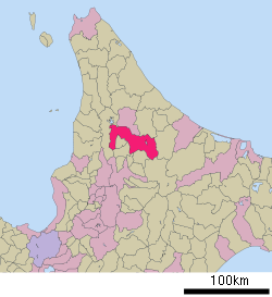 Location of Shibetsu in Hokkaido (Kamikawa Subprefecture) | ||
 Shibetsu Location in Japan | ||
| Coordinates: 43°33′N 141°55′E / 43.550°N 141.917°ECoordinates: 43°33′N 141°55′E / 43.550°N 141.917°E | ||
| Country | Japan | |
| Region | Hokkaido | |
| Prefecture | Hokkaido (Kamikawa Subprefecture) | |
| Government | ||
| • Mayor | Makino Yuji | |
| Area | ||
| • Total | 1,119.29 km2 (432.16 sq mi) | |
| Population (June 2008) | ||
| • Total | 22,859 | |
| • Density | 20.4/km2 (53/sq mi) | |
| Time zone | Japan Standard Time (UTC+9) | |
| Symbols | ||
| - Tree | Japanese Rowan and Ezo Spruce | |
| - Flower | Cosmos and Ezo-murasaki-tsutsuji (Rhododendron dauricum) | |
| Address |
4-1, Higashi Roku-jō, Shibetsu-shi, Hokkaidō 095-8686 | |
| Phone number | 0165-23-3121 | |
| Website | Shibetsu City | |


Shibetsu (士別市 Shibetsu-shi, Ainu: シペㇳ Sipet) is a city located in Kamikawa Subprefecture, Hokkaido, Japan.
As of 2008, the city has an estimated population of 22,859 and the density of 20.4 persons per km². The total area is 1119.29 km².
It is situated by the Shibetsu River in the north and its valley and is accessed by an expressway which has its northern terminus in the north, which opened its interchange on October 4, 2003 and route 40 The bypass is not yet planned. It is located N of Asahikawa and NNE of Sapporo.
The name comes from the Ainu meaning great river.
It has two train stations including one in Shimoshibetsu.
The city was founded on July 1, 1954.
On September 1, 2005, the town of Asahi (from Kamikawa (Teshio) District) was merged into Shibetsu.
Twinnings
External links
![]() Media related to Shibetsu, Hokkaidō at Wikimedia Commons
Media related to Shibetsu, Hokkaidō at Wikimedia Commons
- (Japanese) Official website
| ||||||||||||||||||||||||||