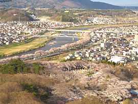
Shibata, Miyagi
| Shibata 柴田町 | |||
|---|---|---|---|
| Town | |||
|
Shibata Town Office | |||
| |||
 Location of Shibata in Miyagi Prefecture | |||
 Shibata
| |||
| Coordinates: 38°03′23″N 140°45′57″E / 38.05639°N 140.76583°ECoordinates: 38°03′23″N 140°45′57″E / 38.05639°N 140.76583°E | |||
| Country | Japan | ||
| Region | Tōhoku | ||
| Prefecture | Miyagi | ||
| District | Shibata | ||
| Area | |||
| • Total | 53.98 km2 (20.84 sq mi) | ||
| Population (June 2014) | |||
| • Total | 39,244 | ||
| • Density | 727/km2 (1,880/sq mi) | ||
| Time zone | Japan Standard Time (UTC+9) | ||
| - Tree | Momi Fir | ||
| - Flower | Sakura | ||
| - Bird | Pheasant | ||
| Phone number | 0224-55-2111 | ||
| Address | 2-3-45 Funaoka-chuo, Shibata-machi, Shibata-gun, Miyagi-ken 989-1692 | ||
| Website | Official website | ||

Shibata (柴田町 Shibata-machi) is a town located in Shibata District, Miyagi Prefecture, Japan. As of June 2014, the town had an estimated population of 39,244 and a population density of 727 persons per km². The total area was 53.98 km².
Geography
Shibata is located in south-central Miyagi Prefecture. The Shiroishi River runs through the town.
Neighboring municipalities
History
The area of present-day Shibata was part of ancient Mutsu Province.The villages of Funaoka and Tsukinoki were established on April 1, 1889 with the establishment of the municipalities system. Tsukioki was promoted to town status on April 1, 1904 and Funaoki on November 3, 1941. The two towns merged to form Shibata on April 1, 1956
Economy
The economy of Shibata is largely based on agriculture.
Education
Transportation
Railway
- JR East - Tōhoku Main Line
Highway
Local attractions
- Site of Funaoka Castle
Sister city relations
 Brazil – Assis Chateaubriand (Paraná), since April 13, 1981
 China – Danyang, Jiangsu, China, since February 23, 1994
External links
![]() Media related to Shibata, Miyagi at Wikimedia Commons
Media related to Shibata, Miyagi at Wikimedia Commons
- Official website (Japanese)
| ||||||||||||||||||