Sheet Harbour, Nova Scotia
| Sheet Harbour | |
|---|---|
| Community | |
 Sheet Harbour Location within Nova Scotia | |
| Coordinates: 44°55′N 62°32′W / 44.917°N 62.533°WCoordinates: 44°55′N 62°32′W / 44.917°N 62.533°W | |
| Country |
|
| Province |
|
| Municipality | Halifax Regional Municipality |
| District | 1 |
| Founded | 1784 |
| Government | |
| • Type | Regional Council |
| • Governing Council | Halifax Regional Council |
| • Community Council | Marine Drive Valley & Canal |
| Area | |
| • Total | 188.38 km2 (72.73 sq mi) |
| Highest elevation | 114 m (374 ft) |
| Lowest elevation | 0 m (0 ft) |
| Population (2001) | |
| • Total | 820 |
| Time zone | AST (UTC-4) |
| • Summer (DST) | ADT (UTC-3) |
| Canadian Postal code | B0J 3B0 |
| Telephone Exchange | 902 885 |
| GNBC Code | CBIKA |
| Part of a series about Places in Nova Scotia | |
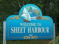
Sheet Harbour is a community on the Eastern Shore of Nova Scotia, Canada. It is part of the Halifax Regional Municipality and lies along the Marine Drive on Trunk 7 approximately 114 kilometres east of Halifax.
History
The settlement began in 1784 by Loyalist refugees and British veterans of the American Revolution and became a prosperous centre for the lumber industry.
Sheet Harbour was named "Port North" on the Royal Navy Chart that was published in 1778. It was decided that "Port North" was not descriptive enough so its name was changed to Sheet Harbour because of a white, flat rock that looks like a sheet (named Sheet Rock). Sheet Rock can be found at the entrance of the harbour. Sheet Harbour for about two decades was known as Cambell Town, this name fell into disuse and became known as Sheet Harbour.[1]
Industry
The economy of Sheet Harbour is based on the tourism, fishery and forestry. In October 1885 the Halifax Wood Fibre Company located the first sulphide pulp mill in Canada at East River, Sheet Harbour. Later on October 5th a ground-wood pulp mill owned by the American Pulp and Wrapping Paper Co. of Albany New York began operation on the West River at the head of the Northwest Arm of Sheet Harbour. This pulp mill replaced a saw mill owned by Rhodes & Currie and remained in operation until destroyed by hurricane Beth in 1971. (Coady 1988)but since the 1990s, there is an industrial park to service the Sable Offshore Energy Project
For Tourism Sheet Harbour has the MacPhee House.

Communications
- Postal Code B0J 3B0
- Telephone exchange 902 885 Aliant
- Television
- CBHT Channel 11 - 18 kW
- CJCH Channel 2
Sheet Harbour has a C@p Site for public use. It has a fax machine and is able to send emails.
Activities
- Seaside Festival

- Winter Parade
- the area has many ATV and walking trails.
- Sheet Harbour's Rockets Field which is one of the two baseball fields in Sheet Harbour
- Taylor Head Beach - a nearby day-use Provincial Park with extensive hiking trails
Programs for Kids
The 2610 Royal Canadian Army Cadet Corps is in Sheet Harbour. This Corps has put Sheet Harbour on the map in Cadet circles for its ability to produce the best young Air Rifle shooters in Canada.
Demographics
- Total Population - 820
- Total Dwellings - 426
- Total Land Area - 188.384 km²
Transportation
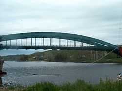
The community is at the junction of three Highways Trunk 7, Route 224,and Route 374. The community also has a small harbour authority and a commercial port.
Schools
- Duncan MacMillan High School (grades 7 to 12) DMHS Website
- Sheet Harbour Consolidated School (Primary to grade 6), SHCS website
References
- ↑ Found in Sheet Harbour: A Local History by James E. Rutledge written in 1954, page 9-10
- Howard Coady; Sheet Harbour History, Lancelot Press Ltd. 1988 Hantsport N.S.