Sheeffry Hills
| Sheeffry Hills | |
|---|---|
| Irish: Cnoic Shíofra | |
|
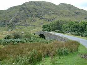
Sheeffry Hills from Sheeffry Bridge | |
| Highest point | |
| Peak | Barrclashcame |
| Elevation | 772 m (2,533 ft) |
| Geography | |
|
<div style="padding:2px 2px 5px 2px;>  Location in Ireland | |
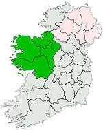
| Country | Republic of Ireland |
| Provinces of Ireland | Connacht |
| Range coordinates | 53°40′N 9°42′W / 53.667°N 9.700°WCoordinates: 53°40′N 9°42′W / 53.667°N 9.700°W |
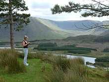
The Sheeffry Hills or Sheeffry Mountains (from Irish: Cnoic Shíofra, meaning "hills of the wraith")[1] is a range of hills in County Mayo, Ireland. It is bounded to the west by Glencullin Lough and Doolough; to the south by Glenummera and Tawnyard Lough; to the east by Owenmore Glen and to the north by the Bunowen River.
The highest peak is Barrclashcame (772 m).[2] The range also includes—from west to east—the peaks of Barrclashcame Northwest aka Storikeennageer (580 m),[3] Tievummera (762 m),[4] Tievnabinnia (742 m),[5] Tawnyard (436 m)[6] and Tawnyrower (510 m).[7]
There are a number of loughs within the Sheeffry Hills, the two biggest being Lugacolliwee and Lugaloughan. The others are—from west to east—Lough Awaniareen, Lough Allisheen, Lough Tarriff, Lough Brawn, Lugalough
Settlements in the area include Drummin and Carrowkennedy (to the east), Cregganbaun (west), and Delphi (south). Carrowkennedy was the site of an ambush in June 1921, during the Irish War of Independence.
See also
References
- ↑ Placenames Database of Ireland
- ↑ MountainViews.ie - Barrclashcame
- ↑ MountainViews.ie - Barrclashcame Northwest
- ↑ MountainViews.ie - Tievummera
- ↑ MountainViews.ie - Tievnabinnia
- ↑ MountainViews.ie - Tawnyard
- ↑ MountainViews.ie - Tawnyrower
External links
- Ordnance Survey Ireland - Online map viewer (centered on the Sheeffry Hills)
| |||||||||||||||||||||||||||||||||||||||||||||