Shawnee Township, Cape Girardeau County, Missouri
| Shawnee Township | |
|---|---|
| Township | |
 | |
| Coordinates: 37°30′54″N 089°36′51″W / 37.51500°N 89.61417°WCoordinates: 37°30′54″N 089°36′51″W / 37.51500°N 89.61417°W | |
| Country | United States |
| State | Missouri |
| County | Cape Girardeau |
| Area | |
| • Total | 92.36 sq mi (239.21 km2) |
| • Land | 90.37 sq mi (234.05 km2) |
| • Water | 1.99 sq mi (5.16 km2) 2.16% |
| Elevation[1] | 558 ft (170 m) |
| Population (2000) | |
| • Total | 3,460 |
| • Density | 38.3/sq mi (14.8/km2) |
| FIPS code | 29-67070[2] |
| GNIS feature ID | 0766402 |
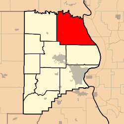
Shawnee Township is one of ten townships in Cape Girardeau County, Missouri, USA. As of the 2000 census, its population was 3,460.
Geography
Shawnee Township covers an area of 92.36 square miles (239.2 km2) and contains one incorporated settlement, Pocahontas. It contains two cemeteries: Apple Creek and Darby.
The streams of Blue Shawnee Creek, Buckeye Creek, Duskin Creek, Flatrock Creek, Indian Creek, Little Indian Creek, Lovejoy Creek, Muddy Shawnee Creek, Neelys Creek, Opossum Creek, Shawnee Creek and Turkey Creek run through this township.
References
- ↑ "US Board on Geographic Names". United States Geological Survey. 2007-10-25. Retrieved 2008-01-31.
- ↑ "American FactFinder". United States Census Bureau. Retrieved 2008-01-31.
External links
| |||||||||||||||||||||||||||||
