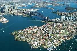
Shark Island (Port Jackson)


Shark Island is an island in Sydney Harbour, Australia. It lies offshore of the Sydney suburbs of Point Piper, Rose Bay and Vaucluse, in the eastern section of the harbour between the Harbour Bridge and the harbour entrance. It is also 3352.00S and 15115.00E.
The local aboriginal peoples call the island Boambilly, or perhaps Bo-a-millie.[1] The name Shark Island is from its shape, which is claimed to resemble a shark.[2]
The island is 1.5 hectares (3.7 acres) in area[3] and measures some 250 metres by 100 metres. Parts were set aside as a recreation reserve as early as 1879 and it was also used as an animal quarantine station and naval depot up until 1975. At that time it became exclusively a recreation reserve and part of the Sydney Harbour National Park. Approved operators and a scheduled ferry service take people to the island.[4][5][6]
Just north of the northern tip of the island is Shark Island Light, an active pile lighthouse which was built in 1913. The lighthouse is painted white. It is very close to the island, about fifteen to twenty metres away. [7]

References
- ↑ Aboriginal People of Coastal Sydney place names chart at the Living Harbour project of the Australian Museum
- ↑ Sydney Harbour National Park - Park Maps, New South Wales Department of Infrastructure, Planning and Natural Resources (as at 9 September 2005)
- ↑ "Sydney Harbour National Park Shark Island". National Parks and Wildlife Service. NSW Government. Retrieved 14 September 2014.
- ↑ Sydney Harbour National Park Culture & history, National Parks and Wildlife Service (as at 21 March 2006)
- ↑ New weekend ferry service for Sydney Harbour's Shark Island, National Parks and Wildlife Service press release 11 April 2003
- ↑ David Messent (1994). The Complete Guide to Sydney Harbour, ISBN 0-646-17888-1, page 130.
- ↑ Searle, Garry. "List of Lighthouses - New South Wales". Lighthouses of Australia. SeaSide Lights.
See also
- Bradleys Head
- Clark Island (New South Wales)
- Dobroyd Head
- Goat Island
- Sow and Pigs Reef
- Sydney Heads
- Sydney Harbour National Park
Coordinates: 33°51′30.08″S 151°15′27.50″E / 33.8583556°S 151.2576389°E
| ||||||||||||||||