Shahbazpur Union, Sarail
| Shahbazpur | |
|---|---|
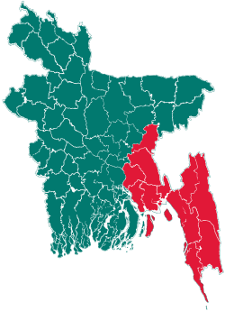
 Shahbazpur Location of Shahbazpur Town in Bangladesh | |
| Coordinates: 24°3.1′N 91°10.4′E / 24.0517°N 91.1733°ECoordinates: 24°3.1′N 91°10.4′E / 24.0517°N 91.1733°E | |
| Country |
|
| Division | Chittagong Division |
| District | Brahmanbaria |
| Upazila | Sarail |
| Government | |
| • MP (Brahmanbaria-2) | Ziaul Haque Mridha (Jatiya Party) |
| Area | |
| • Total | 26.5 km2 (10.22 sq mi) |
| Population (2011) | |
| • Total | 35,288 |
| • Density | 1,300/km2 (3,500/sq mi) |
| Time zone | Bangladesh Time (UTC+6) |
| Postal code | 3431 |
Shahbazpur (Bengali: শাহবাজপুর টাউন) is a union of villages in Sarail Upazila of Brahmanbaria District in the Chittagong Division of eastern Bangladesh.[1] It consists of a self-governing town and It has 6 mouzas and 17 villages. Its geographical coordinates are 24° 3′ 6″ North, 91° 10′ 24″ East and its original old name (with diacritics) is Shāhbāzpur.
Geography
Shahbazpur is located at 24°03′06″N 91°10′24″E / 24.051667°N 91.173333°E. It has 7958 units of house hold and total area 26.5 km².
Administrative
Shahbazpur Union has 6 Mauzas/Mahallas, and 17 villages. The villages and other areas of this town.
- Shahbazpur Union (Union Council)
- Bolurampur (Village)
- Khomutapur (Village)
- Shahbazpur (Village)
- Rajamarakandi (Village)
- Tumontur (Village)
- Jadubpur (Village)
- North Dithpur (Village)
- South Dithpur (Village)
- Nismontupur (Village)
- Voishamura (Village). etc
- Titas Nadirpar (River)
- Shapla beel (lake)
- Madrasha Bazar, 2nd Gate (main town area)
- Khan Market (main town area)
- Arot Bazar (port area)
- Dhaka-Sylhet Highway (road)
- Titas River, Bridge Side (port area)
- Titas Bridge/also known as Shahbazpur Shetu (bridge)
- Shahbazpur Highway Police Station (Police Station)
- 1st Gate, Post Office Para (Post Office).
People
Majority of people living here are Muslims, and also Hindus. The main occupation of people here is businesses, agriculture as this area is highly fertile. The population of the Shahbazpur is around 35,288 (50.27% male, 49.73% female), with the literacy rate of 82%. It needs to mentioned that Shahbazpur M.L. High School, Shahbazpur Girls High School and Shahbazpur Darul Ulum Madrasah were established in 1907, 2000 and 1886 respectively
Connectivity
The Shahbazpur Town is directly connected to Asian-Highway road.
See also
References
- ↑ Md. Azad Uddin Thakur (2012). "Sarail Upazila". In Sirajul Islam and Ahmed A. Jamal. Banglapedia: National Encyclopedia of Bangladesh (Second ed.). Asiatic Society of Bangladesh.
External links
| |||||||||||||||||||||||||||||||||||||||||||||||||||||