Sexton, Arkansas
| Sexton, Arkansas | |
|---|---|
| Ghost town | |
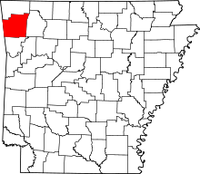
 Sexton, Arkansas Sexton's position in Arkansas. | |
| Coordinates: 35°54′55″N 94°30′25″W / 35.91528°N 94.50694°WCoordinates: 35°54′55″N 94°30′25″W / 35.91528°N 94.50694°W | |
| Country |
|
| State |
|
| County | Washington |
| Township | Dutch Mills |
| Elevation | 309 m (1,014 ft) |
| Time zone | Central (CST) (UTC-6) |
| • Summer (DST) | CDT (UTC-5) |
| Area code(s) | 479 |
| GNIS feature ID | 81941 |
| U.S. Geological Survey Geographic Names Information System: Sexton, Arkansas | |
Sexton, Arkansas (also Salem Springs) is a former community in Dutch Mills Township, Washington County, Arkansas, United States.[1]
References
- ↑ "Feature Detail Report for: Sexton, Arkansas (historical)." USGS. U.S. Geological Survey Geographic Names Information System: Sexton, Arkansas Retrieved January 11, 2011.