Serres-et-Montguyard
| Serres-et-Montguyard | |
|---|---|
 | |
 Serres-et-Montguyard | |
|
Location within Aquitaine region  Serres-et-Montguyard | |
| Coordinates: 44°40′30″N 0°27′13″E / 44.675°N 0.4536°ECoordinates: 44°40′30″N 0°27′13″E / 44.675°N 0.4536°E | |
| Country | France |
| Region | Aquitaine |
| Department | Dordogne |
| Arrondissement | Bergerac |
| Canton | Eymet |
| Intercommunality | Val et Côteaux d'Eymet |
| Government | |
| • Mayor (2008–2014) | Pierre Richiero |
| Area1 | 6.85 km2 (2.64 sq mi) |
| Population (2008)2 | 182 |
| • Density | 27/km2 (69/sq mi) |
| INSEE/Postal code | 24532 / 24500 |
| Elevation |
47–129 m (154–423 ft) (avg. 50 m or 160 ft) |
|
1 French Land Register data, which excludes lakes, ponds, glaciers > 1 km² (0.386 sq mi or 247 acres) and river estuaries. 2 Population without double counting: residents of multiple communes (e.g., students and military personnel) only counted once. | |
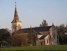
Serres-et-Montguyard is a commune in the Dordogne department in Aquitaine in southwestern France.
Population
| Historical population | ||
|---|---|---|
| Year | Pop. | ±% |
| 1962 | 238 | — |
| 1968 | 196 | −17.6% |
| 1975 | 181 | −7.7% |
| 1982 | 151 | −16.6% |
| 1990 | 139 | −7.9% |
| 1999 | 153 | +10.1% |
| 2008 | 182 | +19.0% |
See also
- Communes of the Dordogne département
References
| Wikimedia Commons has media related to Serres-et-Montguyard. |