Sereel
| Sereel سرعل | |
|---|---|
| City | |
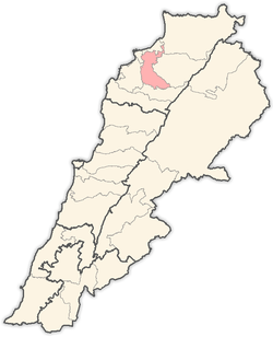
 Sereel Location within Lebanon | |
| Coordinates: 34°17′24″N 35°54′41″E / 34.29000°N 35.91139°ECoordinates: 34°17′24″N 35°54′41″E / 34.29000°N 35.91139°E | |
| Country |
|
| Governorate | North Governorate |
| District | Zgharta District |
| Elevation | 521 m (1,709 ft) |
| Time zone | EET (UTC+2) |
| • Summer (DST) | EEST (UTC+3) |
| Dialing code | +961 |
Sereel ( known also as Siriil or Sir'il, Arabic: سرعل) is a village located in the Zgharta District in the North Governorate of Lebanon. It is situated in the valley of Qozhaya, the northern branch of the Valley of Qadisha.
| |||||||||||||||||||||||||||||