Sengouagnet
| Sengouagnet | |
|---|---|
|
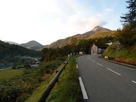
The road into Sengouagnet | |
 Sengouagnet | |
|
Location within Midi-Pyrénées region  Sengouagnet | |
| Coordinates: 42°59′15″N 0°47′23″E / 42.9875°N 0.7897°ECoordinates: 42°59′15″N 0°47′23″E / 42.9875°N 0.7897°E | |
| Country | France |
| Region | Midi-Pyrénées |
| Department | Haute-Garonne |
| Arrondissement | Saint-Gaudens |
| Canton | Aspet |
| Intercommunality | Trois Vallées |
| Government | |
| • Mayor (2008–2014) | Jean-Pierre Sanchez |
| Area1 | 18.60 km2 (7.18 sq mi) |
| Population (2008)2 | 221 |
| • Density | 12/km2 (31/sq mi) |
| INSEE/Postal code | 31544 / 31160 |
| Elevation |
467–1,908 m (1,532–6,260 ft) (avg. 524 m or 1,719 ft) |
|
1 French Land Register data, which excludes lakes, ponds, glaciers > 1 km² (0.386 sq mi or 247 acres) and river estuaries. 2 Population without double counting: residents of multiple communes (e.g., students and military personnel) only counted once. | |
Sengouagnet is a commune in the Haute-Garonne department in southwestern France.
Population
| Historical population | ||
|---|---|---|
| Year | Pop. | ±% |
| 1962 | 169 | — |
| 1968 | 223 | +32.0% |
| 1975 | 213 | −4.5% |
| 1982 | 215 | +0.9% |
| 1990 | 236 | +9.8% |
| 1999 | 220 | −6.8% |
| 2008 | 221 | +0.5% |
See also
- Communes of the Haute-Garonne department
References
| Wikimedia Commons has media related to Sengouagnet. |