Seneca Historic District (Poolesville, Maryland)
|
Seneca Historic District | |
|
| |
|
Seneca Schoolhouse Museum | |
 | |
| Nearest city | Poolesville, Maryland |
|---|---|
| Coordinates | 39°5′28″N 77°20′48″W / 39.09111°N 77.34667°WCoordinates: 39°5′28″N 77°20′48″W / 39.09111°N 77.34667°W |
| Architect | Unknown |
| Architectural style | Italianate, Georgian, Federal |
| Governing body | State |
| NRHP Reference # | 78001475[1] |
| Added to NRHP | November 15, 1978 |
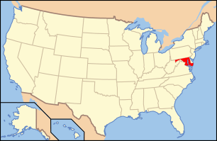
The Seneca Historic District is a national historic district located at Poolesville, Montgomery County, Maryland. The district comprises 3,850 acres (1,560 ha) of federal, state, and county parkland and farmland in which 15 historic buildings are situated. The C&O Canal, including Seneca Aqueduct (Aqueduct No. 1), Lock No. 24 (Riley's Lock), the adjacent lock house; as well as the Seneca Quarry and quarry masters house above the quarry also stand within the district and are also within Seneca Creek State Park.[2] The 15 historic structures are surrounded by dependencies of various periods, in most cases dating from the period of the dwelling. There are slave quarters, smokehouses, springhouses, corn cribs, and tobacco barns.[3] [4]
It was listed on the National Register of Historic Places in 1978.[1]
References
- ↑ 1.0 1.1 "National Register Information System". National Register of Historic Places. National Park Service. 2008-04-15.
- ↑ Peck, Garrett (2012). The Potomac River: A History and Guide. Charleston, SC: The History Press. pp. 62–63. ISBN 978-1609496005.
- ↑ "Seneca Historic District". Maryland Historical Trust. Retrieved 2008-10-29.
- ↑ Dorothy Muir; May Ann Kephart; Austin Kiplinger (December 1975). "National Register of Historic Places Inventory -- Nomination Form: Seneca Historic District" (PDF). Mayland State Archives. Retrieved January 8, 2015.
External links
- Boundary Map of the Seneca Historic District, Montgomery County, at Maryland Historical Trust
| |||||||||||||||||||||||||

