Sencenac-Puy-de-Fourches
| Sencenac-Puy-de-Fourches | |
|---|---|
|
Puy-de-Fourches | |
 Sencenac-Puy-de-Fourches | |
|
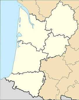
Location within Aquitaine region  Sencenac-Puy-de-Fourches | |
| Coordinates: 45°18′28″N 0°39′38″E / 45.3078°N 0.6606°ECoordinates: 45°18′28″N 0°39′38″E / 45.3078°N 0.6606°E | |
| Country | France |
| Region | Aquitaine |
| Department | Dordogne |
| Arrondissement | Périgueux |
| Canton | Brantôme |
| Government | |
| • Mayor (2008–2014) | Guy-Robert Duverneuil |
| Area1 | 10.79 km2 (4.17 sq mi) |
| Population (2008)2 | 211 |
| • Density | 20/km2 (51/sq mi) |
| INSEE/Postal code | 24530 / 24310 |
| Elevation | 128–234 m (420–768 ft) |
|
1 French Land Register data, which excludes lakes, ponds, glaciers > 1 km² (0.386 sq mi or 247 acres) and river estuaries. 2 Population without double counting: residents of multiple communes (e.g., students and military personnel) only counted once. | |
Sencenac-Puy-de-Fourches is a commune in the Dordogne department in Aquitaine in southwestern France.
Population
| Historical population | ||
|---|---|---|
| Year | Pop. | ±% |
| 1831 | 499 | — |
| 1836 | 506 | +1.4% |
| 1841 | 471 | −6.9% |
| 1846 | 494 | +4.9% |
| 1851 | 493 | −0.2% |
| 1856 | 495 | +0.4% |
| 1861 | 455 | −8.1% |
| 1866 | 446 | −2.0% |
| 1872 | 441 | −1.1% |
| 1876 | 463 | +5.0% |
| 1881 | 435 | −6.0% |
| 1886 | 414 | −4.8% |
| 1891 | 432 | +4.3% |
| 1896 | 381 | −11.8% |
| 1901 | 362 | −5.0% |
| 1906 | 388 | +7.2% |
| 1911 | 411 | +5.9% |
| 1921 | 330 | −19.7% |
| 1926 | 331 | +0.3% |
| 1931 | 313 | −5.4% |
| 1936 | 294 | −6.1% |
| 1946 | 287 | −2.4% |
| 1954 | 265 | −7.7% |
| 1962 | 207 | −21.9% |
| 1968 | 221 | +6.8% |
| 1975 | 191 | −13.6% |
| 1982 | 176 | −7.9% |
| 1990 | 180 | +2.3% |
| 1999 | 193 | +7.2% |
| 2008 | 211 | +9.3% |
See also
- Communes of the Dordogne département
References
External links
| Wikimedia Commons has media related to Sencenac-Puy-de-Fourches. |