Selma Municipal Airport
| Selma Municipal Airport Selfield Field Selfield Army Auxiliary Airfield #1 | |
|---|---|
|
2006 USGS airphoto | |
| IATA: SES – ICAO: none | |
| Summary | |
| Serves | Selma, Alabama |
| Coordinates | 32°26′20″N 086°57′13″W / 32.43889°N 86.95361°W |
| Map | |
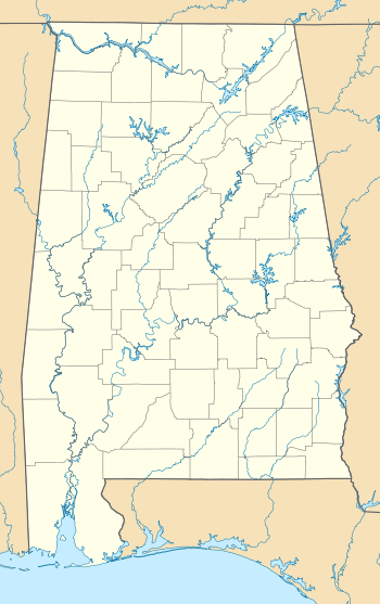 SES Location of Selma Municipal Airport | |
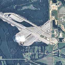
Selma Municipal Airport (IATA: SES), also known as Selma Selfield Airport, was an airport located 8 kilometres (5.0 mi) east-northeast of Selma, Alabama.
History
The airport was built about 1943 as an auxiliary airfield to the Army pilot school at Craig Army Airfield. It was designated Selfield Army Auxiliary Airfield #1 It had a 4,200' hard-surface runway. The field was said to not have any hangars. It was apparently unmanned unless necessary for aircraft recovery.
The field was always closely tied to operations at Craig and served as an auxiliary field for a number of years during World War II with the initiation of Undergraduate Pilot Training for the Air Force though the 1960s. It became a joint use facility in the early 1950s with Delta Airlines operating DC-3 service and later Southern Airways. Selma Municipal Airport was closed in 1978 when the City of Selma relocated the municipal airport to the much larger Craig Air Force Base, which was closed by the Air Force after the Vietnam War.
Today the former airport is used for storage of a large number of house trailers by FEMA; which remain in the area after being repossessed from Hurricane Katrina victims.
See also
References
![]() This article incorporates public domain material from websites or documents of the Air Force Historical Research Agency.
This article incorporates public domain material from websites or documents of the Air Force Historical Research Agency.