Sellicks Beach, South Australia
| Sellicks Beach South Australia | |||||||||||||
|---|---|---|---|---|---|---|---|---|---|---|---|---|---|
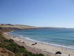 Sellicks Beach south 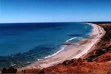 Sellicks Beach north 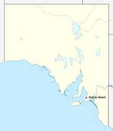 | |||||||||||||
| Coordinates | 35°19′48″S 138°26′53″E / 35.330°S 138.448°ECoordinates: 35°19′48″S 138°26′53″E / 35.330°S 138.448°E | ||||||||||||
| Population | 2,339 (2011 census Census)[1] | ||||||||||||
| Postcode(s) | 5174 | ||||||||||||
| Time zone | ACST (UTC+9:30) | ||||||||||||
| • Summer (DST) | ACDT (UTC+10:30) | ||||||||||||
| LGA(s) | City of Onkaparinga | ||||||||||||
| State electorate(s) | Finniss[2] | ||||||||||||
| Federal Division(s) | Kingston | ||||||||||||
| |||||||||||||
Sellicks Beach is an outer southern suburb of Adelaide, South Australia which is located in the local government area of the City of Onkaparinga and is the southernmost extent of the Adelaide urban conurbation.[3] At the 2006 census, Sellicks Beach had a population of 2,339.[1]
There are housing development projects being undertaken in Sellicks Beach. There is a Post Office, Deli. Sellicks Beach is also close to Aldinga Beach, a 10 minute drive, which has a Petrol Station, Supermarket and other various shops. Driving on the beach is permitted free of charge for residents while a non-residents are charged a small fee.[4]
See also
Notes and references
- ↑ 1.0 1.1 Australian Bureau of Statistics (31 October 2012). "Sellicks Beach (State Suburb)". 2011 Census QuickStats. Retrieved 17 October 2014.
- ↑ "2014 State election boundaries". ELECTORAL COMMISSION SA. Retrieved 17 October 2014.
- ↑ 3.0 3.1 3.2 3.3 "City of Onkaparinga suburb boundaries map". City of Onkaparinga. 9 January 2014. Retrieved 8 October 2014.
- ↑ "Vehicles on beaches". City of Onkaparinga. Retrieved 16 October 2014.