Selden, Kansas
| Selden, Kansas | |
|---|---|
| City | |
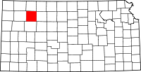
 Location within Sheridan County and Kansas | |
| Coordinates: 39°32′28″N 100°34′1″W / 39.54111°N 100.56694°WCoordinates: 39°32′28″N 100°34′1″W / 39.54111°N 100.56694°W | |
| Country | United States |
| State | Kansas |
| County | Sheridan |
| Area[1] | |
| • Total | 0.30 sq mi (0.78 km2) |
| • Land | 0.30 sq mi (0.78 km2) |
| • Water | 0 sq mi (0 km2) |
| Elevation | 2,835 ft (864 m) |
| Population (2010)[2] | |
| • Total | 219 |
| • Estimate (2012[3]) | 218 |
| • Density | 730/sq mi (280/km2) |
| Time zone | Central (CST) (UTC-6) |
| • Summer (DST) | CDT (UTC-5) |
| ZIP code | 67757 |
| Area code(s) | 785 |
| FIPS code | 20-63875 [4] |
| GNIS feature ID | 0471107 [5] |
| Website | City Website |
Selden is a city in Sheridan County, Kansas, United States. As of the 2010 census, the city population was 219.[6]
History
Selden was laid out in 1888.[7] It was named for one of its founders, Selden G. Hopkins.[8]
The first post office in Selden was established in July 1888.[9]
Geography
Selden is located at 39°32′28″N 100°34′1″W / 39.54111°N 100.56694°W (39.541194, -100.567064).[10] According to the United States Census Bureau, the city has a total area of 0.30 square miles (0.78 km2), all of it land.[1]
Climate
The climate in this area is characterized by hot, humid summers and generally mild to cool winters. According to the Köppen Climate Classification system, Selden has a humid subtropical climate, abbreviated "Cfa" on climate maps.[11]
Demographics
| Historical population | |||
|---|---|---|---|
| Census | Pop. | %± | |
| 1990 | 248 | — | |
| 2000 | 201 | −19.0% | |
| 2010 | 219 | 9.0% | |
| U.S. Decennial Census | |||
2010 census
As of the census[2] of 2010, there were 219 people, 101 households, and 57 families residing in the city. The population density was 730.0 inhabitants per square mile (281.9/km2). There were 118 housing units at an average density of 393.3 per square mile (151.9/km2). The racial makeup of the city was 97.3% White, 0.5% Native American, and 2.3% from other races. Hispanic or Latino of any race were 6.8% of the population.
There were 101 households of which 23.8% had children under the age of 18 living with them, 45.5% were married couples living together, 5.9% had a female householder with no husband present, 5.0% had a male householder with no wife present, and 43.6% were non-families. 39.6% of all households were made up of individuals and 14.9% had someone living alone who was 65 years of age or older. The average household size was 2.17 and the average family size was 2.96.
The median age in the city was 43.7 years. 23.3% of residents were under the age of 18; 8.2% were between the ages of 18 and 24; 20.9% were from 25 to 44; 28.3% were from 45 to 64; and 19.2% were 65 years of age or older. The gender makeup of the city was 56.6% male and 43.4% female.
2000 census
As of the census[4] of 2000, there were 201 people, 103 households, and 55 families residing in the city. The population density was 666.0 people per square mile (258.7/km²). There were 118 housing units at an average density of 391.0 per square mile (151.9/km²). The racial makeup of the city was 99.50% White, and 0.50% from two or more races.
There were 103 households out of which 19.4% had children under the age of 18 living with them, 41.7% were married couples living together, 7.8% had a female householder with no husband present, and 46.6% were non-families. 44.7% of all households were made up of individuals and 20.4% had someone living alone who was 65 years of age or older. The average household size was 1.95 and the average family size was 2.73.
In the city the population was spread out with 20.4% under the age of 18, 6.5% from 18 to 24, 25.9% from 25 to 44, 20.9% from 45 to 64, and 26.4% who were 65 years of age or older. The median age was 43 years. For every 100 females there were 105.1 males. For every 100 females age 18 and over, there were 107.8 males.
The median income for a household in the city was $28,750, and the median income for a family was $37,500. Males had a median income of $20,417 versus $16,250 for females. The per capita income for the city was $17,137. About 8.9% of families and 10.0% of the population were below the poverty line, including 16.0% of those under the age of eighteen and 6.1% of those sixty five or over.
References
- ↑ 1.0 1.1 "US Gazetteer files 2010". United States Census Bureau. Retrieved 2012-07-06.
- ↑ 2.0 2.1 "American FactFinder". United States Census Bureau. Retrieved 2012-07-06.
- ↑ "Population Estimates". United States Census Bureau. Retrieved 2013-05-29.
- ↑ 4.0 4.1 "American FactFinder". United States Census Bureau. Retrieved 2008-01-31.
- ↑ "US Board on Geographic Names". United States Geological Survey. 2007-10-25. Retrieved 2008-01-31.
- ↑ "2010 City Population and Housing Occupancy Status". U.S. Census Bureau. Retrieved September 1, 2011.
- ↑ Kansas State Historical Society (1916). Biennial Report of the Board of Directors of the Kansas State Historical Society. Kansas State Printing Plant. p. 299.
- ↑ "Profile for Selden, Kansas". ePodunk. Retrieved 23 June 2014.
- ↑ "Kansas Post Offices, 1828-1961". Kansas Historical Society. Retrieved 23 June 2014.
- ↑ "US Gazetteer files: 2010, 2000, and 1990". United States Census Bureau. 2011-02-12. Retrieved 2011-04-23.
- ↑ Climate Summary for Selden, Kansas
External links
| Wikimedia Commons has media related to Selden, Kansas. |
- City
- Schools
- USD 316, local school district
- Maps
- Selden City Map, KDOT
| |||||||||||||||||||||