Secretary Island
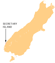 Location of Secretary Island. | |
| Geography | |
|---|---|
| Coordinates | 45°15′S 166°55′E / 45.250°S 166.917°E |
| Area | 81 km2 (31 sq mi) |
| Highest elevation | 1,200 m (3,900 ft) |
| Country | |
| Demographics | |
| Population | 0 |
Secretary Island is an island in southwestern New Zealand, lying entirely within Fiordland National Park. Roughly triangular in shape, it lies between Doubtful Sound in the south and Thompson Sound in the north, with its west coast facing the Tasman Sea. Steeply sloped, it rises to nearly 1,200 metres (3,937 ft). The island is uninhabited, and covers 81 km2 (31 sq mi).
The New Zealand Department of Conservation is engaged in a project to eradicate pests from the island, in order to help protect native species found on the island.[1]
The waters between Secretary Island and the nearby Bauza Island are protected by the Te Awaatu Channel (The Gut) Marine Reserve.
Coordinates: 45°15′S 166°55′E / 45.250°S 166.917°E
See also
- List of islands of New Zealand
- Secretary Islands
References
- ↑ Secretary Island Restoration Project Oct 2004