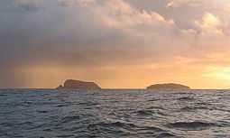
Seanna Chnoc
|
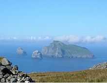
Seana Chnoc (at left) and Bearasaigh from the south west. Stac nam Balg is just visible to the left of Seanna Chnoc | |
| Location | |
|---|---|
 Seanna Chnoc Seanna Chnoc shown within the Outer Hebrides | |
| OS grid reference | NB116413 |
| Names | |
| Gaelic name | Flodaigh |
| Norse name | Flot-ay |
| Meaning of name | raft island |
| Physical geography | |
| Island group | Outer Hebrides |
| Area | <10 ha |
| Highest elevation | 91 metres (299 ft)[1] |
| Political geography | |
| Sovereign state | United Kingdom |
| Country | Scotland |
| Council area | Comhairle nan Eilean Siar |
Seanna Chnoc (English: "old hill"), also known as Seana Bheinn[2][3] is an islet in outer Loch Ròg, Lewis, Scotland. It lies north west of Great Bernera and Bearasaigh.
Stac nam Balg lies offshore to the north and there is a cave in the north west of the island.[1]
There is no regular access to the island although boat excursions are available locally.[4]
The island appears to have been called Garvilan in the early 19th century[5] and in 1549, Dean Monro wrote: "Besides the coist of Leozus towards the said north-west lyis ane Ile callit Garvellan, gude for store and fishing, perteining to Mccloyd of Leozus".[6]
Notes
- ↑ 1.0 1.1 "Get-a-map". Ordnance Survey. Retrieved 31 July 2010.
- ↑ Barrett (2010) p. 136
- ↑ "1:10,560 - Epoch 1. Scotland - Isle of Lewis". (1840) Ordnance Survey. British History Online. Retrieved 24 Nov 2012.
- ↑ Haswell-Smith (2004) p. 312
- ↑ Heather, William (1804) A new and improved chart of the Hebrides or Lewis Islands and adjacent coast of Scotland. National Library of Scotland. Retrieved 30 July 2014.
- ↑ Monro (1549) No. 212
References
- Barrett, Richard (2010) Walking on Harris and Lewis: 30 Routes in the Outer Hebrides. Cicerone.
- Haswell-Smith, Hamish (2004). The Scottish Islands. Edinburgh: Canongate. ISBN 978-1-84195-454-7.
- Monro, Sir Donald (1549) Description of the Western Isles of Scotland. William Auld. Edinburgh - 1774 edition.
| ||||||
| |||||||||||||||||||||||||||||||||
| ||||||||||||||||||||||||||||||||||||||||||||||||||||||||||||||||||||||||||||||||||||||||||||||||||||||||||||||||||||||||||||||||||||||||||||||||||||||||||||||||||||||||||||||||||||||||||||||||||||||||||||
Coordinates: 58°17′02″N 6°55′12″W / 58.2838°N 6.9201°W

