Seal, Kent
| Seal | |
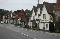 A view along Seal High Street |
|
 Seal |
|
| Population | 2,491 [1] |
|---|---|
| OS grid reference | TQ549567 |
| Civil parish | Seal |
| District | Sevenoaks |
| Shire county | Kent |
| Region | South East |
| Country | England |
| Sovereign state | United Kingdom |
| Post town | TONBRIDGE |
| Postcode district | TN15 |
| Dialling code | 01732 |
| Police | Kent |
| Fire | Kent |
| Ambulance | South East Coast |
| EU Parliament | South East England |
Coordinates: 51°17′18″N 0°13′20″E / 51.2882°N 0.2223°E
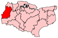
Seal is a village and civil parish in the Sevenoaks District of Kent, England. The parish is located in the valley between the North Downs and the Greensand ridge to the north east of Sevenoaks town.
The village, on the A25 road, although ancient, is fast becoming part of the built-up area of Sevenoaks.
In early documents the name of the village is often given as 'Sele', 'Sale', 'Zela' or 'La Sela'. Until recently it was supposed to come from the French word 'salle' meaning a hall but there is no evidence to support this. The etymology of place names suggests that the name of the village could have come from the Anglo-Saxon word 'sole' or 'sol' meaning a 'muddy slough, wallowing place' or a 'muddy pond that overflows'. Seal still has a pond at the fork at the bottom of Park Lane which tends to overflow at the present day. Another possibility is Anglo-Saxon sēale = "group of sallow trees".
'Seal: The History of a Parish' by Jean Fox, David Williams and Peter Mountfield, published by Philimores in 2007, gives comprehensive coverage of the village's history.

Seal's church, the oldest parts of which date from the 13th Century, is dedicated to St Peter and St Paul and is a grade I listed building. [2] The ecclesiastical parish only became separate from Kemsing in 1874, although there may well have been a Saxon church on the site of the present building. Visitors to the church, which is normally open during the day, can pick up a free guide leaflet pointing out features of interest. There are more details on the church website , and a page for family historians with some records of burials and baptisms at the church (not complete) and information about where to find others.
Seal was recorded in the Domesday Book in 1086
Nearest Settlements
 |
Otford | Kemsing | Heaverham | |
| Sevenoaks and Riverhead | |
Igtham | ||
| ||||
| | ||||
| Sevenoaks | Godden Green | Stone Street |
References
- ↑ a=3&b=795539&c=seal&d=16&e=15&g=459160&i=1001x1003x1004&o=1&m=0&enc=1&dsFamilyId=779 National Statistics Census 2001
- ↑ "Name: CHURCH OF ST PETER AND ST PAUL List entry Number: 1243497". English Heritage. Retrieved 10 August 2014.
External links
![]() Media related to Seal, Kent at Wikimedia Commons
Media related to Seal, Kent at Wikimedia Commons
| ||||||||||||||||||||||||||