Sea lane
A sea lane or shipping lane is a regularly used route for vessels on oceans and large lakes. In the Age of Sail they were not only determined by the distribution of land masses but also the prevailing winds, whose discovery was crucial for the success of long voyages. Sea lanes are very important for trade by sea.
History


The establishment of the North Atlantic sea lanes was inspired by the sinking of the US mail steamer SS Arctic by collision with the French steamer SS Vesta in October 1854 which resulted in the loss of over 300 lives. Lieutenant M. F. Maury of the US Navy first published a section titled "Steam Lanes Across the Atlantic" in his 1855 Sailing Directions proposing sea lanes along the 42 degree latitude. A number of international conferences and committees were held in 1866, 1872, 1887, 1889, and 1891 all of which left the designation of sea lanes to the principal trans-Atlantic steamship companies at the time; Cunard, White Star, Inman, National Line, and Guion Lines. In 1913-1914 the International Convention for Safety of Life at Sea held in London again reaffirmed that the selection of routes across the Atlantic in both directions is left to the responsibility of the steamship companies.[1]
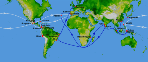
Shipping lanes came to be by analysing the prevailing winds. It is well known that the trade winds allowed ships to sail towards the west quickly, and that the westerlies allowed ships to travel to the east quickly. As such, the sea lanes are mostly chosen to take full advantage of these winds. Currents are also similarly followed as well, which also gives an advantage to the vessel.
It should be noted however, that the sea lanes were chosen based on the importance of cities as well, which could explain some anomalies towards the currents/winds, such as the fact that the shipping lanes are not optimally chosen for the route from Cape town towards Rio de Janeiro (passing Tristan da Cunha).
Main sea lanes may also attract pirates. Pax Britannica was the period 1815–1914 during which the British Royal Navy controlled most of the key maritime trade routes, and also suppressed piracy and the slave trade.
In World War I as German U-boats began hitting American and British shipping, the Allied trade vessels began to move out of the sea lanes to be escorted by Naval ships.
Advantages
_in_ice_in_front_of_South_Harbor_Helsinki_Finland.jpg)
Although most ships no longer use sails (having switched them for engines), the wind still creates waves, and this can cause heeling. As such following the overall direction of the trade winds and westerlies is still very useful. However, any vessel that is not engaged in trading, or is smaller than a certain length, is best to avoid the lanes. This is not only because the slight chance of a collision with a large ship can easily cause a smaller ship to sink, but also because large vessels are much less maneuverable than smaller ships, and need much more depth. Smaller ships can thus easily take courses that are nearer to the shore. Unlike with road traffic, there is no exact "road" a ship must follow, so this can easily be done.
Shipping lanes are the busiest parts of the sea, thus being a useful place for stranded boaters whose boats are sinking or people on a liferaft to boat to, and be rescued by a passing ship.
Threats from shipping lanes

Although the shipping lanes are useful, they do pose threats to some people:
- Divers should stay clear of shipping lanes when performing dives.
- Small boats also do best to avoid the lanes, in risk of conflicts with bigger ships.
- As the shipping lanes are very large, sections of the lane exist which can be shallow or have some kind of obstruction (e.g. sand bank). This threat is greatest when passing some narrows, such as between islands in the Indian ocean (e.g. in Indonesia) as well as between islands in the Pacific (e.g. near the Marquesas islands, Tahiti)
- Some shipping lanes, such as the Straits of Malacca off Indonesia and Malaysia, along the waters off Somalia are frequented by pirates both in ancient times and modern times. Either operating independently or as privateers (for companies and countries). Passing ships run the risk of being attacked and held for ransom.
See also
- Age of sail
- Sea lines of communication
References
- ↑ Encyclopædia Britannica, Fourteenth Edition, Volume 20 Pg 539, 1938