Schnebelhorn
| Schnebelhorn | |
|---|---|
|
View from the summit | |
| Elevation | 1,292 m (4,239 ft) |
| Prominence | 112 m (367 ft)[1] |
| Isolation | 3.0 km (1.9 mi)[2] |
| Parent peak | Tweralpspitz |
| Listing | Canton high point |
| Location | |
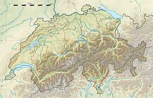
 Schnebelhorn Location in Switzerland | |
| Location | Zurich/St. Gallen, Switzerland |
| Range | Appenzell Alps |
| Coordinates | 47°19′32.2″N 8°58′46.7″E / 47.325611°N 8.979639°ECoordinates: 47°19′32.2″N 8°58′46.7″E / 47.325611°N 8.979639°E |
The Schnebelhorn is a mountain located near Fischenthal in the Töss Valley, between the cantons of Zurich (west) and St. Gallen (east). It is the highest summit of the canton of Zurich.
Various trails lead to the summit from all sides. Most of the massif is covered by forests.
References
- ↑ Retrieved from the Swisstopo topographic maps. The key col is the Schindelbergpass (1,180 m).
- ↑ Retrieved from Google Earth. The nearest point of higher elevation is north of the Höchhand.
External links
- Schnebelhorn on Hikr
- From Toggenburg to the highest Point of Canton Zürich MySwitzerland.com
| Wikimedia Commons has media related to Schnebelhorn. |
| ||||||
