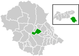
Schlaiten
Schlaiten is a municipality in the district of Lienz in the Austrian state of Tyrol. Its name is of Slavonic origin, deriving from *slatina, which means swamp. The municipality consists of the following neighbourhoods: Plone, Gonzach, Mesnerdorf, Bacherdorf, Gantschach and Göriach.
Population
| Historical population |
|---|
| Year | Pop. | ±% |
|---|
| 1869 | 337 | — |
|---|
| 1880 | 339 | +0.6% |
|---|
| 1890 | 317 | −6.5% |
|---|
| 1900 | 289 | −8.8% |
|---|
| 1910 | 302 | +4.5% |
|---|
| 1923 | 293 | −3.0% |
|---|
| 1934 | 330 | +12.6% |
|---|
| 1939 | 323 | −2.1% |
|---|
| 1951 | 345 | +6.8% |
|---|
| 1961 | 431 | +24.9% |
|---|
| 1971 | 447 | +3.7% |
|---|
| 1981 | 453 | +1.3% |
|---|
| 1991 | 466 | +2.9% |
|---|
| 2001 | 498 | +6.9% |
|---|
| 2012 | 468 | −6.0% |
|---|
References
 |
Wikimedia Commons has media related to Schlaiten. |
Municipalities in the district of Lienz |
|---|
| |
|