Schaerbeek
| Schaerbeek Schaarbeek (Dutch) | |||
|---|---|---|---|
| Municipality | |||
 | |||
| |||
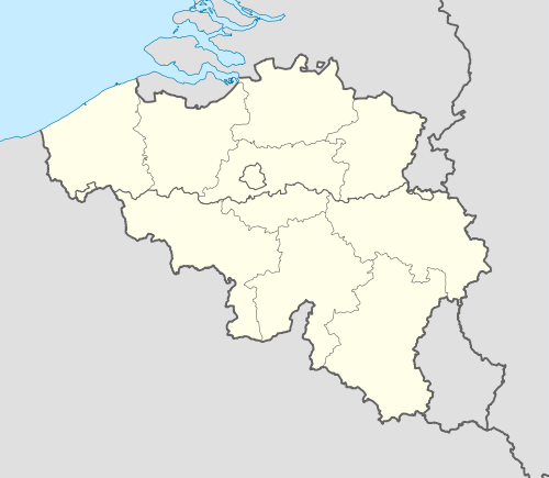 Schaerbeek Location in Belgium | |||
|
Schaerbeek municipality in the Brussels-Capital Region  | |||
| Coordinates: 50°52′N 04°23′E / 50.867°N 4.383°ECoordinates: 50°52′N 04°23′E / 50.867°N 4.383°E | |||
| Country | Belgium | ||
| Community |
Flemish Community French Community | ||
| Region | Brussels | ||
| Arrondissement | Brussels | ||
| Government | |||
| • Mayor | Bernard Clerfayt (FDF) | ||
| Area | |||
| • Total | 8.14 km2 (3.14 sq mi) | ||
| Population (1 January 2013)[1] | |||
| • Total | 127,747 | ||
| • Density | 16,000/km2 (41,000/sq mi) | ||
| Postal codes | 1030 | ||
| Area codes | 02 | ||
| Website | www.schaerbeek.be | ||


Schaerbeek (obsolete Dutch spelling, retained in French, pronounced [skaʁˈbek]) or Schaarbeek (Dutch, pronounced [ˈsxaːrbeːk]) is one of the nineteen municipalities located in the Brussels-Capital Region of Belgium. The first mention of the name was Scarenbecca, recorded in a document from the Bishop of Cambrai in 1120.[2] The origin of the name may come from the Franconian (Old Dutch) words schaer (notch, score) and beek (creek).[3]
Schaerbeek is nicknamed "the city of donkeys" (la cité des ânes or de ezelsgemeente). This name is reminiscent of times when people of Schaerbeek, who were cultivators of sour cherries primarily for Kriek production, would arrive at the Brussels marketplace with donkeys laden with sour cherries. Donkeys are still kept in Josaphat Park and sour cherry trees line the streets of the Diamant Quarter of Schaerbeek (Avenue Milcampslaan, Avenue Emile Maxlaan and Avenue Opale/Opaallaan). The Square des Griottiers/Morelleboomsquare is named after these trees.
The eastern part of Schaerbeek (the area near Vergote Square, Diamant quarter, and Josaphat Park) is nowadays a location selected by affluent people for its architecture and its convenient location (close to the EU institutions and the financial heart of the city, the airport and highways). Young couples are also favouring this suburb for its "Notting Hill" atmosphere and the still reasonable pricing of real estate, while prices are on the surge everywhere else in Brussels.
The western part of Schaerbeek (the area near the Brussels-North railway station, the Chaussée de Haecht/Haachtsesteenweg and the Van Praet bridge) is home to a large Turkish immigrant community, a significant part of which originates from Afyon or Emirdağ, Turkey. It is also home to a large Moroccan population and other immigrant communities such as Spanish, Congolese, and Asian immigrants. The area around St. Mary's Royal Church is the part where the Turkish community gathers in Brussels, which has led the area to be dubbed "Petite Anatolie"[4] because of all the Turkish restaurants and shops at the Chaussée de Haecht/Haachtsesteenweg. However because of the numerous schools like the Hogeschool Sint-Lukas Brussel, the administrations and the proximity of the Rue Royale there is a social mix. There are also several affluent streets and neighbourhoods in this area including the Quartier des Fleurs/Bloemenwijk, Boulevard Lambermontlaan, Place Meiserplein, Squares Huart-Hamoir and Francois Riga and Avenue Eugene Demolderlaan).
The Schaerbeek Cemetery, despite its name, is actually in the neighbouring municipality of Evere.
History
Antiquity and Middle Ages
The period at which human activity started in Schaerbeek can be inferred from the Stone-Age flint tools that were recovered in the Josaphat valley. Tombs and coins dating from the reign of Hadrian (2nd century) were also found near the old Roman roads that crossed Schaerbeek's territory.
The first mention of the town's name appears in a legal document dated 1120, whereby the bishop of Cambrai granted the administration of the churches of Scarenbecca and Everna (today's neighbouring Evere) to the canons of Soignies. Politically, the town was part of the Duchy of Brabant. In 1301, John II, Duke of Brabant had the town administered by the schepen (aldermen) of Brussels. A new church to Saint Servatius was built around that same time, at the same location as the old church.
At the end of the 14th century, the Schaerbeek lands that belonged to the Lords of Kraainem were sold and reconverted into a hunting ground. The official entry of the visiting Dukes of Burgundy into Brussels, their second capital, was also through Schaerbeek, where they had to swear to uphold the city's privileges. The game reservation and the rural character of the village lasted until the end of the 18th century. The areas not covered by woods were used to cultivate vegetables and grow vines. In 1540, Schaerbeek counted 112 houses and 600 inhabitants.

16th century until now
Up until then, the village had lived in relative peace. This would change in the middle of the 16th century as the Reformation set in. Schaerbeek suffered through ravages and destructions about a dozen times over the following two centuries, starting in the 1570s with William the Silent's mercenary troops fighting the Catholic Duke of Alba.
Spanish, French, British, and Bavarian troops all came through Schaerbeek, with the usual exactions and requisitions inflicted on the population.
After the French Revolution, it was decreed that Schaerbeek would be taken away from Brussels and proclaimed an independent commune, with its own mayor, schepen, and municipal assembly.
On 27 September 1830, during the Belgian Revolution, some fighting occurred in the Josaphat valley between the revolutionary troops and the retreating Dutch troops.
In 1879, a more modern Saint Servatius Church was built near the old one, which was eventually demolished in 1905. The town hall and Schaerbeek railway station were built in 1887 and 1902, respectively.
At the end of the 19th and in the early 20th centuries, Schaerbeek became home to the gentry. Avenue Louis Bertrand was laid out to herald a new, tree-filled residential district for the city's burgeoning middle classes, many of whom employed the period's best architects to design their new homes. Gustave Strauven, François Hemelsoet and Henri Jacobs were just three of the architects who reinvented family houses, apartment buildings and educational buildings in the Art Nouveau style.
In 1889 the shooting range known as the Tir national was established at Schaerbeek. It was there that the British nurse Edith Cavell was executed by an occupying German Army firing squad in 1915.
Dwight D. Eisenhower came to visit the city at the close of World War II. Five years later, the population of Schaerbeek peaked at 125,000 inhabitants.
Nowadays, the city is governed by a liberal-ecologist majority, after a disputed run between Bernard Clerfayt (FDF) and Laurette Onkelinx (PS).
Sights


- Schaerbeek counts a number of art deco and art nouveau houses, including the Maison Autrique, the first house built by Victor Horta in the Brussels area.
- The impressive town hall was inaugurated by King Leopold II in 1887.
- Josaphat Park, also inaugurated by King Leopold II (in 1904), provides a haven of quiet in the heart of the city. It is bordered by the Brusilia Residence, the tallest residential building in Belgium.
- Schaarbeek railway station, where the new national railway museum of Belgium, Train World, is under construction and scheduled to open in 2014.[5]
- The Clockarium is a clock museum. There is also a beer museum and a mechanical organ museum nearby.
Famous inhabitants
- Jacques Brel, famous Belgian singer (1929–1978)
- Paul-Henri Spaak, politician and statesman (1899–1972)
- René Magritte, surrealist painter (1898–1967)
- Nicolas Colsaerts, European Tour professional golfer (b. 1982)
- Paul Deschanel, French statesman and President of France (1855–1922)
- Michel de Ghelderode, novelist (1898–1962), employed at the Townhall from 1923 to 1946
- Georges Eekhoud, novelist (1854–1927)
- Camille Jenatzy, race car driver (1868–1913)
- Jan Ferguut, novelist (1835–1902)
- Gustave Strauven, architect (1878–1919), art nouveau
- Franz Hemelsoet, architect (1875–1947), art nouveau
- Henri Jacobs, architect (1864–1935), art nouveau
- Andrée de Jongh, member of the Resistance during World War II (b. 1916)
- Monique de Bissy, member of the Resistance during World War II (1923–2009)
- Todor Angelov, member of the Resistance during World War II (1900–1943)
- Roger Somville, painter (b. 1923)
- Jean Roba, comics author, creator of Boule et Bill (1930–2006)
- Rob Redding, American media proprietor and abstract artist (2013–2014)
- Roger Camille, cartoonist (1936–2006)
- Claude Coppens, pianist and composer (b. 1936)
- Alain Hutchinson, politician (b. 1949)
- Raymond van het Groenewoud, musician and singer (b. 1950)
- Daniel Ducarme, politician (b. 1954)
- Emilio Ferrera, football player and coach (b. 1967)
- Maurane, singer (1960–)
- François Schuiten (1956–), comics author (Brüsel...)
- Agustín Goovaerts, architect (b. 1885)
- Jan Cornelis Hofman, Post-Impressionist painter, died here in 1966
- Georges Grun, former football player (1962–)
- Virginie Efira, cinema actress (1977-)
Twin cities
- Belgium: Houffalize – at the end of World War II, Schaerbeek collected fundings to relief Houffalize, suffering heavily from the last German counter-attack in the Ardennes; since then, Houffalize yearly sends hundreds of Christmas Trees to Schaerbeek
- Morocco: Al-Hoceima
- Turkey: Beyoğlu
- United States of America: Prairie Village, Kansas
References
- ↑ Population per municipality on 1 January 2013 (XLS; 607.5 KB)
- ↑
- ↑ "Enquete Communale – Final". Scribd.com. 31 August 2009. Retrieved 2012-02-14.
- ↑ "Promenades découvertes de Schaerbeek : Parcours 1: les abords de la place de la Reine" (PDF) (in French). Retrieved 2012-12-23.
- ↑ Robinson, Frances (19 March 2013). "Belgian Train Museum Had a Hard Time Getting on Track". The Wall Street Journal. Retrieved 3 April 2013.
External links
| Wikimedia Commons has media related to Schaerbeek. |
- Official site of Schaerbeek municipality (in French, Dutch and English)
- Site of Burgmester Bernard Clerfayt
- Committee of Federated Suburbs of Schaerbeek
- Social harmonisation of Schaerbeek – carte sociale
- Local libraries
- Police zone site – 5344 (Evere-Saint-Josse-Schaerbeek)
- CHU Brugmann – site Paul Brien
 |
Brussels | |
Evere | |
| |
||||
| ||||
| | ||||
| Saint-Josse-ten-Noode | Brussels, Etterbeek | Woluwe-Saint-Lambert |
| |||||||||||||||||||||||||||||||||
