Scafells
Coordinates: 54°28′16″N 3°08′38″W / 54.471°N 3.144°W
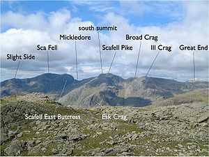
The Scafell range as seen looking west from Crinkle Crags. (Interactive labels.)
Scafells is a collective term for the Scafell range of fells in the western English Lake District, including Scafell, Scafell Pike, Broad Crag and Ill Crag. Great End, Lingmell and Slight Side are also usually included within the definition. These hills form part of the Southern Fells.
Geologically, the Scafells is what remains of an ancient supervolcano that erupted in the Ordovician period over 400 million years ago with VEI-8 force. This volcano as well as all other volcanoes of the Lake District are long since extinct.[1]
-
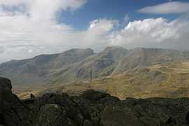
Scafells from Bowfell